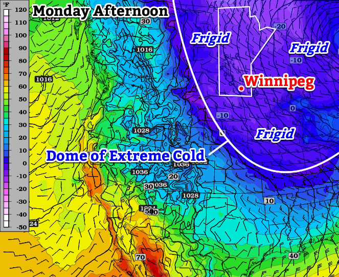
We’ll have to deal with a few more days of frigid weather before a warming trend begins to take hold.
Monday
Mainly Sunny
-28°C / -32°C
Today will start out with extreme cold yet again. Low temperatures this morning will be in the minus thirties, though values will be closer to -30C than -40C. Afternoon temperatures will warm little, with temperatures “rising” into the upper minus twenties. Unfortunately, the wind will be quite a nuisance today, generating wind chills in the -40s once you factor in north-westerly winds of 20-30km/h. The mercury will plummet once again tonight, with lows in the minus thirties expected.
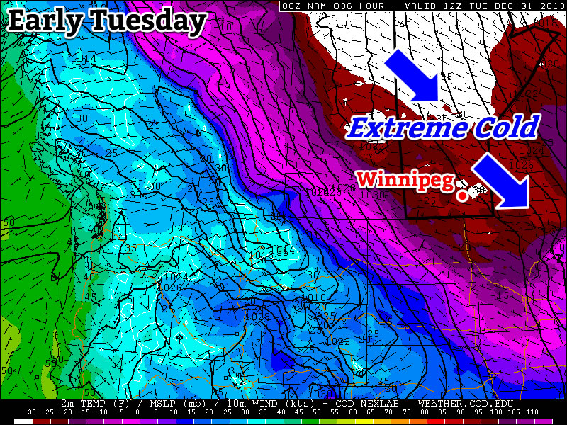
Tuesday
Mainly Sunny
-22°C / -30°C
Tuesday will be a slightly nicer day than Monday. The main improvement will be lighter winds, which will make it feel more like the actual air temperature. But those air temperatures will remain very cold, with highs once again being well into the minus twenties.
Wednesday
Mainly Sunny
-21°C / -25°C
Wednesday will remain very cold, with morning temperatures near the minus thirty mark, and daytime highs being near the -20C mark. The wind doesn’t look to be particularly strong, so like Tuesday it will feel close to what the air temperature indicates.
Warming in the Long Range?
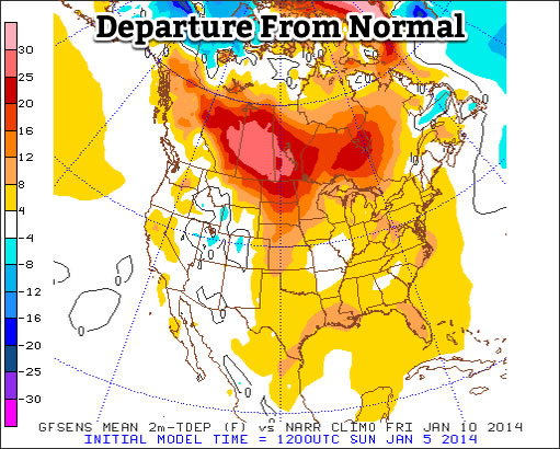
The long range is where the light begins to appear in the tunnel. Models suggest that we’ll do better than -20C on Thursday as a warmer air mass begins to move into Southern Manitoba. However, this advancing air mass will be accompanied by strong southerly winds, which will cause Thursday to remain a fairly chilly day. However, by Friday into the weekend it appears that we’ll begin to see high temperatures consistently be in the low minus teens or minus single digits. Models don’t show any major cold snaps returning in the foreseeable future, but there will still be colder days here and there. The bottom line is that a prolonged period of warmer weather is finally on the way – time to pop the champagne!