Get Ready For More Wet Weather

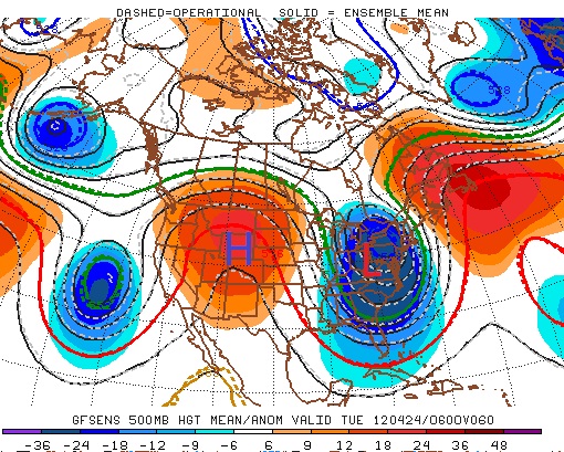
Southern Manitoba is on tap for another complicated significant precipitation event for the second half of the week as another strong low stalls over North Dakota. With a good moisture feed northwards from the Gulf of Mexico, significant convection will fire up through the Northern Plains and wrap around the low into Southern Manitoba. If this sounds like last week’s system…well, it is. Scott had a keen eye to mention it in Monday’s post and this system certainly has the potential to have a significant impact on some communities in the Red River Valley, especially those near the western escarpment who were deluged with up to 8 inches of rain on the May long weekend.

So just how much rain will fall and when? Read on to find out.

Today & Tonight


20°C / 14°C
A mix of sun and cloud. Increasing cloud overnight.

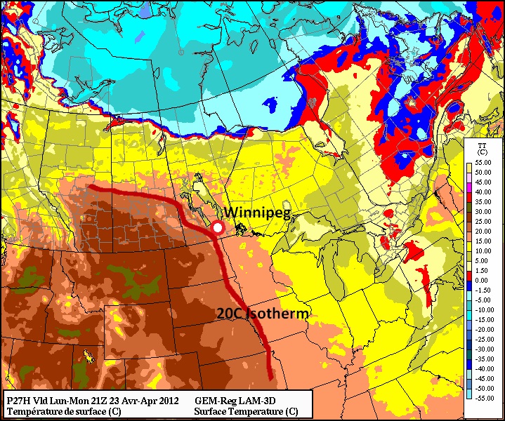
Today will be a fairly nice day with a mix of sun and cloud as we push to a high of around 20°C. There may be some fog patches through the Red River Valley this morning – and some may be dense – but they should burn off by mid-morning. Winds will remain fairly light out of the west at around 10–15km/h.

Clouds will begin to push into the Red River Valley from the south overnight as thunderstorms fire up in North Dakota. There may be a scattered shower or two overnight, but the main area of rain should stay south of Winnipeg until Thursday morning.

Thursday & Friday

The main event begins Thursday morning as rain pushes up from North Dakota into Southern Manitoba. This area of rain may have thunderstorms embedded in it and will likely produce moderate accumulations as it pushes northwards. This band will continue to push northwards until it’s fully developed along the deformation zone resting along a line through the Manitoba Parkland and Interlake regions. It will likely rain through most of the day across all regions of Southern Manitoba before tapering off Thursday night. The temperature, for those who still like to know despite it raining all day, should climb to around 19–20°C.

Thursday

20°C / 14°C
Rain beginning in the morning & tapering off overnight. 15-25mm generally.
Friday

20°C / 9°C
Rain or thunderstorms beginning by midday, tapering off early Saturday. 10-20mm generally.

It’s likely we’ll get a 6–12 hour reprieve from the rain sometime overnight Thursday into Friday morning; the exact timing of this break will depend on two particular things:

  1. When the moisture first arrives in Southern Manitoba
  2. The exact placement of the low pressure centre in North Dakota.

It may happen a little bit earlier or later, and if the low ends up further south than currently forecast, the break may not occur for places in the Northern Red River Valley, just the south. But at this point it does look likely that we’ll see a reprieve from the rain for a little bit.

On Friday morning the rain will start up again as significant instability develops along a trowal[1] laying across the Red River Valley. There’s a decent chance that we’ll see a thunderstorm or two; whether or not they’ll be severe is too early to tell, but there may be a threat for hail or even an isolated, weak tornado formed from the steep low-level lapse rates and vorticity rich environment near the upper low. At the moment, it looks like the best bet for any thunderstorm activity would be close to or just south of the U.S. border, but we’ll keep an eye out and post updates below. The rain/thunderstorm activity will gradually move southwards and eastwards through the day and night. It won’t be until Saturday morning that all the precipitation leaves the province as the upper low finally pushes eastwards.

The Convective Element: Heavy Rain

The biggest unknown right now is exactly how convective things will be. As mentioned above, the storm-total rainfall accumulations for this event will likely sit around 30–50mm (1.5–2”) for most areas in Southern Manitoba. Any convection or thunderstorms have the potential to dramatically increase that amount as does any upslope flow along the escarpment.

Storm Total Precipitation

Estimated storm-total precipitation by Saturday morning.

Two areas of concern exist. First, over the western Red River Valley and SW Mantioba northward into the Interlake; as mentioned before, generally 30–50mm are expected, but there’s potential for significant embedded convection to exist within the area of rain, and localized accumulations of much greater than that are possible. At this point, it looks most likely that the worst-case scenarios would top out at around 3“ total accumulation (75mm) by Saturday morning, but this early it’s impossible to say. The second area of concern are for the upslope environments of the western escarpment of the Red River Valley and Parkland regions. A strong north-easterly wind will be in place through the duration of this event which will provide additional lift and enhanced precipitation to communities close to these features. With the last system, which was similar to this one in many ways, rainfall accumulations were about 5–8” along the escarpment, depending on location. Any people living in regions that were hit hard by the last system may want to make preparations for another significant rainfall event. Again, at this point it’s only safe to say that more than 4” is possible in these locations, not that they will for sure get higher amounts.

We’ll keep a close eye on this system as it develops. Being convective in nature it will be inherently complex, but we’ll provide updates below. Live in Southern Manitoba and have a question about this system? Ask in the comments below and we’ll be happy to try and get an answer for you!


  1. A trowal is a Trough of Warm Air Aloft and is an mid-to-upper atmospheric feature that wraps from the fronts of a low around the northern side of the low and commonly produces precipitation.  ↩

Warm Start to the Week

This week will start out on the warm side as a high pressure ridge edges into Manitoba. Temperatures on Monday and Tuesday are expected to reach or exceed 20C, which will mark the first occurrence of a 20 degree reading since April 6.

A large ridge centred over Western North America will bring warm weather to Southern Manitoba on Monday and Tuesday

A large ridge centred over Western North America will bring warm weather to Southern Manitoba on Monday and Tuesday

Highs on Monday should be around 20C in most of Southern Manitoba. Skies will range from mainly sunny to mainly cloudy, with Winnipeg and the Red River Valley tending to be on the cloudier side and Western Manitoba on the sunnier end. As such South-Western Manitoba will likely be a bit warmer than the rest of Southern Manitoba. Tuesday will feature much the same weather as Monday with temperatures once again climbing up to around the twenty degree mark over Southern Manitoba. Skies on Tuesday will mostly likely be a mixture of sun and cloud, preventing temperatures from climbing much above 20 degrees. Should Monday or Tuesday be sunnier than currently expected you can easily add a couple degrees onto the temperatures listed above.

20 degree temperatures are expected in Southern Manitoba on Monday and Tuesday

20 degree temperatures are expected in Southern Manitoba on Monday and Tuesday

A cold front will slice through Manitoba on Wednesday, dropping our temperatures back down to normal values. Highs on Wednesday are expected to hover in the low teens in Southern Manitoba, while on Thursday temperatures will remain stuck in the single digits. A recovery in temperatures in expected to begin on Friday and stretch into the weekend.

No significant precipitation is expected this week, although some weak shower activity might form as a low pressure system and associated cold front pass through on Tuesday night and Wednesday.


Elsewhere in Weather News

Australian Rains

As Australia’s summer transitions into fall, heavy rains have pummelled its capital, Sydney, and surrounding regions resulting in flash floods throughout the area.

Rainfall map from this past week in NSW, including Sydney’s approximate location. (Source: Bureau of Met.)

Rainfall map from this past week in NSW, including Sydney’s approximate location. (Source: Bureau of Met.)

Between Monday, April 16th and Wednesday, April 18th, the New South Whales (NSW) region was hit hardest from the flooding where some areas received between 150mm-200mm of rain. The flash floods were triggered by a number of towns receiving rainfall of 40mm/h over a couple hours, and the fact that the soil was saturated in those areas due to heavy rainfall that occurred over the past month.

Parking lot swamped by water. (Source: Seven Network)

Parking lot swamped by water. (Source: Seven Network)

Emergency crews were called to assist residents whose cars were overtaken by water and also to help those trapped in their homes as water levels rose in a matter of hours. Utility crews were also busy due to more than a thousand people losing power.

Video of car struggling to cross flooded roads. (Source: mascott1963)

Unfortunately, more rain was forecast to fall this weekend as another slow moving trough/cold front stretched across the whole region. No additional flash flooding was reported with this latest rainfall, however more rainy days are expected to hit the coast this coming week which increases the risk of further flooding in the region where another 15mm-25mm are expected through to Wednesday.

This event comes just two months after the region located north of NSW, Queensland, was hit hard by flooding (brought to you on February 27th post). Australia’s eastern coast has seen its fair share of dangerous flash flooding already this year.

Elsewhere in Weather News has been provided by Matt

Rain and Thunderstorms for Next Week

The soggy spring we’re experiencing in Southern Manitoba just doesn’t seem to be letting up.  With some areas in Southeast Saskatchewan and Southwestern Manitoba already having seen in excess of 2/3s of what they normally receive through an entire year, everybody, including the ground, is ready for a break from the rain.  Unfortunately, it doesn’t look like it’s in the cards.  A sunny and warm weekend will change into quite an unsettled pattern for the first half of next week.  Read on to find out where and how much rain will fall.


24hr. QPF valid 12Z Monday morning from the 00Z Friday Jun 10 GEMGLB model.

Enjoy the sunshine and warmth today and tomorrow!  Plenty of sunshine is in store for us with daytime highs in the low twenties and fairly light winds.  Most of Sunday will be pleasant as well, but by evening a new system is going to be pushing into Southwest Manitoba.

An trowal will swing through Southern Manitoba Sunday night through Monday, bringing with it another batch of rain and thunderstorms.  By Sunday evening, rain will begin to push into Southwest Manitoba with a chance of thunderstorms developing before midnight.  While much concern exists about the more rainfall for SW Manitoba, it looks currently like the greatest threat for heavy rain exists from areas south of Winnipeg and spreading eastward through the Whiteshell.

As the trowal rotates into our area on Sunday, an area of thunderstorms should rapidly develop on Sunday evening in North Dakota near and east of the triple point of the associated wave.  For those who don’t know what that is, the triple point is the point where the warm front and the cold front meet.  This should develop upscale quite rapidly into a large MCS that will track east northeast and should cross into S. MB overnight.  Currently, it appears that Winnipeg would be on the northern edge of the higher amounts, with it likely that areas south of the city could see 20-40mm of rain.  Areas elsewhere in Southern Manitoba (including the Southwest corner) that are not impacted by the MCS from North Dakota will see between 10 and 20mm of rain through Monday evening.

This system will then pull northward and rotate into Central Manitoba.  Unfortunately, this prolonged period of rain could bring an additional 20-30mm to the absolutely soaked Interlake region, which is battling un-before-seen high lake levels.

Perhaps of even bigger concern is the next system that will barrel into Southern Manitoba on Wednesday evening.  While details are sure to change, this has the potential to be the most significant convective system we’ve experienced this year.  An extremely intense shortwave will head northeast into North Dakota through the day on Wednesday and initiate a large area of convection by Wednesday evening.  This convection will be pulled northward with the shortwave as it slowly becomes captured in an upper low and rests over the western lakes.  


12hr QPF valid 12Z Wednesday morning, June 15 from the 00Z Friday June 10 GEMGLB.

Thunderstorms will develop and intensify through an upper trough and pull northward into the upper low, resulting in prolonged, intense precipitation along a fairly narrow band.  Positioning will be crucial for this system, but with the potential to be dumping 1.5” – 3” of rain through the RRV into the Interlake, this will be a extremely important system to keep an eye on.

So get out and enjoy the sun!  As summer tries to push in next week, the storm track is going to move back into Southern Manitoba and we are likely going to see several impulses move through during the week.

Severe Thunderstorms Tonight

Environment Canada has issued a severe thunderstorm watch for most of southern Manitoba for this evening. A few thoughts on the coming hours…

For Southwestern MB:

The main threat for severe storms should end this evening. High temperatures and dewpoints combined with daytime heating have contributed to a favourable environment for severe thunderstorms. These ones should primarily be driven by the sun, so once the sun starts going down, so too should the intensity of the storms.

For the Red River Valley:

The main threat for severe storms will continue through the evening as an 850mb jet pushes up out of North Dakota into the RRV. The main threat with these storms will primarily be rain. The storms are developing on the nose of the 850mb jet, just downwind of an area of moisture convergence, so as the evening continues, the storms will have more and more moisture to work with. This, combined with the fact that storms will most likely be training (multiple storms moving in rapid succession over the same area), will result in some areas in the RRV getting large quantities of rain. My initial estimate would be that some areas will receive total amounts of 70-90mm locally, however it could potentially be higher than that. Most areas will probably receive on average 15-25mm of rain.

Other threats from these storms will primarily exist during the evening hours when they still could be surface based. If any storms can develop by themselves this evening, there’s a slight chance they could become supercells given the SSE flow through much of the RRV. If that is able to happen, then there would be a chance of large hail (my estimates would be quarter to loonie sized) and strong winds (90+ km/h). Give the backed surface flow, there would also be a very slight chance of a supercell becoming tornadic, but the overall setup doesn’t look to favourable for that; you never know what storms will do when working with 3000+ joules of CAPE, though.

This MCS will stick around for a good portion of the night, resulting in a widespread wet and noisy evening for many residents in Southern Manitoba.