Tropical Depression Isaac: Update
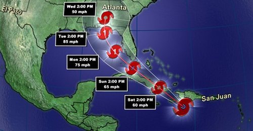
What was once dubbed Hurricane Isaac when it made landfall as a category one hurricane, is now considered a ‘tropical depression’. Isaac continues to pose a threat a week after it made landfall but it has weakened significantly, and will continue to do so, as it penetrates further into the southern half of Continental United States. Although this hurricane was “only” rated a category one when it made landfall, comprising of maximum sustained winds of 135km/h at peak intensity, you would have not guessed the incredible amounts of rain it brought into Louisiana and surrounding Gulf States. Here are a couple of the most impressive rainfall totals recorded throughout the whole event:
-In Gretna, LA, the National Hurricane Center (NHC) unofficially reported 466mm of rainfall.
-In New Orleans, LA, 510mm of rainfall was reported, breaking New Orleans’ old daily rainfall record by 48mm (a record thsat was set by Hurricane Katrina).
-In Kiln, MS (west of Gulfport) 433mm of rainfall was reported.
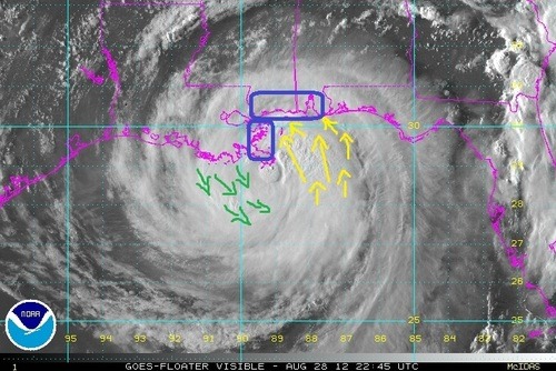
Not only did Hurricane Isaac bring with it enormous amounts of rain, the storm surge that accompanied it was quite severe. Wind-driven storm surge is mostly caused by the severe winds accompanying a hurricane. These winds push ocean waters towards land similar to a wave but larger in size (in this case with south winds) and in turn, ocean levels are higher than the normal tide. This phenomena makes for serious flooding along the Gulf Coast since the terrain along the Gulf of Mexico is not mountainuous – it is more of a gradual slope. When ocean water then rises, it is easy for it to move inland quickly.
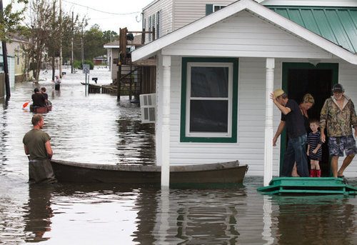
In Louisiana, two people lost their lives in the Plaquemines Parish, one of the hardest hit parishes, as the tide rolled in and consumed their house. This now brings the Hurricane Isaac death toll in the United States to four, with damages listed in the hundreds of millions. In Louisiana and Mississippi, power was out to over a million people and it was estimated that 75% of New Orleans was out of power when the eye wall passed closest to the city. For a storm being of weak category one, it did an extensive amount of damage. This was in part caused by it’s broad area of precipitation, large area extending out from the eye of tropical storm force winds, extremely slow movement, and storm surge levels you would expect form a category two or three hurricane.
This week in the tropics there are three other notable storms: Hurricane Kirk out in the middle of the Atlantic which poses no threat to land; Tropical Storm Leslie which does not pose a threat to the United States but as it strengthens, could pose a threat to Bremuda; and lastly, Hurricane Ileana out in the Eastern Pacific poses no threat to land but could cause high surf to the Baja Peninsula.