Already an Active 2012 Hurricane Season
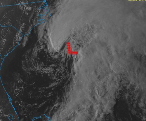
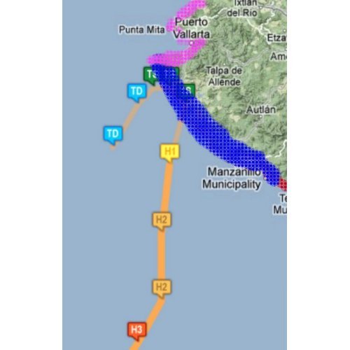
The first major hurricane of the year for the Eastern Pacific Ocean spun up on May 22 to the south-west of Mexico and will likely make landfall on the west coast. As of Friday afternoon, Hurricane Bud was cruising along at a northerly trajectory as a category one hurricane, packing winds of 120km/h in its core and releasing very heavy rains within its spiral banding.
Bud is forecast to decrease slightly in intensity as it hits the mountainous regions of Mexico’s west coast and interacts with the dry air to its north. However, Bud is still predicted to bring winds from 90km/h to 110km/h, as it makes landfall just to the south-west of Puerto Vallarta, between a weak category one hurricane and strong tropical storm status.
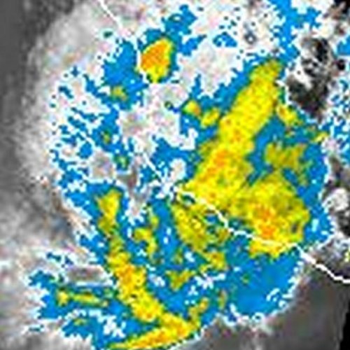
The worrisome part of this storm, however, is not the winds that accompany Bud, but the rainfall associated with it. From 150mm to 200mm are expected to fall with even higher amounts locally along the coast. As it makes landfall on the hilly coast, mudslides are a big threat to towns in the vicinity. A hurricane warning has been issued for a small part of the Mexican coast that is sparsely populated in the area where Bud’s centre will make landfall.
Interesting facts on Bud:
- Bud is the strongest hurricane ever recorded in the Eastern Pacific this early in the year; it reached category three (185km/h) late Thursday night.
- Only 12 hurricanes have been recorded in the Eastern Pacific in May since 1949, Bud is one of them.
- Two meter high waves were already experienced on the Mexican coast Friday afternoon ahead of Bud.
Mexico officials say they are ready for Bud; they have cancelled schools in 11 municipalities for Friday and have 15,000 spots ready in rescue shelters if evacuations are needed. Bud will reach land on Friday night and slowly curve back out to the Pacific as a tropical depression by the end of the weekend.
The hurricane season in the Eastern Pacific officially started May 15th and it has already been very eventful at its outset with two named storms. In the Atlantic, where the season officially kicks off on June 1st, an area of low pressure is already forming off the coast of Georgia and has a very good shot of becoming a subtropical/tropical storm by this weekend. So, lots to keep an eye on during this active start to this year’s hurricane season as there will certainly be more to come!