Showers and Thunderstorms on Tap for Southern Mantioba

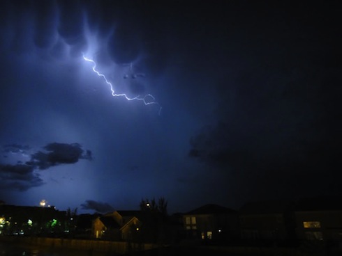
While temperatures will soar to the 30°C mark today, much of the Red River Valley should be prepared for showers and thunderstorms to develop by mid-to-late afternoon as a low pressure system moves into the area and taps the available heat and moisture.

850mb Theta-E Values

850mb Theta-E values at 00Z May 19th (this evening) from the NAM. A sharp warm front is evident jsut north of the US border in Southern Manitoba.

With a strong capping inversion in place over the Red River Valley today, heat and moisture being pumped northwards will be trapped at the surface, allowing our temperature to soar to the 30°C mark and pooling moisture that will push our dewpoints up to around 15°C. Much of the day will be a beautiful day, especially given that it’s only May 18th. Conditions will deteriorate somewhat by late afternoon, though, as a surface low lifts northwards into Southern Manitoba.

The surface low will travel along a pre-existing surface trough and be supported by a shortwave ejecting northeastwards from the main upper trough, still anchored through Montana and Wyoming. With the heat trapped near the surface, the Lifted Index is expected to drop to the -2 to -8 values, with the lowest values running along a line from Gretna, MB to Bisset, MB and increasing to the southeast of that line. The heat combined with ample moisture is also expected to produce high CAPE values generally from 2000 to 3000J/kg. Increasing mid-level lapse rates with the approach of the shortwave will provide enough destabilization to erode the capping inversion through the afternoon and allow showers and thunderstorms to develop along and ahead of the warm front, initially concentrated near the triple point of the system. The showers and thunderstorms will expand in coverage as the evening progresses and the low-level jet intensifies.

Severe Weather Threat

Today marks one of the first severe weather threats of the season. Things look promising, and have even caught the attention of some seasoned storm chasers from the United States:

On paper, things look fairly good that there’s a risk for severe weather. EHI values rise to between 1.5-2.0 by late afternoon, which when combined with the presence of 30-35kt of bulk shear certainly presents the chance for supercell storms to develop. A few things hamper my excitement, though:

  • Bulk shear isn’t really all that impressive; the really good shear moves through Western Manitoba through the day today, lifting northwards into the Interlake. The shear diminishes to the SE and isn’t particularly strong where the greatest CAPE is. When it comes down to it, it’s likely that we’ll end up with marginally strong shear on top of marginally high CAPE this afternoon, with the most favorable conditions missing each other.
  • CAPE values may be too high. The NAM & GFS have been forecasting dewpoints slightly higher than have materialized. The amount of energy for storms to work with is going to be heavily dependant on the dewpoints that develop this afternoon, and if they don’t make it as high as forecast then we’ll be seeing weaker storms.
  • Too many storms. With so many marginally severe features, we may see quite a few showers and thunderstorms develop this afternoon as the cap erodes. If too many fire off, then it will be difficult for any one storm to oragnize itself into anything that poses a severe weather threat.

All that being said, a potential for severe weather does exist today across south-central and southeast Manitoba. The main threats should severe weather develop will be hail and/or the possibility of a tornado.

Thunderstorm Outlook for May 18th

Thunderstorm Outlook for May 18th to May 19th. Please note: Analysis has only been done for Manitoba. Storms may develop elsewhere in the Canadian Prairies.

Residents in Southern Manitoba should stay up-to-date on the weather today to ensure that if severe storms do develop, the appropriate precautions can be taken.

Powerful Thunderstorm Rips Through Winnipeg; What’s Next?

Winnipeg Lightning
Photo by Phil Hossack, The Winnipeg Free Press

A powerful thunderstorm developed rapidly along an advancing cold front last night, pounding the city with heavy rain, strong winds and hail. Things looked like they would pass north of the city until the front reached about 30-40km west of Winnipeg, where rapid southward development of the existing storm line occurred. This storm, a rarity this summer, comes after a month and a half of hot, dry weather where thunderstorms constantly split as they approached the city and passed north of our south of the area. For storm lovers, we couldn’t have asked for more from a late-evening thunderstorm: great structure in the clouds, much-needed rain, some hail, and one of the most impressive light shows I’ve seen in a long, long time. Read on to see pictures and video of this storm in action!

I was able to capture this video from the west-end of town around 9:45 last night, shortly after it had stopped raining. I haven’t seen as much lightning in a single storm as the one last night in a long, long time:

Intense Lightning in Winnipeg (August 18, 2011) from buffaloseven on Vimeo

User submitted photo
Photo submitted by @hubertguiggsy on Twitter

Twitter user @hubertquiggsy sent me this picture of the storm. It’s a beautiful shot that shows the gust front crossing the city (this picture is facing North) with ample amounts of scud being sucked up into the storm.

Lightning + Mammatus
This picture is one of a few great ones at http://www.steinbachweather.ca from the storm as it moved through his area, such as the one above. I highly recommend you visit the site and take a look.

The Weather Network always has plenty of submissions, and last night’s storm was no different; here are some of the highlights:

Clouds
Clouds; submitted by Arienna Paul

This shot (Clouds) shows the impressive structure the leading edge of this storm had, with a well-defined lowering and gust front, complete with beautiful striations running along the main lowering.

Wow!
Wow!; submitted by Christina Unger

Seen from a different angle, Wow! shows us how ominous this storm looked as it approached. Scud getting sucked up into the storm as it advanced on the city, with nothing but ominous behind the gust front. Again, striations can be seen running along the gust front on the upper half of the lowering.

funnel cloud
funnel cloud; submit by Wendy Buleziuk

This shot, taken near East St. Paul, shows another beautiful shelf cloud. The photo is titled “funnel cloud” and I chose not to change that, but it’s important to note that there is no funnel cloud in this picture. The elongated strands of clouds pointing towards the lower left of the picture, protruding from the shelf cloud itself, is known as ‘scud’. This is very low level cloud that is generated by strong lift right ahead of the gust front. These clouds are indicative of a powerful thunderstorm, but do not have a direct connection to the development of funnel clouds or tornadoes.

Thunder Storm Winnipg
Thunder Storm Winnipg (sic); submitted by Greg Pecold

Another beautiful shot of the gust front as it advanced into town.


What’s next for Winnipeg? Cooler weather for today and tomorrow with a mix of sun and clouds. It looks like there’s a chance of showers tomorrow afternoon/evening as a weak disturbance slides through the interlake in the northwest flow, although it looks likely that the showers will stay north of Winnipeg. Sunday may be a little more unsettled as another system moves by and starts to push the cold air out of the province. We’ll see temperatures rebound to close to 30°C Sunday afternoon as the system brings warmer air into the province, and then for the first half of next week we’ll be under the influence of a building upper ridge, which will bring sunshine and temperatures near 30°C for Monday, Tuesday and Wednesday.

Rain and Thunderstorms for Next Week

The soggy spring we’re experiencing in Southern Manitoba just doesn’t seem to be letting up.  With some areas in Southeast Saskatchewan and Southwestern Manitoba already having seen in excess of 2/3s of what they normally receive through an entire year, everybody, including the ground, is ready for a break from the rain.  Unfortunately, it doesn’t look like it’s in the cards.  A sunny and warm weekend will change into quite an unsettled pattern for the first half of next week.  Read on to find out where and how much rain will fall.


24hr. QPF valid 12Z Monday morning from the 00Z Friday Jun 10 GEMGLB model.

Enjoy the sunshine and warmth today and tomorrow!  Plenty of sunshine is in store for us with daytime highs in the low twenties and fairly light winds.  Most of Sunday will be pleasant as well, but by evening a new system is going to be pushing into Southwest Manitoba.

An trowal will swing through Southern Manitoba Sunday night through Monday, bringing with it another batch of rain and thunderstorms.  By Sunday evening, rain will begin to push into Southwest Manitoba with a chance of thunderstorms developing before midnight.  While much concern exists about the more rainfall for SW Manitoba, it looks currently like the greatest threat for heavy rain exists from areas south of Winnipeg and spreading eastward through the Whiteshell.

As the trowal rotates into our area on Sunday, an area of thunderstorms should rapidly develop on Sunday evening in North Dakota near and east of the triple point of the associated wave.  For those who don’t know what that is, the triple point is the point where the warm front and the cold front meet.  This should develop upscale quite rapidly into a large MCS that will track east northeast and should cross into S. MB overnight.  Currently, it appears that Winnipeg would be on the northern edge of the higher amounts, with it likely that areas south of the city could see 20-40mm of rain.  Areas elsewhere in Southern Manitoba (including the Southwest corner) that are not impacted by the MCS from North Dakota will see between 10 and 20mm of rain through Monday evening.

This system will then pull northward and rotate into Central Manitoba.  Unfortunately, this prolonged period of rain could bring an additional 20-30mm to the absolutely soaked Interlake region, which is battling un-before-seen high lake levels.

Perhaps of even bigger concern is the next system that will barrel into Southern Manitoba on Wednesday evening.  While details are sure to change, this has the potential to be the most significant convective system we’ve experienced this year.  An extremely intense shortwave will head northeast into North Dakota through the day on Wednesday and initiate a large area of convection by Wednesday evening.  This convection will be pulled northward with the shortwave as it slowly becomes captured in an upper low and rests over the western lakes.  


12hr QPF valid 12Z Wednesday morning, June 15 from the 00Z Friday June 10 GEMGLB.

Thunderstorms will develop and intensify through an upper trough and pull northward into the upper low, resulting in prolonged, intense precipitation along a fairly narrow band.  Positioning will be crucial for this system, but with the potential to be dumping 1.5” – 3” of rain through the RRV into the Interlake, this will be a extremely important system to keep an eye on.

So get out and enjoy the sun!  As summer tries to push in next week, the storm track is going to move back into Southern Manitoba and we are likely going to see several impulses move through during the week.

Significant Storm System Heading into Manitoba

A powerful early-summer storm system has pushed through Montana overnight and pushed into Southwestern Manitoba, bringing with it heavy rain and widespread thunderstorms.  Read on to find out what’s in store for today, and where there might be severe thunderstorms…


0845Z 10.7u/3.9u Multispectral Satellite Imagery; a extremely large area of thunderstorms covers most of Southern Saskatchewan, the northern half of Montana.  This system also has an arm of convection that extends west-east across northern North Dakota approaching the international border.  This system has brought nickel sized hail to the Estevan region and 90km/h wind gusts to northern Montana.

A significant storm system ejecting from the Rocky Mountains intensified rapidly overnight and has produced widespread thunderstorms throughout southern Saskatchewan.  This system will move eastwards through the day today, pushing precipitation through Manitoba.

The setup today is quite complex.  There is a surface low running near the international border that is connected to the upper-level impulse.  These two features are acting in tandem to produce much of the convection in Saskatchewan this morning.  Further to the southeast, a surface low is entering into western North Dakota with an associated frontal wave attached to it.  A warm front extends through southern North Dakota and across central Minnesota, with a cold front laying south from the low pressure centre along the Montana/Wyoming – Dakotas boundaries.


1000Z Radar Composite for the Prairies

So!  For Southern Manitoba today.  The band of thunderstorms stretching from Melita-Virden to Emerson should continue through the early morning hours, but will be sheared apart by mid-to-late morning as the western portion of the line is pulled westward around the upper low and the eastern half is pushed further east by a significant low-level jet.  I think that there will be thunderstorms up to a line that lay from Portage la Prairie – Winnipeg – Kenora.  North of that line (including Portage and Winnipeg), I’d say that there’s a good chance of some showers this morning, but only a slight risk of a thunderstorm as the line is weakened through the stretching as well as the morning sun.

After that line passes, we’ll see a relatively cloudy lunch and early afternoon.  During this period, the warm front in North Dakota will have advected northward and lay fairly close to the Canadian border.  By mid-afternoon, convection will initiate south of the border along the warm front, caused by daytime heating and increasing instability as the upper centre approaches.  These storms will probably become marginally severe to severe quite quickly, with the main threat being large hail.  There is a slight chance that storms right near the warm front could produce tornadoes.

I think that the worst should stay south of the border, but it’s highly dependant on how far north the warm front can push.  The SPC agrees with me, and has pushed their slight risk area into Southern Manitoba, with concerns that the worst could actually occur on our side of the border.  I’d advise anyone living within 75km of the border in the Red River Valley and east to keep an eye out for weather watches or warnings this afternoon.


24hr. precipitation accumulation valid 12Z Wednesday morning from the 00Z June 7 GEMREG model.

Storms that initiate along the warm front should become elevated this evening, as they become support by a strong low level jet overrunning the warm front.  As the upper low moves across Southern Manitoba, it too should support an area of convection due to significant instability aloft.  All this will move through overnight, giving rain and thunderstorms to many areas in Southern Manitoba.  Rainfall amounts may vary significantly depending on convection, but general widespread amounts will likely be from 15-25mm, with areas that get battered by thunderstorms potentially seeing 30-40mm.

We should see some light rain tomorrow morning through the RRV and points east as the system pulls out, with skies beginning to clear through the afternoon.  After that, it looks like we’ll have at least a few days without rain before the next system moves through!