Hot weather will continue in Winnipeg, but shifting winds will fumigate southern Manitoba with wildfire smoke this weekend.
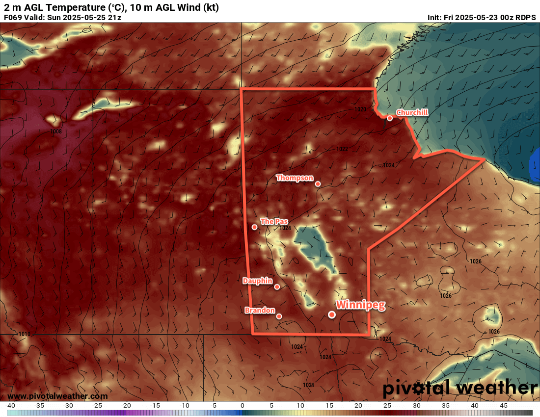
An upper ridge parked over the Canadian Prairies will bring hot weather to southern Manitoba over the next few days. Daytime highs will reach around 30 °C over the next few days with overnight lows in the low to mid-teens. There will be little cloud through the weekend…but that doesn’t mean it’s going to be sunny.
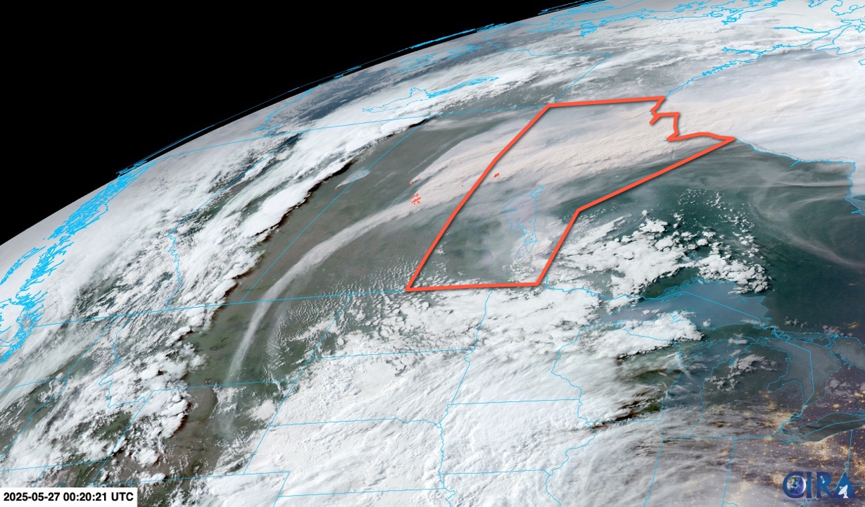
Instead, the region will battle with smoke throughout the weekend. Today will again bring a dreary plume of high-level smoke to the region, a repeat of that not-quite-sunny day the region saw yesterday. A weak low pressure system will cross the province tonight, shifting light westerly winds into an organized northwesterly breeze.
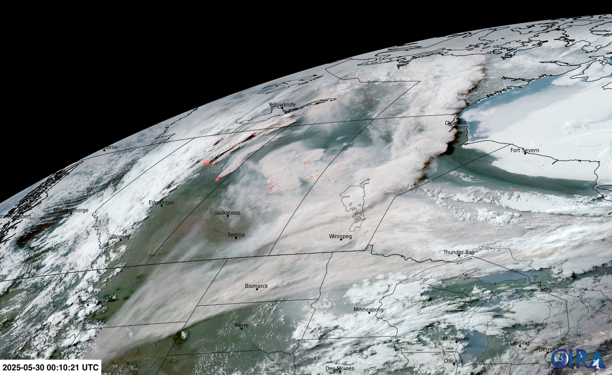
These northwest winds will usher in thick smoke plumes from wildfires over the central Prairies. By Saturday morning, it’s likely that smoke levels will increase to hazardous values across much of southern Manitoba. While the intensity of these plumes are difficult to forecast in advance, all signs point to a deterioration of air quality to the point where everybody should aim to reduce or eliminate time outdoors.
Winds will shift back to the south or southwest on Sunday as a new low pressure system develops over Saskatchewan. There is no guarantee that this will bring clean air back to the region; there is a chance that the region ends up having a diluted version of the same smoke plume lift back north through the region. There will likely be an improvement in the air quality, but it may not end up being back below hazardous levels.
Long Range Outlook
The forecast gets difficult heading into next week. That new low pressure system in Saskatchewan may move through as early as Sunday night, which would likely bring more northwest winds and a fresh blast of smoke from the central Prairies. Winds are forecast to gradually shift westerly in the first part of the week, which should help to clear out the air. A few showers or thunderstorms will be possible Monday, along with cooler temperatures, then it looks like the rest of the week will return to near-seasonal conditions.
For the foreseeable future, any organized northwesterly winds in the forecast will have to be eyed with caution; they will regularly run the risk of bringing thick plumes of wildfire smoke into the region and produce dangerously poor air quality.
With the return to seasonal conditions next week, there will likely be a few chances for scattered showers or thunderstorms. Any moisture will be appreciated, but it doesn’t look like there will be any substantial amounts of rainfall to ease the parched conditions across the region.
Today’s seasonal daytime high in Winnipeg is 22 °C while the seasonal overnight low is 8 °C.