A broad area of high pressure moving through the northern Prairies will bring seasonal conditions to the Winnipeg area this weekend. Unfortunately, northerly winds will also bring several plumes of wildfire smoke through the region over the coming days.
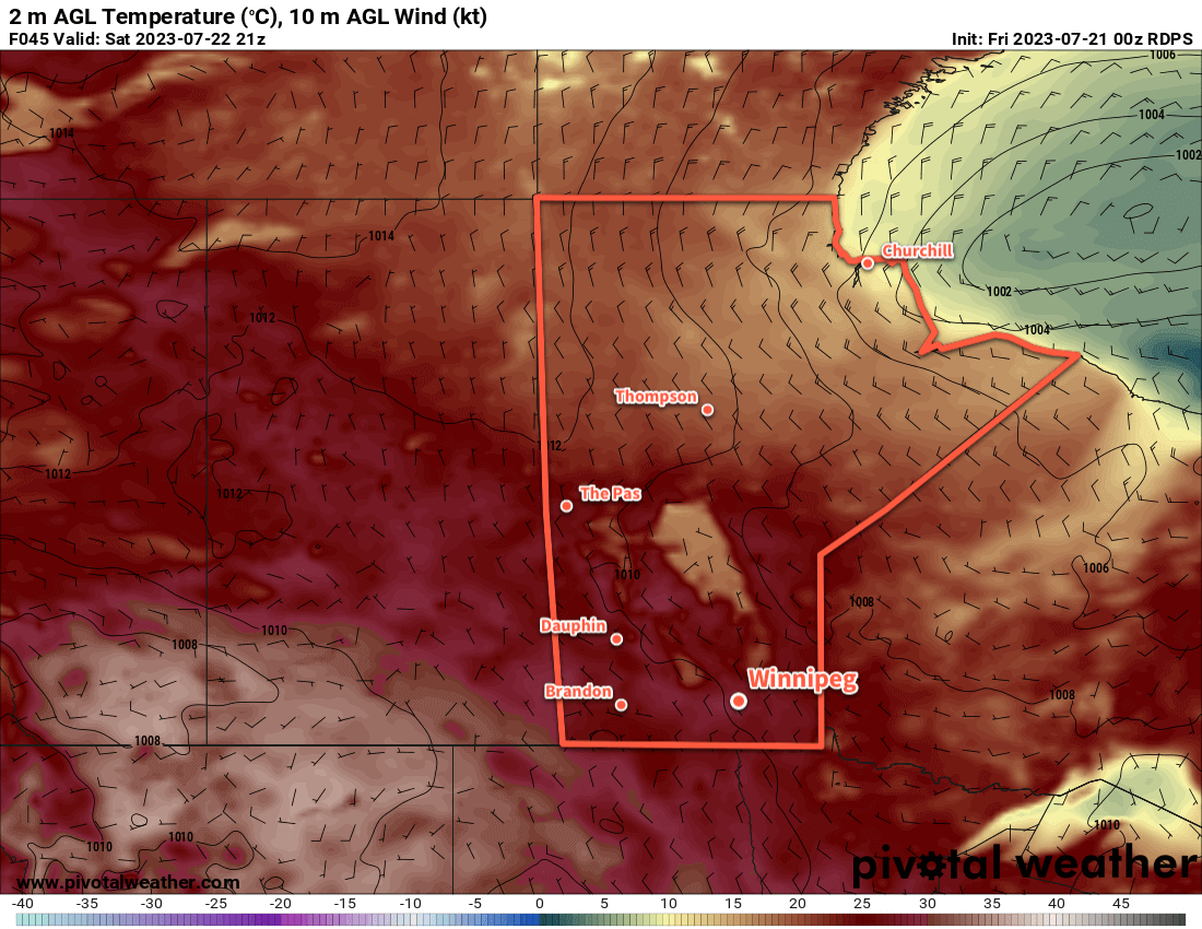
The Winnipeg area will get a chance to dry out after yesterday’s soaking as the slow-moving system responsible for it trundles towards the Great Lakes. Behind it, a ridge of high pressure will build in from the north as an area of high pressure moves into northern Manitoba this weekend.
This pattern change will bring partly cloudy to mixed skies to the area over the next few days with daytime highs in the mid-20s and overnight lows in the mid- to upper-teens. Winds will stay northerly over the next few days, up to around 30 km/h today then easing to 20 km/h or less for the weekend.
There is a low chance of a brief rain shower this afternoon due to lingering instability, then it will stay dry through the weekend.
The bigger issue in the days ahead will be plumes of wildfire smoke that descend through the region in the northerly winds.
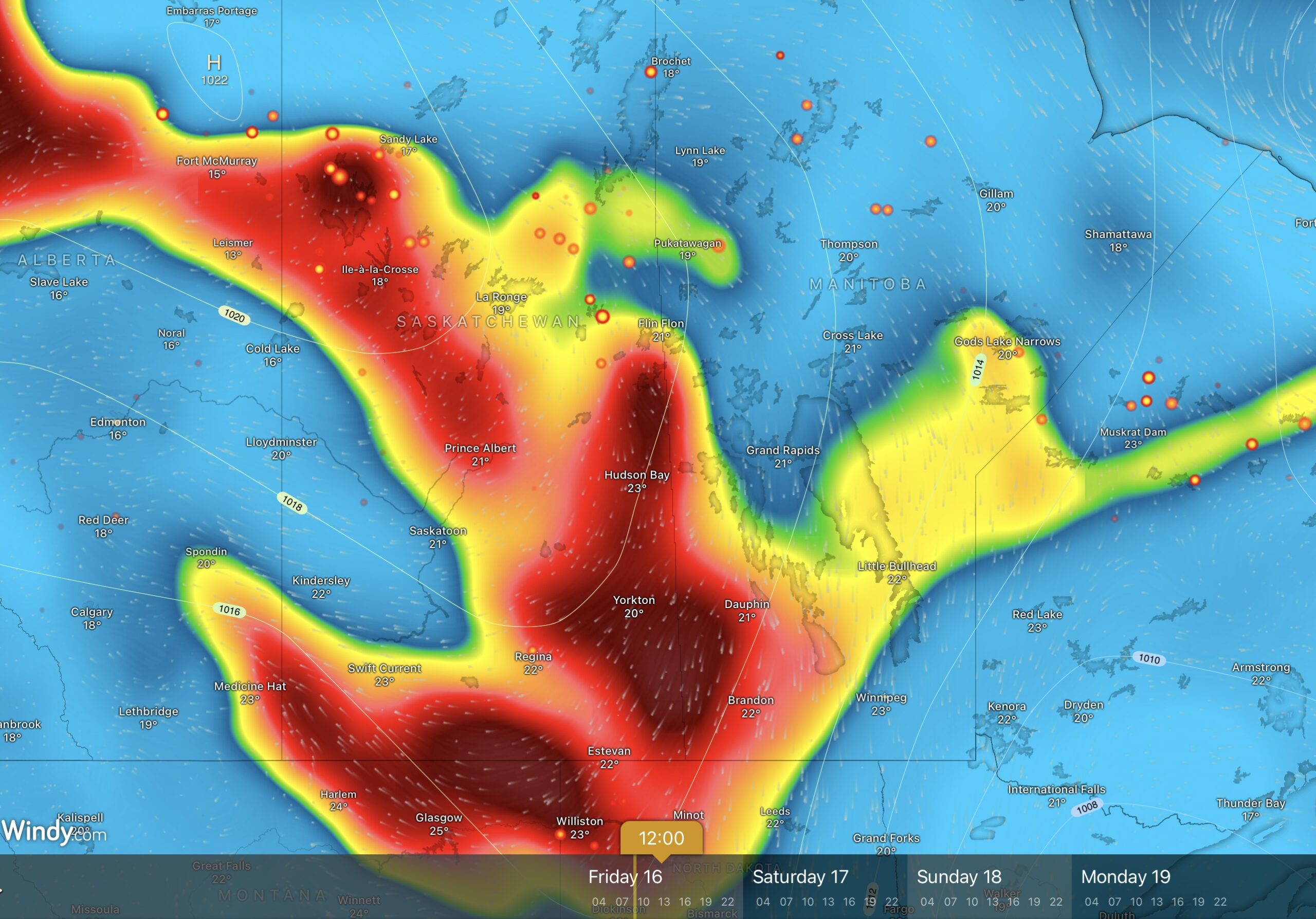
Today, dense plumes of smoke will move through portions of western Manitoba and Saskatchewan, sourced from wildfires over west-central Manitoba and northern Saskatchewan. Additionally, a secondary plume from wildfires in the Island Lake region in northeast Manitoba will drift southwest across the southern Interlake into the southwest corner of the province.
For Winnipeg, smoke models are trending towards keeping the smoke west and north of the city, but there is a chance that the city is caught by the edge of the plume this afternoon. If that happens, AQHI values will likely climb into the 6 to 8 range for the afternoon with improvement on Friday evening across the Red River Valley and western Manitoba.
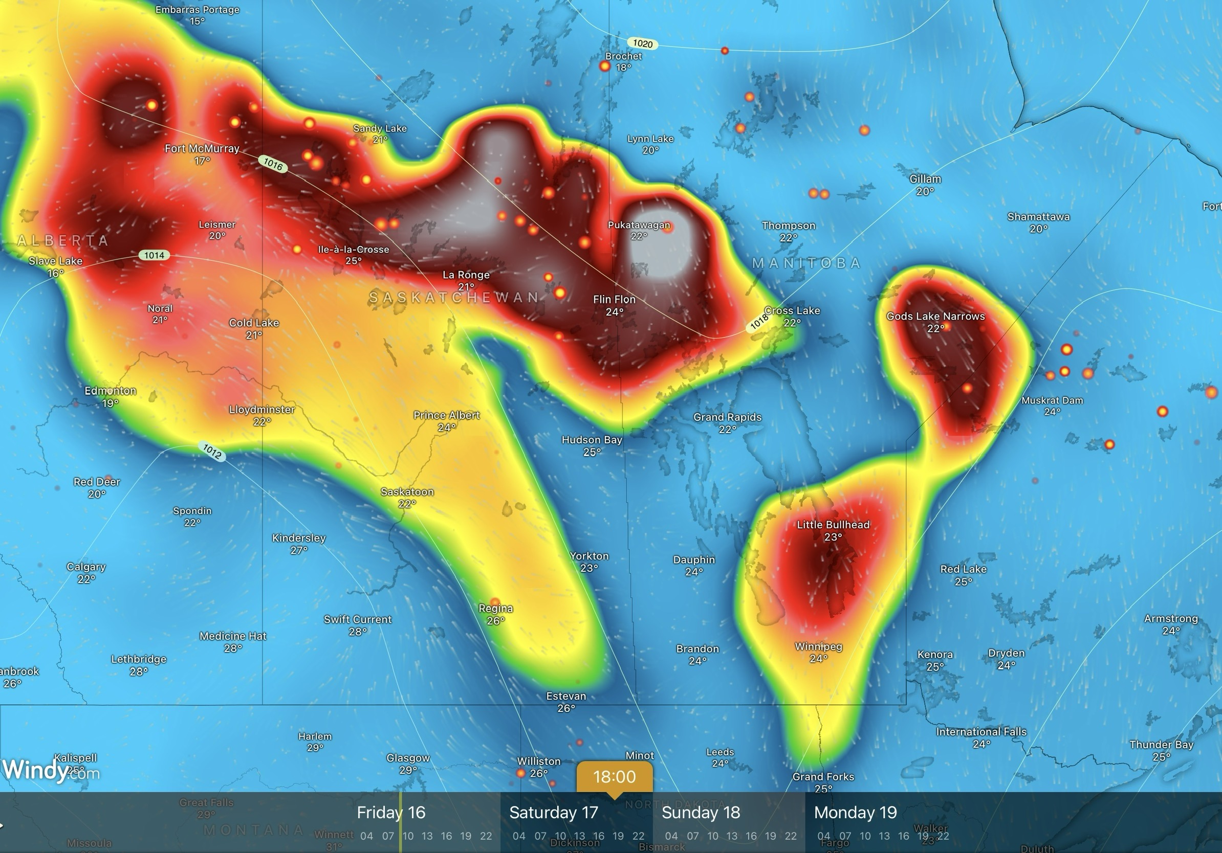
Heading into Saturday, a dense plume of smoke is forecast to drift from the Island Lake fires southwest into the Red River Valley. Unfortunately, if this happens the plume will end up stalling out under the ridge of high pressure over the Red River. This plume is forecast to arrive by Saturday afternoon and persist through midday Sunday before clearing. AQHI values with this plume could be as high as 10+.
AQHI values of 4 to 7 suggest that people with sensitivities to air quality should consider reducing their exposure. When values reach 7 to 10, all should consider reducing their exposure. AQHI values of 10 or higher are unhealthy and everybody should minimize their exposure.
Long Range Outlook
The ridge of high pressure will shift to the east on Monday, bringing southerly winds back to the region. Temperatures will climb back into the upper-20s with mainly sunny skies. The southerly winds will push wildfire smoke back northwards, bringing cleaner air to the southern Prairies and worse air quality to the northern Prairies.
Today’s seasonal daytime high in Winnipeg is 25 °C while the seasonal overnight low is 12 °C.