RDPS 2m Temperature Forecast valid 21Z Thursday October 24, 2019

Cool With An End-of-Week Warm Up

Winnipeg’s cool weather will stay for a couple more days, then warmer weather arrives for the end of the week.

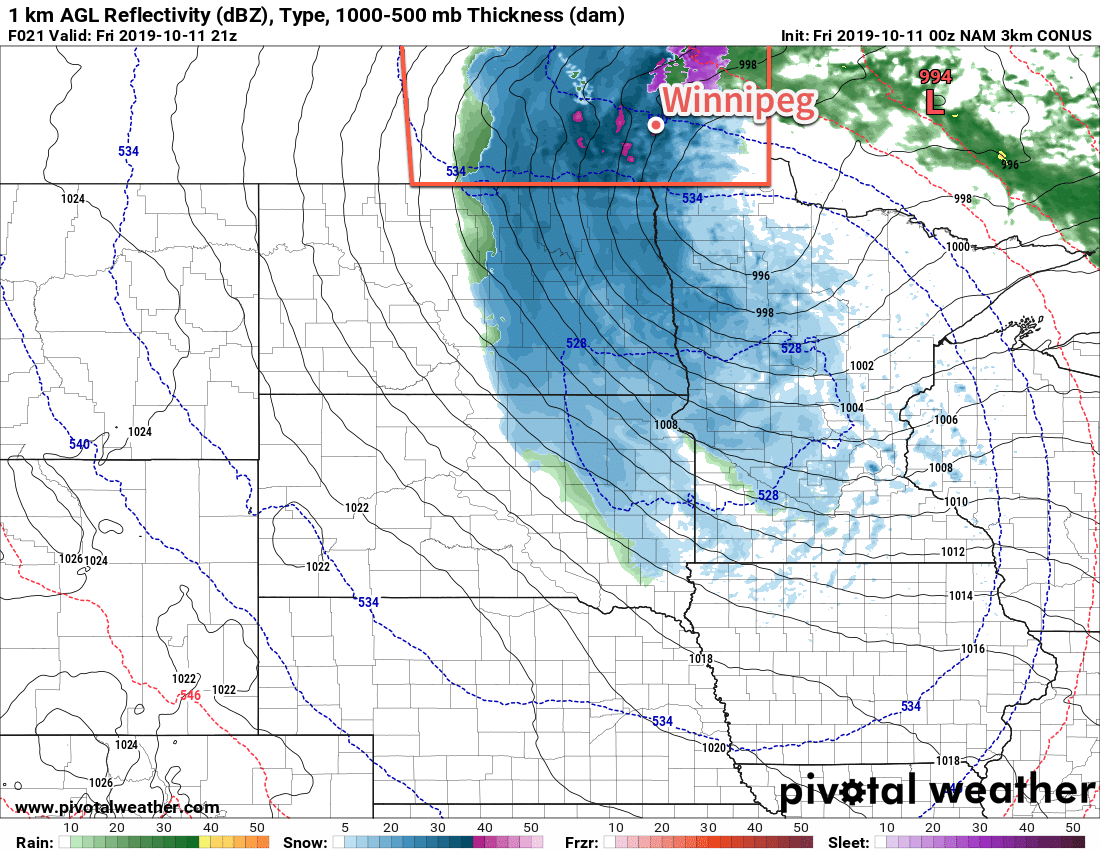
A couple cool days are coming up for Winnipeg as an Arctic air mass remains entrenched over the region. The city will see a high of only 3°C today as northwest winds of 30 gusting 50 km/h continue. Skies will stay cloudy for much of the day as a combination of system1 and lake-effect cloud moves through.

As the day progresses and cooler air aloft pushes into the area, both Lake Winnipeg and Manitoba will likely begin to produce some lake-effect snow. Winnipeg may see some of this snow or rain in the morning. By the afternoon, the precipitation will mainly fall in the lee of the lakes. With a northwest wind, this will likely mean that Winnipeg will end up between a band of snow or rain showers to the west and to the east.

Lake-effect flurries are possible in the lee of the lakes today. The most likely areas to see precipitation will be in the lee of Lake Winnipeg.

The lake-effect precipitation will taper off overnight as the winds ease and turn westerly. The city will see a low near -2°C as the cloud cover begins breaking up.

Thursday will be a cool day with a high of just +4°C. A ridge of high pressure moving through will keep the winds light, but skies will remain partly cloudy to mixed. A warm front pushing eastwards across the Prairies will spread a southerly wind into the Red River Valley on Thursday night along with a bit of cloud. Winnipeg’s low will sit somewhere around the freezing mark.

A return to seasonal warmth arrives on Friday as temperatures climb to a high near 10°C. The region will likely see a fair amount of cloud as the warmer air pushes as well as a strengthening southerly wind into the 30 to 40 km/h range. These breezy winds will persist through the night, keeping the low relatively mild at around 6°C.

Long Range Outlook

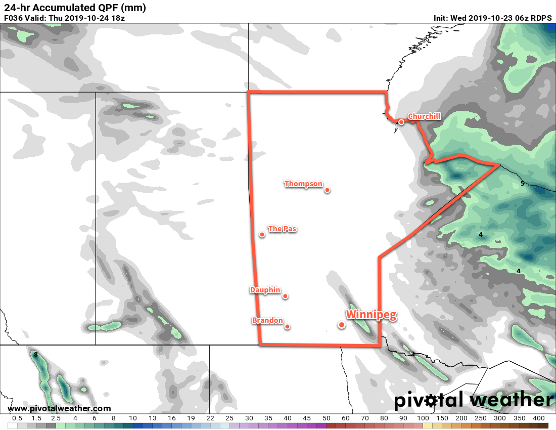
Seasonal warmth will stick around for Saturday, but a passing low will send a cold front sweeping through the region on Saturday night. While the Red River Valley won’t see much precipitation, it will plunge the region into an extended stretch of below-seasonal temperatures. There isn’t much rain or snow in the extended forecast, but with the cooler temperatures it’s likely that lake-effect flurries will be relatively common in the coming week.

Today’s seasonal daytime high in Winnipeg is 7°C while the seasonal overnight low is -3°C.

  1. “System” cloud is the cloud associated with a low pressure system.

Week’s Rainy Start Leads to Much Cooler Weather

More rain will move through the region today, followed by northwest winds and much cooler conditions.

Rain will move through the region today as a Colorado Low moves into NW Ontario. The rain will spread from southwest to northeast across the Red River Valley and have a sharp edge on the northwestern side. This will result in rainfall accumulations dropping from around 5 mm to nothing over a short distance. Winnipeg should see around 5 mm of rain, although the city could see a bit more if the band ends up shifting a bit west or east.

Generally speaking, the eastern Red River Valley into the southeast corner of the province will see 5 to 10 mm of rain. Narrow convective banding could result in localized accumulations of 10 to 20 mm. The western Red River Valley will see amounts generally around 5 to 10 mm in the southwest diminishing to nothing near Portage la Prairie.

While the NAM rainfall accumulations in the Red River Valley for today might end up a tad on the high side, the areas that will see rain look well-represented.

Aside from the rain, highs today will be a seasonably cool 7°C in Winnipeg. A brisk northwest wind will develop through the day, picking up to 30 gusting 50 km/h this afternoon. The wind will then increase to 40 gusting 60 km/h this evening. While the rain will taper off later today, the chance for showers (or eventually flurries) will persist overnight. Temperatures will dip to a low near +2°C.

Cloudy skies will continue in Winnipeg on Tuesday with a continued chance for some scattered showers or flurries. The moderate northwest winds will continue and temperatures will cool with a high of only 5°C. Skies will stay cloudy on Tuesday night with winds beginning to ease as temperatures head to a low near 0°C.

The sun might be able to poke out on Wednesday, but Winnipeg will likely continue to see mainly cloudy skies. The cold air will continue to push into the region, keeping highs cool at just +3°C. Winds, while lighter than Tuesday, should still persist out of the northwest at 20 to 30 km/h. The cloud cover will begin to break up a bit on Wednesday night as the winds finally ease. Winnipeg will see a low near -3°C on Wednesday night.

Long Range Outlook

The rest of the week should bring mixed skies to the city and dry conditions. The cool weather will persist on Thursday, but seasonal temperatures may return (alongside some cloud) for the end of the work week into the weekend.

Today’s seasonal daytime high in Winnipeg is 8°C while the seasonal overnight low is -2°C.

Cleanup Continues With Cool and Cloudy Conditions

Southern Manitoba will continue to see plenty of cloud cover as the region continues to clean up after the historic winter storm last week.

Another low pressure system crossing the Prairies will keep Winnipeg locked under cloudy skies for the next few days. Between the lack of sun and the new snow pack covering the region, temperatures will stay well below seasonal averages. Over the next few days daytime highs will hover near 4°C while low dip to around freezing.

Winds won’t be much of an issue the next while, either. Light southerlies will persist today, switching to northerly on Tuesday as the low passes. Northwest winds of 20 to 30 km/h will develop for Tuesday, but a ridge of high pressure will bring light winds for Tuesday night into Wednesday.

Cooler daytime highs will occur over the fresh snowpack in southern Manitoba and North Dakota.

The only notable weather will be as the low moves through tonight into Tuesday. A wintery mix of light precipitation will move through the Red River Valley overnight, leaving behind a chance of scattered rain showers or flurries for Tuesday. Accumulations will generally be light with 1 to 3 mm for most areas, but a narrow band of 5 to 10 mm may develop along the low track. The heaviest precipitation will remain south of Winnipeg, but whether it occurs in southern Manitoba versus North Dakota is still questionable.

Long Range Outlook

The sun will attempt to reappear in the latter half of the week as warmer air pushes eastwards across the Prairies. Exactly how warm temperatures are able to climb will depend on how much snow remains on the ground. More snow will mean temperatures stay locked into the low single digits. For any areas that are able to eliminate much of the snow pack, highs could climb into the low teens.

No precipitation is expected through the latter half of the week.

Today’s seasonal daytime high in Winnipeg is 11°C while the seasonal overnight low is 0°C.

Major Winter Storm Hammers Southern Manitoba

A Colorado Low is bringing a major early-season winter storm to southern Manitoba that ranges from rain to a crippling blizzard.

Because the storm is ongoing and long-lasting, we are not issuing a standard forecast today. This is a complex and dynamic system that requires constant monitoring as the snow/rain line wiggles around the region. We strongly encourage you check your local weather forecast from ECCC and the weather warnings in your area.

As a general overview, a Colorado Low will gradually move into southeastern Manitoba today. Waves of rain will spread westwards, transitioning into moderate to heavy snow over the Red River Valley and areas west. Storm total snowfall will range from a trace all the way up to in excess of 50 cm. The most snow will fall in upslope areas of the Turtle Mountains, Riding Mountains, and the western escarpment of the Red River Valley. The snow that is falling will be wet, heavy snow, resulting in significant snow loading on trees and infrastructure.

Complicating matters will be strong north-northwest winds with widespread gusts in the 70 to 90 km/h range. These strong winds, combined with the heavy snow, will produce poor visibilities and an elevated risk of damage to trees an infrastructure. Over 23,000 people were without power on Thursday evening and the widespread power outages will likely continue today as well.

Heavy snow will continue over southern Manitoba today with the hardest hit areas extending from the western Red River Valley region southwards into eastern North Dakota.

The storm will gradually ease across the region on Saturday, leaving just a few flurries or showers for Sunday.

Today’s seasonal daytime high in Winnipeg is 12°C while the seasonal overnight low is +1°C.