Cool, Wet Weather Ahead for Winnipeg

A slow-moving low pressure system will bring wet weather to southern Manitoba as rain showers transition to snow mid-week.

NAM Precipitation Type and Intensity Forecast valid 00Z Wednesday April 17, 2024
Manitoba will be under the influence of a complex weather set-up spanning from the central United States the fringes of Canada’s Arctic regions this week.

It will be a cool and wet few days in Winnipeg this week as moisture streams northwards out of the United States and brings rain showers to southern Manitoba. This is a large system that spans the Canadian Prairies and into much of the American Plains and mid-west.

The broad view of this system starts with a potent Colorado Low in the United States which is supporting a broad area of rain showers and waves of thunderstorms. This system will stream moisture northwards, where it will then be captured by an upper low over the Prairies and drawn into the northern Prairies.

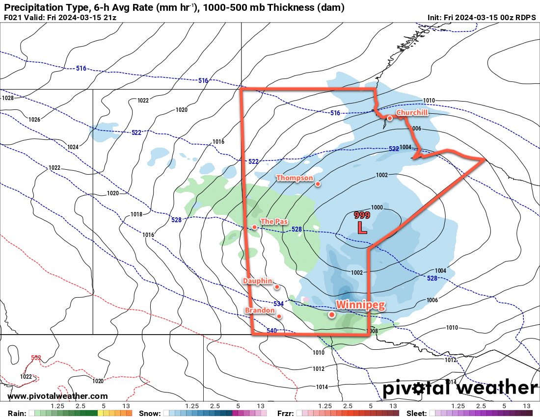
The result of all this will be waves of rain showers that lift northwards out of the United States into southern Manitoba, pushing towards a feature called a deformation zone that will be aligned north-south along the Saskatchewan/Manitoba border. These are upper-level features that act as walls in the atmosphere; the wind does not move through them, and instead spreads out along them.

As the rain meets this feature, it will spread out into a broad area of rain over western Manitoba. This feature will gradually drift east later today and overnight as colder air slumps into the region. This precipitation will likely become mixed with snow overnight as it drifts east to the Red River Valley.

By Wednesday, it could be rain or snow falling as the band of precipitation slowly crosses the Red River Valley. Much of the precipitation should come to an end in Winnipeg later on Wednesday; by this point, the region will have seen anywhere from 10 to 30 mm of precipitation, with a chance that localized areas see even higher amounts. In Winnipeg, storm total precipitation will likely fall in the 15 to 25 mm range.

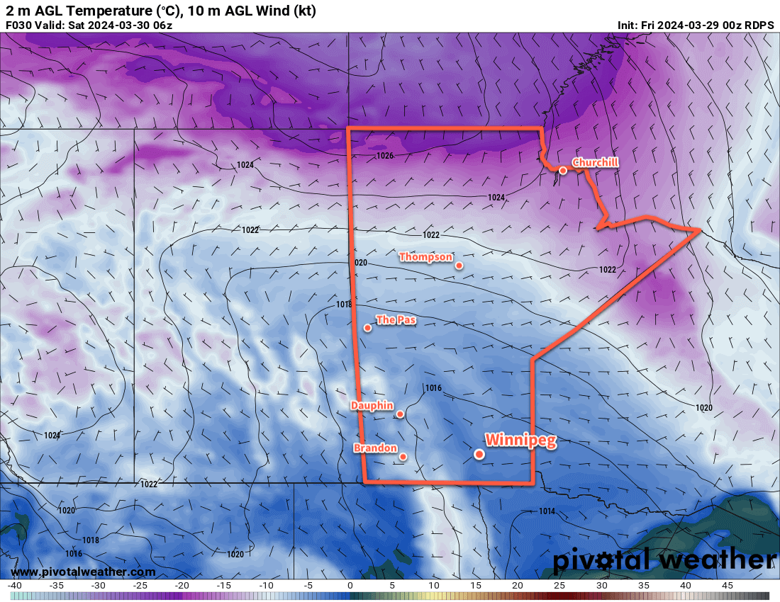
Temperatures throughout this period will fall from a high in the low teens today to high single digits on Wednesday. A cold front will sweep through on Wednesday night, drawing wrap-around snow into southern Manitoba and bringing even colder air into the region.

Daytime highs on Thursday will struggle into the low single digits with bands of wrap-around snow moving through the region. It will be a windy, cool day that comes as an unpleasant turnaround from the beautiful weather on the weekend.

A Note On Confidence

This system is large and complex, and even at this point there is notable uncertainty with how it will develop; in particular, the complex interactions of the Colorado Low and the thunderstorm activity it triggers in the United States could have knock-on effects that impact the weather here. The evolution of the moisture supply, the positioning of low-level jets, how the deformation zone evolves…these all could notably impact the when, where, and how much of these forecasts.

I’ve shared by best effort at a forecast here with full knowledge that I might think “I should have made a different decision in my forecast” by this evening. This should give you a good idea of the general weather pattern over the next few days, but I recommend keeping up to date on the latest forecasts for your area over on the MSC’s weather forecasts page.

Long Range Outlook

This system will finally start moving out of the region on Friday, leaving behind sunny skies for the weekend. Daytime highs will climb back into the low teens over the weekend, leading into a pleasant start to next week with near-seasonal temperatures and plenty of sunshine.

Today’s seasonal daytime high in Winnipeg is 11 °C while the seasonal overnight low is -2 °C.

More Snow in Southern Manitoba as Warm-Up Begins

Winnipeg will see another burst of snow later today as warmer air begins spreading into Manitoba.

RDPS 2m Temperature Forecast valid 06Z Saturday March 30, 2024
A low pressure system with an inverted trough will cross southern Manitoba on Saturday night.

Forecasts have shifted over the past few days regarding the next low pressure system moving through the province today. What earlier in the week was forecast to weaken as it moves into Manitoba is now expected to maintain its integrity. As a result, not only will skies cloud over today, light snow will spread from western Manitoba into the Red River Valley later this afternoon. Winds will pick up out of the southeast to around 20 km/h as temperatures climb to a high near +1 °C.

The snow will continue overnight before tapering off on Saturday morning. While areas in western Manitoba will see close to 10 cm of snow, amounts in the Red River Valley will be less. Winnipeg will likely see 2 to 5 cm of snow by the time it tapers off, though there is an off-chance of seeing totals in the 5 to 10 cm range. Temperatures will head down to a low near -4 °C tonight.

Skies will stay mainly cloudy on Saturday as a trough of low pressure hanging back into the region continues to weaken. Light westerly winds will develop as temperatures bounce back above freezing into the low single digits for the daytime high. Skies will begin to clear out overnight with a low in the -10 to -5 °C range.

A ridge of high pressure will begin moving into the region on Sunday, bringing partly cloudy skies and light winds. Daytime highs will again climb above freezing into the low single digits. Temperatures will dip down into the -15 to -10 °C range on Sunday night with partly cloudy skies.

Long Range Outlook

The warm-up starts in earnest early next week as an upper ridge begins building into the Prairies. This will push milder Pacific air eastwards, sending daytime highs into the 5 to 10 °C range for much of next week.

It looks dry through much of the week, though a couple passing systems could bring a chance of rain showers or light snow.

Today’s seasonal daytime high in Winnipeg is +4 °C while the seasonal overnight low is -7 °C.

Chance of Snow as Colorado Low Lifts North, Then a Gradual Warm-Up Begins

The Winnipeg area will see a chance of light snow today as a Colorado Low lifts into northwest Ontario. Once it passes, the region will move into a gradual warming trend towards Spring weather.

RPDS 2m Temperature Forecast valid 00Z Wednesday March 27, 2024
A Colorado Low lifting northwards into Ontario will support driving northerly winds across southern Manitoba today.

It will be a cool day in Winnipeg today with daytime highs barely reaching the seasonal overnight low for this time of year. Northerly winds up to 40 gusting 60 km/h will drive this cooler air southwards through the day, limiting Winnipeg’s high to around -7 °C. This will be accompanied by cloudy skies and a chance for light snow; a Colorado Low lifting through NW Ontario will spread light snow into eastern Manitoba, but this far west it will struggle against drier air undercutting it. We’ll likely see flakes through the day, but accumulations should be minimal.

A ridge of high pressure will continue to push colder air into the region on Tuesday night, but cloud cover will moderate the overnight low. Those northerly winds will gradually ease overnight as temperatures head to a low in the -15 to -10 °C range.

Skies will stay cloudy on Wednesday as the low departs NW Ontario and the surface ridge moves in. Temperatures will rebound to a high near -5 °C with northerly winds of 30 gusting 50 km/h easing later in the day. Skies should clear out on Wednesday night with temperatures dropping into the -20 to -15 °C range as the ridge of high pressure moves in.

The region will see sunny skies on Thursday as warmer temperatures slowly move back into the region on the backside of the departing high. Winnipeg should see a high in the -5 to 0 °C range on Thursday afternoon and a low near -10 °C on Thursday night.

Long Range Outlook

The end of the week and the weekend will start with a chance of light snow as the stagnant pattern over the region breaks down and a disturbance crosses the southern Prairies. Daytime highs will creep above freezing, though, and in Winnipeg little accumulation is likely. Sunshine should return to the region on Sunday with a high in the 0 to +5 °C range.

Heading into next week, a couple disturbances will slump through Manitoba as a broader push of warm air occurs. This will bring a slight chance of snow or rain, depending on its timing, in the first half of the week. Daytime highs will climb into the 5 to 10 °C range and stay there while overnight lows vary from -10 to 0 °C.

A low pressure system crossing the Prairies mid-week could even bring daytime highs in the 10 to 15 °C range! The warmth will melt the snow left in the city and, combined with the strengthening sun, will likely shift the region into steadier Spring weather.

Today’s seasonal daytime high in Winnipeg is +3 °C while the seasonal overnight low is -8 °C.

Friday Rain Gives Way to Cooler Weekend Weather

A low pressure system crossing the province will bring rain to Winnipeg today, but its cold front will usher in cooler weather for the weekend.

RDPS Precipitation Type and Rate Forecast valid 21Z Friday March 15, 2024
A wintery mix will spread southwards through Manitoba today.

As we mentioned on Tuesday, a low pressure system will drop through Manitoba today, spreading a large area of precipitation across the region. An area of snow mixed with rain will spread southeastwards out of central Manitoba this morning, gradually transitioning to mainly rain as temperatures warm through the day. In Winnipeg, precipitation will begin midday; with temperatures near 0 °C, it will likely start as snow, but as temperatures climb towards a high near 5 °C in the afternoon, it will change over to rain quickly. Periods of rain will be likely through the afternoon with westerly winds up to 40 gusting 60 km/h.

In the evening, a cold front will sweep through the region and usher in northwesterly winds up to 40 gusting 60 km/h. The front will bring an end to the rain, replacing it with a chance of flurries that will last through the night and into Saturday morning. Temperatures will head to a low near -5 °C.

For the weekend, the weather will be shaped by a large Arctic high that will slowly slump into the province. This will result in a gradual break-up of the cloud cover in the region as a cooler air mass pushes into the region. Daytime highs will slump into the -5 to 0 °C range on Saturday and near -5 °C on Sunday. Overnight lows will dip down into the minus teens both nights. Winds will be breezy through the weekend with northwest winds of 30 to 40 km/h on Saturday easing into the 20 to 30 km/h range on Sunday.

Long Range Outlook

Another disturbance will pass through the region on Monday and bring another push of warmer air. Daytime highs should climb back up close to +5 °C on Monday with moderate southerly winds.

Behind this system, an upper trough is forecast to dig into the Prairies; this will bring cooler temperatures for the rest of next week with daytime highs falling below 0 °C. Much of the week will be dry, but there could be accumulating snow across southern Manitoba mid-week.

Today’s seasonal daytime high in Winnipeg is -1 °C while the seasonal overnight low is -11 °C.