Warm and humid weather will bring a chance of showers or thunderstorms to the Winnipeg area this weekend.
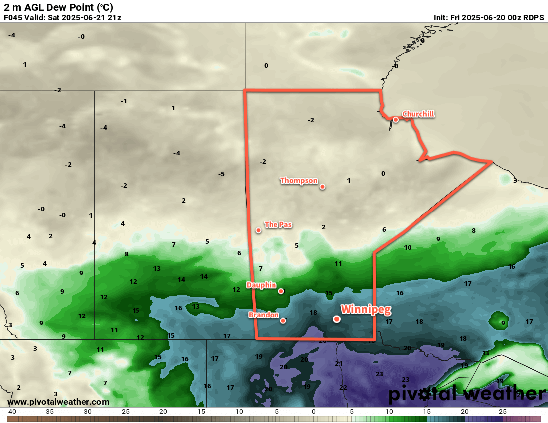
An upper ridge will continue to build over the eastern Prairies to end the week, bringing warmer temperatures and a shift into one of the first humid periods of the year. Dew point values will climb from the low and mid-teens into the upper teens or even the low 20s over the next 24 to 48 hours. This will shift conditions to be notably more humid than seen for any notable period this season.
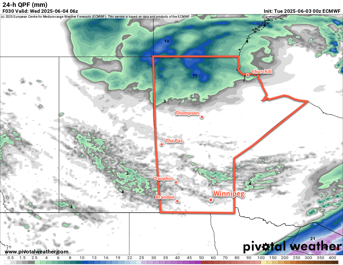
This push of warmer and humid weather will turn unsettled as an upper trough begins to deepen over western North America. This will send multiple disturbances towards the region over the next few days, each bringing a chance of showers or thunderstorms with them as they track through.
There will be a chance of showers thunderstorms this evening, roughly from the northern Red River Valley northeast, along a warm front pushing north through the region.
This frontal boundary will lie draped across the region on Saturday and generate more showers and thunderstorms as potent low pressure system in Alberta begins to shift east. Much of this activity will develop west and north of the Red River Valley, likely leaving Winnipeg dry.
On Sunday, a well-organized low will track through the American Plains and draw the front over southern Manitoba to the southeast through the day. This system will produce widespread showers and thunderstorms across southern Manitoba through the day that gradually taper off on Sunday night.
Temperatures will climb into the upper 20s both today and tomorrow, with the humidity making it feel closer to the low to mid-30s once it pushes in. Overnight lows both nights should sit in the upper teens or low 20s. The cloud and showers on Sunday will keep highs cooler, likely in the low 20s. As the front sweeps southeast later Sunday, a cooler and drier air mass will move into the region. Temperatures will be much cooler on Sunday night, dropping into the low teens.
Lastly, the region could see smoke this weekend from the Nopiming Provincial Park wildfire and from a few other fires burning further into Ontario. Northeast winds developing tonight and through Saturday will draw smoke southwest from these fires, but where the plumes go will be sensitive to the exact wind directions. Best chance to see smoke right now will be east of Lake Winnipeg into the southern Interlake, but there is a chance that the plumes will reach the Winnipeg area. The chance will begin to decrease Saturday night into Sunday, then come to an end as winds swing around with the cold frontal passage later Sunday.
Long Range Outlook
After a cool Monday, temperatures will rebound to seasonal to slightly above-seasonal values through the rest of next week. The region should see variable cloudiness with a chance of isolated to scattered thunderstorm activity on several days.
A low pressure system tracking through the central Prairies may bring hot and humid conditions to the region again next weekend.
Today’s seasonal daytime high in Winnipeg is 24 °C while the seasonal overnight low is 11 °C.