Elsewhere in Weather News: July 20th, 2013

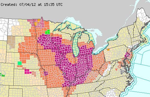
Severe Weather Outbreak in Southern Ontario; Numerous Warnings Issued Friday

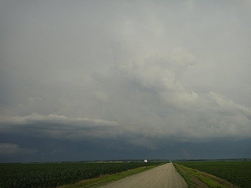
On Friday, severe weather rolled across much of southern Ontario, southern Quebec and nearby states such as Michigan and New York. Severe weather was imminent in the region as a strong squall line of storms formed with some bowing segments in the morning and continued into a great thunderstorm environment as the afternoon wore on. CAPE values were quite high, shear sufficient and for any storms that remained discrete, a decent tornado potential was there before getting absorbed into the squall line. This prompted a plethora of warnings to be issued, including numerous tornado warnings throughout the day.

Wind damage was the biggest concern on Friday though, numerous reports of wind gusts exceeding 100km/h and even one report as high as 119km/h in Waterloo Ont., were reported. In turn, significant damage was reported across southern Ontario; mature trees knocked down, trees falling on homes and winds flattening crops. As of Friday night 550,000 people were still without power in Quebec and Ontario due to winds knocking down power lines and trees falling on lines. Storm survey teams are expected to head out to various spots across southern Ontario tomorrow to determine if damage was caused by straight-line winds or a tornado touching down. Two unconfirmed funnel clouds had been reported around the towns of Bradford and Barrie, Ontario. Unfortunately one person has died and ten more have been injured because of falling tree limbs; this is a reminder to people that even though a tornado might not be imminent, it’s better to take cover as a storm approaches.

Downed tree

Large trees downed in Toronto by strong winds produced in Friday’s storms. (Source: City News)

The cold front behind this system will put end to Ontario’s heatwave. Many cities in southern Ontario, including Toronto, had reached “official” heatwave status by reaching 32°C three days in a row. This combined with high humidity values made for excessive heat, therefore it’s likely that most residents will welcome the cooler and drier air on Sunday.

Elsewhere in Weather News: July 7th, 2012

Devastating Derecho Races Across US States

An extremely powerful storm raced across part of the Midwest and Atlantic region the night of Friday, June 29th and into Saturday, shutting down power to millions of people. The type of storm, called derecho (pronounced day-RAY-cho) is a severe thunderstorm that produces severe wind gusts –downbursts that can produce a large swath of damage in a short amount of time. In addition to the wind threat normally associated with this type of storm, the intense lightning also poses a great danger to residents.

Time lapse video of the derecho trekking across the Midwest and Atlantic states. (Source: NOAA/NASA)

On this occasion, the derecho moved over 10 states and traveled for over 24 hours before reaching the Atlantic Ocean. Over three-and-a-half million people in the Midwest and Atlantic states were without power following the event. Boundless amounts of trees were uprooted, electrical poles taken down, and mobile homes that flipped, could be seen throughout the storm’s path. In all, 27 people lost their lives due to the storm. Hundreds of others were injured. In the storm’s aftermath, searing heat moved back into the region inciting more deaths as heat stroke became a major concern with no electricity to work with. As of Thursday night, July 5th, almost one week since the event passed through these states, there were still a quarter of a million people without power, mostly people north of Washington DC. Many cooling shelters had to be put in place across the area. Heat and humidity advisories were posted, urging residents to limit time spent outdoors to no more than a half-hour at a time. Some cities even cancelled July 4th celebrations due to power outages and excessive heat.

Wind damage

Just one of the many pictures taken of wind damage in the Washington, DC area, product of the derecho. (Source: Associated Press)

The tremendous heat and humidity is expected to stay in place throughout most of the eastern US where 3,000 temperature records were already broken this week, as of Thursday. There is a chance of relief from these extreme conditions next week, as a cold front is forecast to slice its way in a southerly motion through the Midwest and Atlantic states.

Heat warnings

Heat advisories in orange and excessive heat warnings in purple scattered across the Midwest and Atlantic states. On Friday the 6th of July, even a larger area was covered in warning and advisories. (Source: National Weather Service)

Powerful Storm Hits Bemidji

On Monday July 2nd, a few AWM team members headed down to Fargo to chase supercells. The targeted supercells quickly became a cluster of severe storms as they moved into Minnesota. Shortly afterwards, the cluster merged into a bow echo segment, which is very similar to a derecho but smaller in size. Locally, significant damage, similar to what was observed in the Midwest, was reported in Bemidji with the passing of this storm. One boater died as his vessel capsized due to the severe winds and torrential rains. Many trees over 100 years old and power lines snapped easily in the storm’s path, causing widespread power outages locally, in Central Minnesota. Because of all the damage and not much time to tend to downed power lines, the city issued a curfew to residents on Monday night from 11:00 pm to 6:00 am. The Storm Prediction Centre had warned of a bow echo in the days before the event, stressing the severe wind potential. Weather in Central Minnesota this weekend will be similar to Southern Manitoba’s, perhaps a little warmer.

Bemidji storm

Picture of the back side of the storm as it approaches Bemidji, taken north-east of Fargo in Minnesota. (Source: AWM chase team)