We’ll slowly warm up this week, but no spectacular weather is in store.
Monday through Wednesday
Clearing
-3°C / -14°C
Mainly sunny
-4°C / -14°C
Mainly sunny
-3°C / -12°C
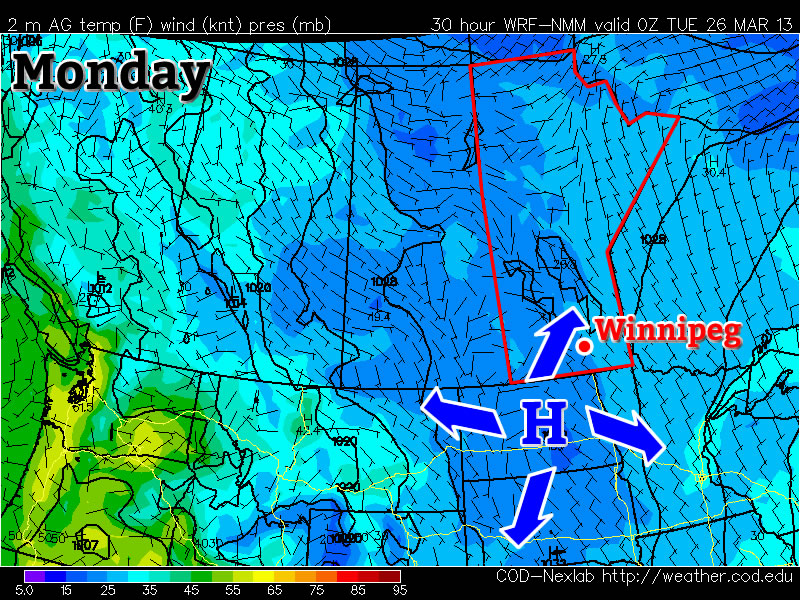
Monday will be another carbon-copy of what we’ve seen a lot of lately. Temperatures will be in the mid minus single digits in most areas, with the exception of forested areas and areas within the cities, where temperatures will be a good five or so degrees warmer than that. There will be a chance of flurries during the morning into the early afternoon before we clear out by later in the day. Tuesday will again be almost identical to Monday – except sunnier – so no further elaboration is needed about that.
Wednesday should see temperatures come up a bit more, with highs in the low to mid minus single digits in most areas. Like Monday and Tuesday, forested and city areas will be a bit warmer than the open prairie, with values around or just above freezing.
Long Range
The long range is neither good nor bad. It looks like we should warm up even more later this week, with more widespread freezing or above freezing temperatures expected. However, further out in the long range models show more cold air dropping south into Southern Manitoba around next weekend, with no more substantial warm-ups currently in the forecast.