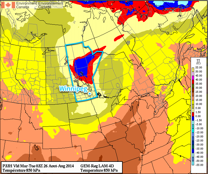
Southern Manitoba will see its first blast of fall-like weather as gusty northwesterly winds draw cool air southwards over the region. Fortunately, it doesn’t look like the cold weather is here to stay and seasonal temperatures are expected to return by week’s end.
Today will be an unwelcome day for late August as abnormally cold air will move into the province behind the low pressure system that brought 20–40mm of rain to Winnipeg & the Red River Valley Saturday night into Sunday morning. Brisk northwesterly winds to around 30–40km/h will usher in this cooler air and will restrain our daytime high to just the mid-teens. Additionally, the abnormally cool air aloft and favourable wind profiles will combine to produce lake-effect showers that will spread southeastwards towards Winnipeg.

Given that, occasional showers are likely in Winnipeg although due to the nature of lake-effect precipitation[1] the precise wind direction will determine whether or not the showers find their way into Winnipeg or whether they end up just north or just south of the city.
The clouds will clear out tonight as temperatures drop to around 7°C.
Tuesday and Wednesday will trend towards seasonal weather. Winds will be relatively light both days while the Red River Valley enjoys mainly sunny skies. Temperatures tomorrow will climb into the high teens while highs on Wednesday will reach the low 20’s. Lows on Tuesday night will bottom out around 10°C while Wednesday night sees more seasonal lows in the mid-teens.
Seasonal End to the Week
Looking ahead to the second half of the week, summer weather returns in full swing. Temperatures heading through the end of the week will see daytime highs in the mid–20’s with overnight lows in the mid-teens. The weather looks fairly dry until Friday when a weak cold front pushing across the province brings the chance for some shower or thundershower activity.
- Lake-effect precipitation extends in a very narrow band along the direction of the wind. ↩
