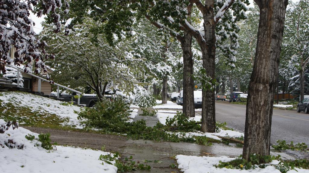
Unfortunately, this week’s plunge into terrible cold for September is far from over, with cooler temperatures still set to work their way into Southern Manitoba. The growing season will be at risk for a tragically early end with frost a slight possibility over the next couple nights here in the Red River Valley.
The weather story for the Red River Valley over the next few days is dominated by a rather significant high pressure system slumping southwards through Alberta. The 1034mb or stronger high is a result of a large outbreak of cold air from the high Arctic and while the high center is sliding down the foothills of Alberta, the system covers the entire Prairies.
This means that substantially below-normal temperatures[1] accompanied by brisk northerly winds will persist for much of the rest of the week before slightly milder air finally pushes across the Prairies as the high pushes southwards into the United States.
Today will be a windy day with moderate northerly winds to around 30km/h and a high of only 12°C or so. Skies will be fairly mixed, although it will become more consistently cloudy this evening as cooler air begins working into Southern Manitoba aloft and the lakes begin producing more cloud. By late-evening a slight chance of drizzle will work its way into Winnipeg as north/northeasterly winds bring in cloud streamers off the south basin of Lake Winnipeg. Drizzle or showery weather is more likely near the Portage La Prairie region where Lake Manitoba, under slightly colder air and more favourable wind profiles undergoes more vigorous lake-effect activity.
Temperatures will drop to around 2°C or so, however it’s possible that the temperature drops to the freezing mark with some frost in some of the rural areas in the Red River Valley, depending on where cloud vs. clear skies set up.
Thursday will bring mixed skies again, although the winds should be a bit lighter than today. The high will once again be around 12°C. There will be more cloud from the lakes on Thursday night and a slight chance for some drizzle down-wind of the lakes as we head to a low of around 1°C. Once again, it’s possible some areas see the temperature drop to the freezing mark in rural regions, depending on cloud cover.
Friday will bring a shift in the weather as the high finally slumps to our south and westerly winds work their way in. We won’t see the temperature move much during the day thanks to the fact that, despite the shift in wind, southern Manitoba will still be under the influence of outflow winds from the high. The westerly winds should clear things out, allowing for our sunniest day of the week.
A disturbance will then begin diving southwards from the Northern Prairies on Friday night, spreading cloud ahead of it and slightly milder temperatures aloft. As a result, temperatures will likely be a little warmer on Friday night with lows near 5°C.
Improving Conditions for Next Week
Looking ahead, things look to begin gradually improving on the weekend. Saturday will bring some sun and cloud alongside a slight chance for some shower activity as a weak disturbance trundles through. On the backside of the system lake-effect showers/drizzle will again be possible on Saturday night. Temperatures will likely be limited to the low teens on Saturday.
Sunday will be a nicer day. At this point it looks like it will likely be a mainly sunny day with a high in the mid-teens. There’s some discrepancy in models right now with some models suggesting a mainly cloudy day, others mainly sunny. We’ll have to wait and see what exactly pans out for the day.
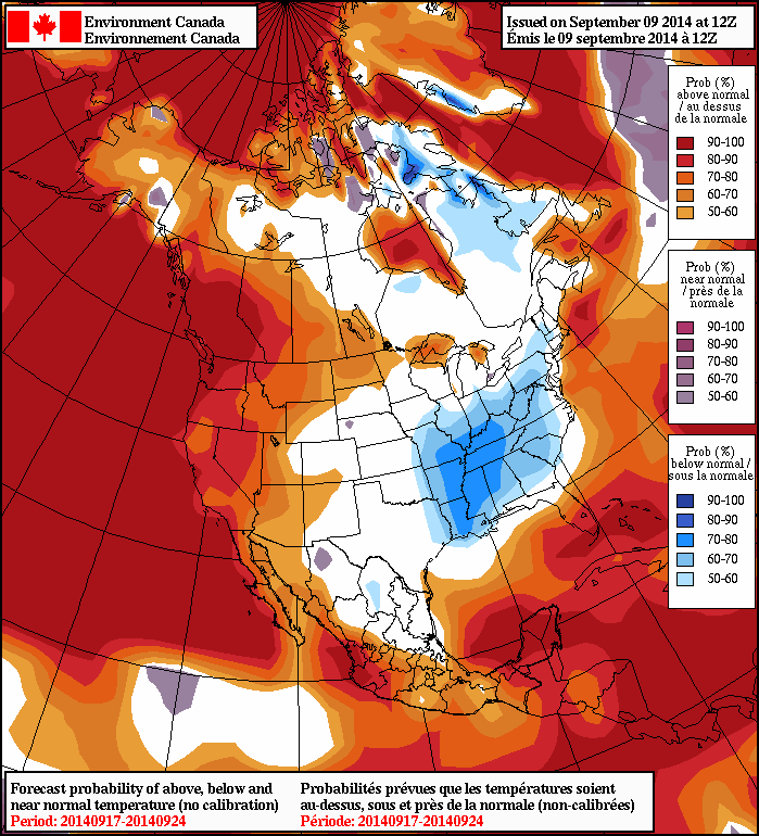
Into next week, it looks like we’ll see a return to summer weather as a surge of warm air spills eastwards across the Prairies. The NAEFS[2] is calling for above-normal temperatures in the 8–14 day outlook, which will be a welcome relief after this very early cold snap. Models are suggesting that next week will be relatively dry, with the potential for rainfall near the end of the week.