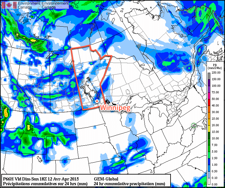
Some absolutely beautiful weather is on tap heading into this weekend as a stretch of above-normal temperatures sets up over Southern Manitoba. An upper-level ridge building into Manitoba will bring with it a surge of warmer air that will allow our temperatures to soar into the mid-to-upper teens with plenty of sunshine. A brief hiccup in the nice weather will move through on Sunday, but then it looks like a quick rebound for the upper ridge, maintaining warmer than seasonal temperatures across Southern Manitoba.1
Today will be a transition day from the cooler air behind yesterday’s cold front into the incoming warm air spreading eastwards with the upper-level ridge. Mainly sunny skies will be in place over the Red River Valley with a high near 12°C. Winds will start off light out of the northwest and back to the south by evening; winds will remain fairly light through the day, though, up to only around 10–15km/h. Tonight will bring clear skies and a low near +1°C and light winds.
Saturday will be a beautiful day. Full sun combined with the warming temperatures aloft will allow our daytime high to climb to – a nearly 10°C above normal – 18°C. The winds will be, as they are often when we see big warm-ups, pretty stiff out of the south with sustained winds to 30–40km/h with gusts to around 50km/h. Winds will slowly taper off overnight, but with all the warm air in place over the region, we’ll see a balmy overnight low near 8°C with a bit of cloud cover moving in overnight.

Sunday will be more of an unsettled day as a cold front moves through the region. The day will start off with increasing cloud and likely some showers moving through with the cold front. Behind the front, we’ll see clearing skies making for a sunny afternoon and a high near 14°C. Unfortunately, the winds will pick up out of the northwest behind the front and be pretty breezy; by late afternoon the winds will likely be up to 40 gusting 60km/h out of the northwest. There may be a slight chance of some late-day showers for Winnipeg, but it really ends up depending on the exact track of the upper-level low as it moves through. It looks most likely that any wrap-around showers will remain north of the city.
Sunday night will bring mainly clear skies and a low near +2°C as cooler air works in aloft.
Next Week At A Glance
Next week looks to continue the warm streak with daytime highs in the mid-teens. Conditions look fairly dry with most the precipitation associated with any lows moving through remains further north into central Manitoba.
After a week of cooler temperatures, it looks like we finally get to switch into a more prolonged period of spring-like warmth.
Seasonal daytime highs for this time of year in Winnipeg are around 10°C.↩

The overall air mass that moved into the region today was a little bit warmer than it looked like it would be when I was writing this up on Thursday evening; so we managed to crush my forecast high of 18°C with a beautiful 22.1°C reported at the Winnipeg airport (the 22.1°C comes from a SYNO report; the actual METAR reports, as shown in the attached image, only hit 21°C). While I may have been wrong, I’m at least happy to have forecast for nice weather and had really nice weather than say it’d be nice and it ends up…not so much.
Likewise, tomorrow will likely be a couple degrees warmer than my forecast high with the air mass being warmer across the board; expect a high closer to 17 or 18°C instead of 14°C.