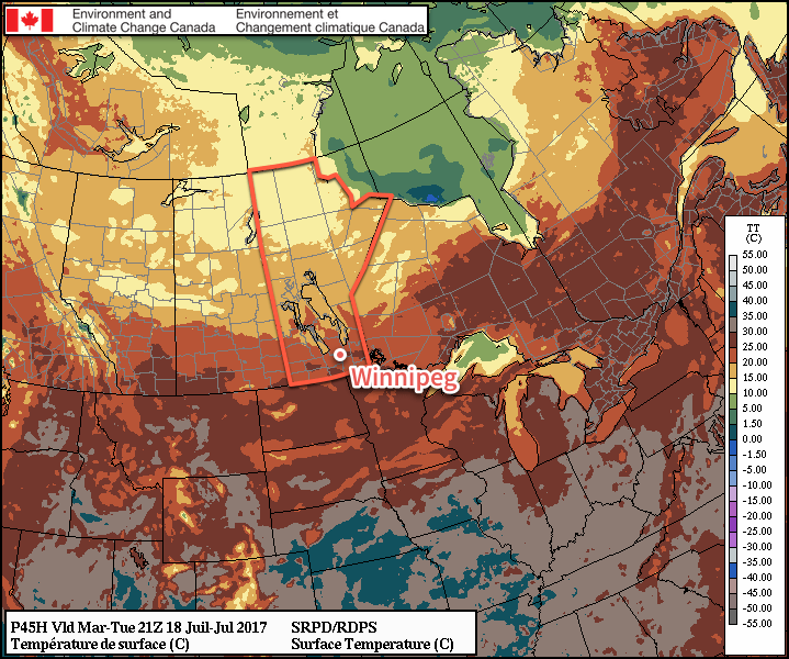
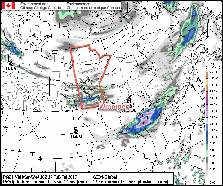
Winnipeg will see a little bit of everything over the next few days as warm and humid conditions are replaced by a northwest wind that ushers in slightly cooler and much drier air. Winnipeg will also see several chances for thunderstorms this week.
This morning will start off cloudy with the chance of a thunderstorm for Winnipeg & much of the Red River Valley as elevated convection that developed overnight moves through the region. Behind the morning convection, temperatures will climb to a high near 28 or 29°C with winds of 15-25 km/h out of the northwest. It’ll get rather humid this morning with dew points climbing up to around the 18°C mark before drier air works in from the northwest for the afternoon. Skies will break up somewhat for the afternoon and then clear out in the late afternoon or evening. Temperatures will head to a low near 14°C under clear skies tonight.

A ridge of high pressure will move across the province on Tuesday, bringing slightly cooler temperatures and mainly sunny skies for Winnipeg. A disturbance moving through North Dakota may spread cloud cover across the southern Red River Valley, but there’s still a bit of uncertainty about that. Temperatures will be just a touch below-seasonal for the latter half of June with a high near 25°C, but winds will be light, so it’ll feel like a pretty nice summer day. Temperatures will dip to a low near 13°C on Tuesday night under clear skies.
Wednesday will bring the next chance for thunderstorms to the province as a warm front moves in. It’s expected that elevated convection will from ahead of the warm front on Tuesday night in Saskatchewan, and then spread across southwest Manitoba overnight and into the Red River Valley on Wednesday morning.

In these situations, there’s almost always a significant amount of uncertainty, so we’ll definitely be keeping an eye on how things develop. The end result will be a “cloudy with sunny breaks” kind of day with a high near 25°C once again. Winds will be fairly light. Skies will clear by evening & temperatures will be on the way to a low near 15°C.
Long Range
The remainder of the week looks continue the pattern. Temperatures will edge up a few degrees for Thursday and Friday, but it appears that things will turn increasingly unsettled Thursday night into Friday morning, and Friday night into Saturday.
Extended forecasts hint that we may see a stretch of warm, dry weather beginning Sunday, but that’s been advertised more than once this summer and vanished like dust in the wind, so we’ll hold off on promising that.
So…pleasant overall, but still no sign of that big hot, dry summer stretch.
Winnipeg’s seasonal daytime high is currently 26°C while the seasonal overnight low is 13°C.
