A low pressure system moving through southern Manitoba on Friday will bring light snow to Winnipeg and usher in cooler conditions for the weekend.
Winnipeg will see cloudy skies and a chance of flurries today as a low pressure system slides across the Red River Valley through the day. Temperatures will be quite warm with highs near -1°C, but winds will shift to the northwest this afternoon as a cold front sweeps through and strengthen to around 30 gusting 50 km/h. As the upper-level core of this system moves into the Red River Valley this evening, more organized snow will spread into the region. Winnipeg will likely see periods of snow through the night with around 2 cm of fresh snow by Saturday morning. Temperatures will steadily drop towards a low of -12°C.
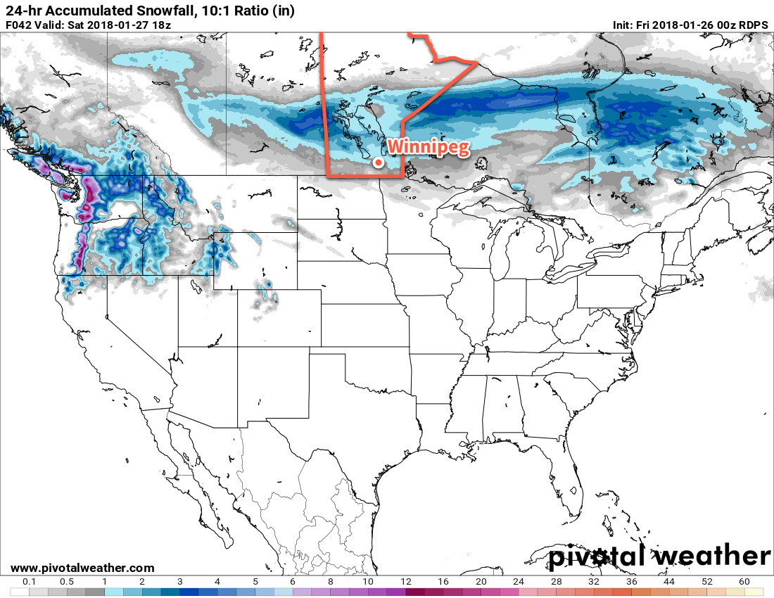
Saturday will see the snow gradually taper off with temperatures slowly falling through the day as an Arctic high builds in from the northwest. Skies will remain cloudy with winds continuing out of the northwest at around 30 km/h. The temperature will fall to around -16°C by the evening, and continue on to a low near -22°C. That northwest wind should begin to ease on Saturday night.
Sunday should bring a bit of sun back to Winnipeg with a mix of sun and cloud in place for the day, but it will be a cool one with a high near -16°C. Sunday night will be another cool one as the Arctic high moves across the province with lows dipping back down to around -22°C again under variable cloudiness.
Long Range Outlook
Next week will start off cool again as the ridge exits the province, followed by a brisk southeasterly flow that will develop on Monday night ahead of a low that is showing some indications of potentially bringing one of the more significant snowfalls to Winnipeg so far this winter.
There’s still quite a bit of uncertainty on exactly how this system will develop, but in general it looks like many parts of southern Manitoba will see the potential of getting between 5 to 15 cm of snow Monday night into Tuesday.
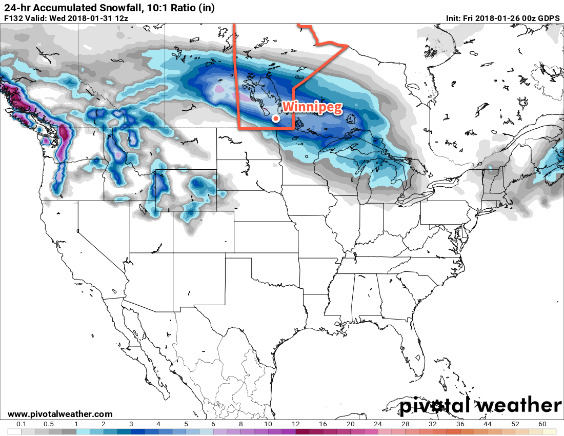
After this system moves through, indications are that Winnipeg will move back to cooler conditions as temperatures fall well below seasonal values for the latter half of the week with highs falling into the -15 to -20°C range.
Winnipeg’s seasonal daytime high is currently -12°C while the seasonal overnight low is -23°C.