Friday will bring one more hot and hazy day to Winnipeg before a passing low pressure system ushers cooler temperatures and widespread smoke into the region.
Winnipeg will see temperatures soar back up to the 30°C mark again today as a hot air mass remains in place over the region. The city will see varying levels of haze through the day under mainly sunny skies. Winds will remain light for much of the day. A low approaching from the west will spread southerly winds near 20 km/h into Winnipeg overnight. Temperatures will remain warm tonight as the southerly winds help keep the warmer temperatures near the surface. Winnipeg will see a low near 18°C.
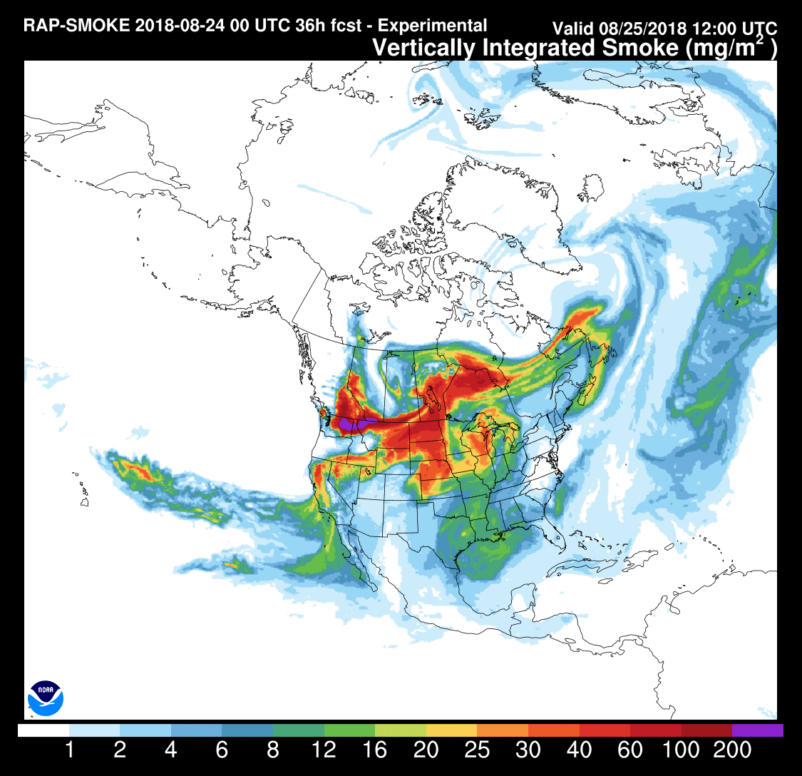
Just in time for the weekend, a low pressure system passing through on Saturday morning will spread widespread smoke across the province. As it moves through on Saturday morning, it will push a cold front through the Red River Valley. The passage of this front will bring west-northwest winds of 20 to 30 km/h into the Red River Valley and usher in a smoky air mass that’s been in place over the western Prairies for several days. While the cold front will bring variable cloudiness to the region, the thicker smoke moving in aloft will cut down on any sunshine. Winnipeg’s temperature should top out near somewhere in the 22 to 25°C range, depending on the thickness and timing of the smoke. With the passage of the cold front there is a small chance of some showers, but the odds look very slim at the moment.
Temperatures will drop to a chilly low near 7°C with light winds on Saturday night. A strong ridge of high pressure moving in should push out the smoke overnight.
Sunday will be a much cooler day in Winnipeg as a high pressure system moves through the province. Indications at this point are that the smoke should have cleared out of the region, leaving Winnipeg with partly cloudy skies as some cloud develops in the afternoon. Daytime highs will climb to around 21°C in Winnipeg with light t northerly winds. The low should drop to around 12°C on Sunday night.
Long Range Outlook
Next week looks to start with a low pressure system moving through the province bringing cooler temperatures, cloud cover, and a chance for rain/thunderstorms. The pattern then gradually turns towards seasonal temperatures mid-week, followed by a return of unsettled conditions near the end of the week.
Winnipeg’s seasonal daytime high is currently 24°C while the seasonal overnight low is 10°C.