While warmer will arrive in Southern Manitoba today with thanks to an abrupt switch to above normal temperatures, the bigger weather story on the horizon is the increasingly unsettled weather that will move into the region for the end of the week, culminating in what will most likely be the first major spring storm for Winnipeg & the Red River Valley.
Today will be the most pleasant day of the week as temperatures soar into the mid-teens with winds gradually increasing out of the southeast to around 30km/h for the afternoon. Skies will be fairly sunny, so all in all it will be a great day and boy, best to get out and enjoy it. Skies will begin clouding up tonight as the first of several systems approaches. Those breezy southeasterly winds will continue throughout the night. Into the second half of the night, some shower activity will begin spreading into the Red River Valley from western Manitoba.
Thursday will start off with some showers throughout the Red River Valley tapering off by mid-day. Temperatures will be quite mild with daytime highs climbing up to around the 17°C mark as a warm front pushes northwards out of the United States in response to a deep upper-level trough digging into the Plains from the Rocky Mountains.
With the warm front developing over the region through the afternoon, a chance of some isolated showers or drizzle will continue throughout Thursday afternoon. Heading into Thursday night, the main event will begin to take shape: a major storm that will impact all of Southern Manitoba.
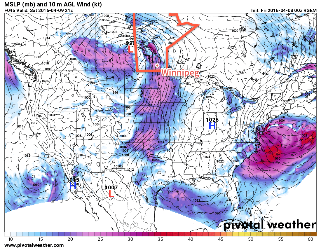
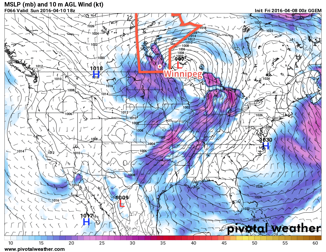
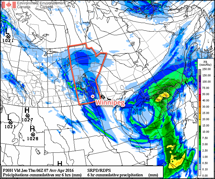
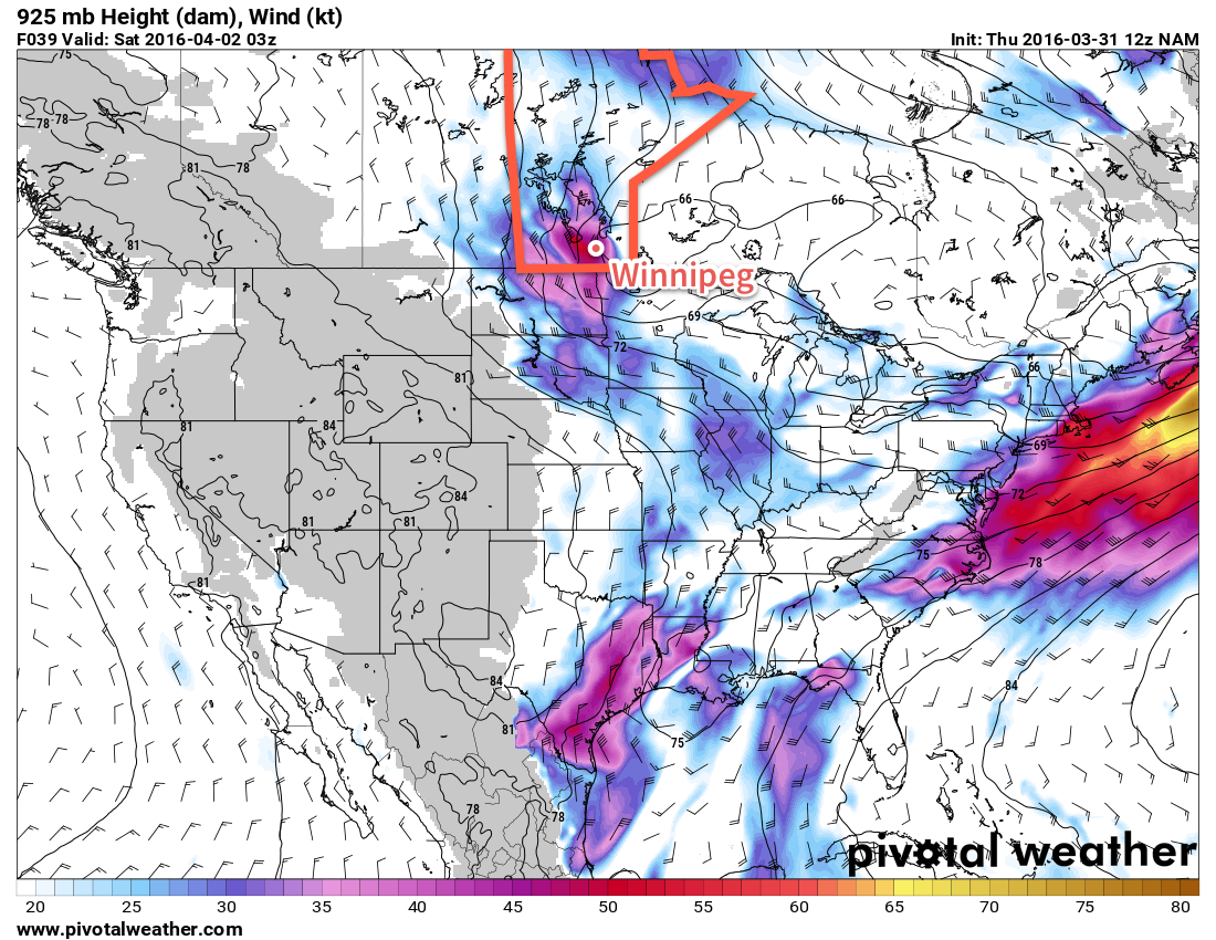
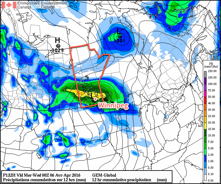
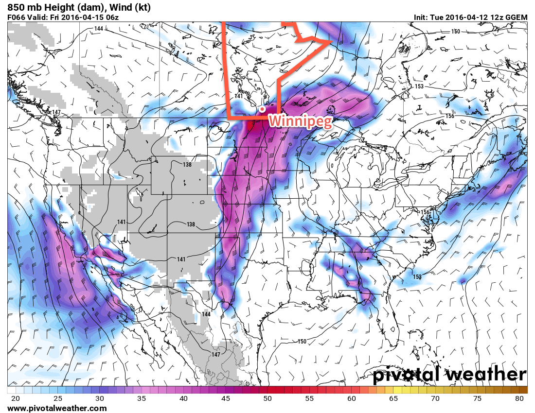
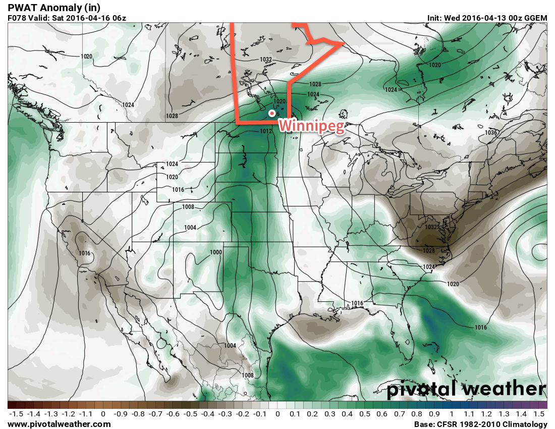
As this large-scale trough mentioned above develops, a significant amount of Gulf moisture will surge northwards through the Plains of the United States and head into Southern Manitoba, sending PWAT[1] values soaring to nearly 20mm above seasonal values. As a low pressure system pushes out of Wyoming and heads northeastwards into the Dakotas on Thursday night, a large area of rain will blossom over Montana, North Dakota and SE Saskatchewan and spread eastwards into Manitoba through the day on Friday.
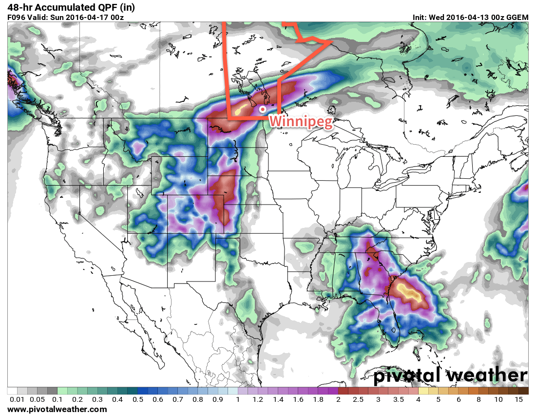
The amount of precipitation is a relatively known quantity; it looks like 40-75mm over the course of 2 days is likely along the main axis of precipitation with amounts dropping to around 15-25mm along the edges of the precipitation. The challenge comes in where exactly this band of precipitation will set up, which will be determined by the position of the warm front and how far northwards it can push. The vast majority of the precipitation will fall to the north and northwest of the warm front, while drier and warmer weather remains to the south and southeast of the front.
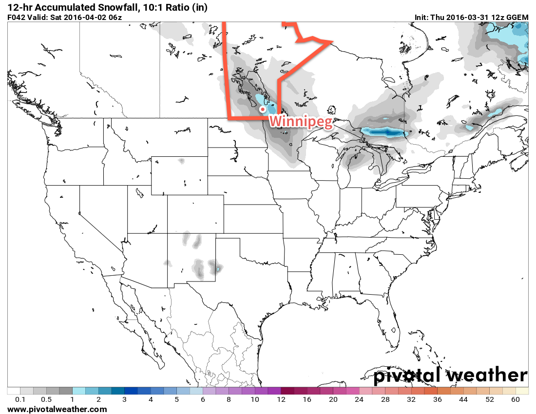
There’s a chance that some of the rain may change over to snow on the western fringes of this system, most likely in the Melita, Virden and Minnedosa/Riding Mountain region. Depending on exact temperatures and the timing of the transition, it could mean a significant snowfall if the switch-over happens and it happens early enough.
For Winnipeg, the general consensus for 2-day totals tends to be around 45mm by Saturday evening. The nature of getting to that number varies, with the GFS producing a fair amount of rain on Friday and Saturday while the GDPS holds almost all the precipitation back until Saturday. We’ll have simply wait and see how exactly the warm front sets up to have a better idea of where the precipitation is going to fly.
Summary
Mild weather returns to Manitoba through the second half of this week, however with it will come the development of the first major spring storm of the year. A few showers will move through on Thursday morning, however the main event will occur through Friday and Saturday when a sharp warm front will separate temperatures in the mid-single digits over western Manitoba from near-20°C temperatures over southeastern Manitoba. To the north and northwest of this warm front, a significant rainfall event is expected, driven by a surge of moisture from the Gulf of Mexico as a deep long-wave trough digs into the Plains of the United States.
By the time all is said and done, between 40-75mm is likely to have fallen along the axis of heaviest precipitation by Saturday evening. Where exactly this line lies will depend on exactly how far northwards the warm front is able to push; the uncertainty associated with this means that we simply have to wait and see how things develop to refine Winnipeg’s forecast for timing & amounts of precipitation.
With such a big system on the doorstep and so much uncertainty, we’ll be working ahead and getting our Friday forecast out at some point on Thursday evening rather than on Friday morning so that you can get a better idea ahead of time on what to expect for the weekend!
Winnipeg’s seasonal daytime high is currently 10°C while the seasonal overnight low is -2°C.
- Precipitable Water, a vertical integration of the amount of water vapour in a column of the atmosphere. ↩