Moderately miserable, categorically cold; the weather leading into this weekend will be fairly miserable as a large low pressure system moving through Ontario exerts its influence over southern Manitoba causing strong northwesterly winds as the coldest shot yet of Arctic air plunges southwards into the United States.
Friday: A Miserable Fall Storm
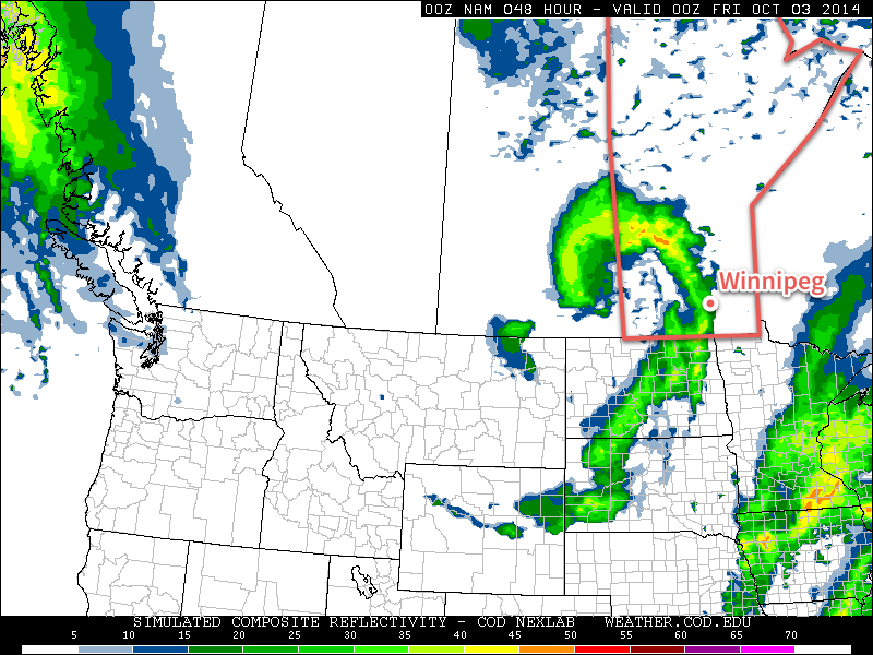
The Red River Valley will be under the grip of a miserable fall storm lifting northwards through Northern Ontario today, driven by a massive push of cold Arctic air sweeping through Manitoba. We’ll see a very cold start to the morning with temperatures hovering around 2–3°C, strong northerly winds at 40–50km/h with gusts as high as 70–75km/h and a band of rain stretching north-south through the region. Embedded within the band will likely be some convection, significant since increased precipitation intensity could mean that in addition to the rain, we might see brief bursts of snow as well.
The precipitation should taper off by early afternoon, but we’ll still be left with a strong northerly wind and temperatures struggling to get to our high of 5°C. If the sun manages to poke out at all, we may eke out a 6°C for a high, but that looks quite unlikely.

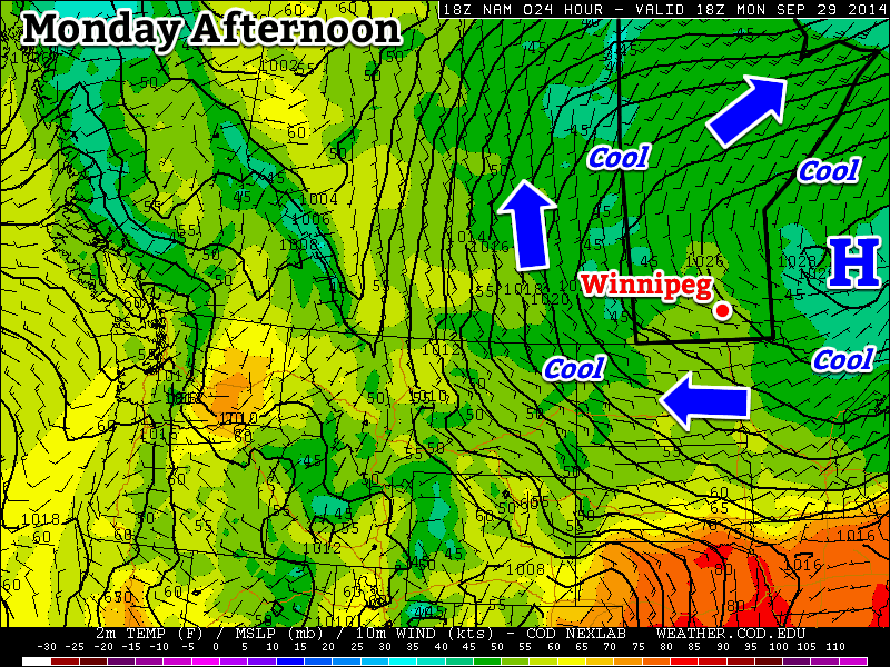
Winds will begin to taper off tonight to around 20km/h. Combined with the cold air, the lake-effect machine will likely start up again, producing lake-effect showers or snow through the overnight period across regions in the lee of the lakes. At this point it looks like Winnipeg will remain safely between the two bands of lake-effect precipitation. The overnight low will be anywhere from –1 to 2°C, depending on exactly how much cloud remains in the area. Here in Winnipeg we should end up on the colder end of things under clearing skies.
A Chilly Weekend
It will be a chilly weekend in Winnipeg with temperatures on Saturday and Sunday both climbing only into the mid-to-upper single digits. Saturday should be a fairly nice day with mainly sunny skies in Winnipeg, but just to our west and east, lake-effect cloud (and likely precipitation) will be ruining a few people’s day. Temperatures will dip to the 0 to 2°C range Saturday night with just a few clouds. Again, lake-effect cloud will be present in the lee of the lakes.
Sunday will bring mixed skies as the whole storm system begins backing into Northern Manitoba from Ontario. Rain or snow will push through Central Manitoba into the Interlake through the day, spreading cloud ahead of it. Winds don’t look too bad this time – only around 20–30km/h – and precipitation should hold off in Winnipeg until overnight. Temperatures will drop to around 3–4°C on Sunday night, heading into a cool and showery Monday.