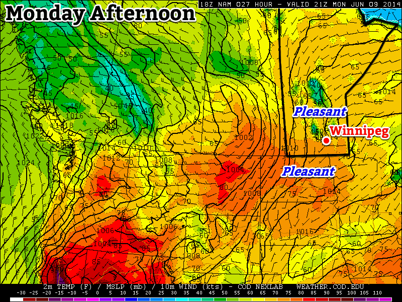
Alberta Clipper Brings Back the Deep Freeze

After enjoying a well above-normal –2°C daytime high on Monday, things are set to plunge back into the deep freeze as an Alberta Clipper low pressure system tracks into Ontario and allows a new supply of very cold Arctic air to surge southwards across the Prairies.

The Clipper

Wednesday

-9°C / -26°C
Mostly cloudy; flurries likely. Windy.

A potent Alberta Clipper will move through Manitoba today with the bulk of it’s snow falling along a line from Flin Flon through Norway House and Beren’s River where anywhere from 4–10cm can be expected. Further south, we’ll see light snow through the Parkland and Interlake through much of the day, but the snow won’t start in earnest until the afternoon along and south of the Trans-Canada Highway when the cold front associated with this system moves through.

And what a cold front it is! Yesterday saw genuine flash-freezes in the high plains of the Rockies; Dawson Creek, BC had it’s temperature fall from +5°C to –16°C in just 3 hours. In Grand Prairie, AB temperatures plummeted similarly, with temperatures falling from +5°C to –15°C in just 3 hours as well. It’s this intense blast of arctic air which will help this system produce snow despite the fact it is lacking considerable moisture.

While temperatures won’t be set to plummet quite so dramatically further east in Manitoba, we’ll certainly see the cold air return with a blast. We’ll be dealing with snow, wind, blowing snow and bitterly cold temperatures/wind chill by the end of the day today. Here’s what you can expect:

Snow: We’ll likely see scattered light flurries through the morning and early afternoon. Marginally more organized snow will try to push in through the afternoon along the cold front, but the system will have difficulty producing much snowfall anywhere other than along the northern edge of the track of the low pressure system. By the time things taper off this evening, anywhere from just a trace of snow to 2–3cm will likely have fallen in Winnipeg & the Red River Valley.

Wind & Blowing Snow: Winds will remain fairly light through the day until the passage of the cold front early this afternoon. Behind the front the winds will flip to the northwest and pick up strength to 30–40km/h with gusts as high as 60km/h. This wind will couple with the loose snow on the ground and the falling snow to produce widespread blowing snow through much of the Red River Valley. The worst areas for blowing snow will be the western and central RRV on any west-east running roads, including the Trans-Canada Highway between Winnipeg & Portage la Prairie. If you have plans to travel west on the Trans-Canada Highway today, be prepared for slippery roads with snow and blowing snow producing very poor visibilities.

Falling Temperatures/Wind Chill: Temperatures will fall quite aggressively behind the cold front with temperatures dropping from our daytime high of around –9°C to an overnight low of around –26°C. The cold temperatures coupled with the wind will produce wind chill values near –35 through the overnight hours.

The Remainder of the Week

Thursday

-21°C / -28°C
Sunny & cold.

The remainder of the week through the beginning of next week will be marked by the presence of yet another significant Arctic air mass entrenched over the Prairies. We’ll see mainly sunny skies on Thursday with light winds but temperatures will be very cold. Our high will only climb to around –22 or –21°C before plummeting back down to –28 or –29°C for our overnight low on Thursday night.

Friday

-17°C / -25°C
Some afternoon cloud.

Temperatures will climb a little higher on Friday as a very weak disturbance ripples down the northwest flow, spilling a little bit of cloud across Southern Manitoba by the afternoon hours. The temperature will climb up to around –17°C and we’ll see the temperature drop to around –25°C on Friday night.

Things look clear and cold for the weekend. Another shot of Arctic air will push into the Red River Valley bringing another batch of bitterly cold temperatures and overnight lows near –30°C.

A Brief Reprieve From the Deep Freeze

After a record cold morning on Sunday, we’ll see a dramatic warm-up to start the week.

Temperatures Will be Warming Up on Monday

Temperatures Will be Warming Up on Monday

Monday

Monday

Chance of Flurries in the Morning, then Clearing
-5°C / -14°C

Today will be the warmest day of the week with temperatures climbing into the minus single digits. There may be a few flurries in the morning, before skies clear later in the day. It will be a windy day too, as westerly winds help to bring in that warmer air. Winds will be 20-30km/h gusting to 40-50km/h.

Tuesday

Tuesday

Mainly Sunny
-13°C / -15°C

Temperatures will cool down a bit for Tuesday, with highs in the low minus teens. It will not be as windy as Monday though, so conditions will remain fairly pleasant.

Wednesday

Wednesday

Mainly cloudy. Chance of flurries.
-8°C / -24°C

A low pressure system is expected to pass through Manitoba on Wednesday, signalling the beginning of the end of this little warm spell. At this point it appears that this system will pass far enough to our north that we won’t see much, if any, snow with it – although that may change. Temperatures on Wednesday look to be around -10C with fairly light winds. A cold front associated with this low will move through Southern Manitoba on Wednesday afternoon and evening, allowing another arctic airmass to surge into the region.

Long Range

Models suggest we will continue to see arctic air dominate our weather until Christmas. There may be the odd break in the deep freeze here and there, but in general there are no lengthly warm-ups currently in our future.

Cold Continues Through Weekend

The cold weather plaguing southern Manitoba will continue through the weekend as yet more bitterly cold Arctic air spills southwards. There’s some hope on the horizon that we’ll see temperatures skyrocketing above normal, albeit briefly, so read on to find out what to expect!

Friday

Friday

-24°C / -26°C
Mixed skies and cold with a chance of flurries.

Today will be a very cold day here in Winnipeg; a building Arctic ridge on the north side of a moderately strong baroclinic zone[1] will keep Winnipeg on the cold side of things and bring us one of our coldest days so far: our daytime high will only climb to around –24°C under mixed skies. There may be a slight chance of a flurry, but overall things look to be setting up even a bit further southwest than it appeared on Wednesday and the accumulating snow looks to have shifted out of the Red River Valley. This is not entirely unexpected; when strong Arctic air masses are in place, the models often give the warmer air far too much credit and push things further north than they ought to be. Unfortunately, they don’t always do that so it’s a little touch and go on figuring out whether or not the precipitation tracks are right in the long range.

Skies will become cloudy overnight as the temperature drops to around –26°C and we’ll see a chance of flurries through the night.

Saturday

Saturday

-24°C / -29°C
Cloudy; flurries likely. Clearing overnight.

Saturday will bring cold weather, cloudy skies and a continued chance of flurries. The temperature will once again only climb to around –24°C as we continue to be under the influence of this cold Arctic air. Flurries will persist through almost the entirety of Southern Manitoba as an upper trough slides across the region. We’ll drop to around –28 or –29°C on Saturday night under clearing skies.

Sunday

Sunday

-20°C / ↗ -5°C
Increasing cloud then light snow. Significant warming overnight.

Sunday will be comparable to the last week or so; skies will be mainly sunny until we see some increased cloudiness in the afternoon as some light snow moves into the region associated with a warm front pushing eastwards across the Prairies. We’ll climb to a high of around –20°C. There will be a slight chance of flurries on Sunday night, but we’ll likely just see a stiff wind out of the south as the temperature climbs climbs climbs up into the minus single-digits!

Next Week

At this point, the first half of next week looks quite warm, with daytime highs climbing towards –2 or –3°C. Little precipitation is expected. Unfortunately, and I hate to be the bearer of bad news, but it looks like another brutal cold snap will move in for the end of the week, and at this point it looks like it will be (possible significantly) colder than we’ve seen the past week.

So to make it short: get out there and enjoy the weather through the first half of next week!


  1. A baroclinic zone is an area of heightened temperature contrast; similar to a warm front or cold front but without the significant movement that those features have.  ↩

Deep Freeze Continues

Bitterly cold Arctic air will remain entrenched over Southern Manitoba for the remainder of the week and through the weekend as nothing seems to be able to disrupt the pipeline of cold air flowing down over the Prairies. We will likely see some snow on Friday and Saturday as a low pressure system rides along the leading edge of a reinforcing shot of Arctic air which will ensure longevity to our December deep freeze.

Wednesday

-22°C / -28°C
Sunny and cold.
Thursday

-20°C / -27°C
Increasing cloud.
Friday

-23°C / -26°C
Cold with some light snow.

We’ll see sunny skies today with a light westerly wind as a ridge of high pressure slides to our south. The sunny skies are, unfortunately, symptomatic of the very cold air that will be in place today; our daytime high will only climb to around –22°C with wind chill values near –40 this morning that will ease slightly into the afternoon. We’ll drop to around –28°C tonight with just a few clouds.

Tomorrow will manage to climb a couple degrees higher than today with a high near or just under –20°C, largely thanks to the cloud coverage that will increase through the day. This may seem backwards since it would seem to make sense that blocking out the sun would make it cooler, however at this time of year the heat provided by the sun is so meagre that cloud coverage can often warm things up by both giving off some heat that works it’s way down to the ground as well as preventing any more heat from leaving the surface. In the winter time, think of cloud cover as a big blanket. Skies will be cloudy by the end of the day and light snow will begin to push into the province tonight beginning in the Parkland and spreading southeast through the night.

Friday

Friday will see light snow over much of Southern Manitoba as a mid-level baroclinic zone[1] tightens up over the region. At this point, it appears that most of the snow will fall to the west and south of Winnipeg, but we should still see some light snow along the northern edge of this system. Temperatures will remain cold; here in Winnipeg the daytime high is only expected to be around –23°C or so.

Total snowfall expected at this point for this coming Friday. Little of any significance is forecast to fall in the Red River Valley.

As shown above, no significant amounts are expected with this system as it moves through; a few cm are possible through the western and south-central Red River Valley while most other places just see a light dusting. The snow will taper off to some flurry activity in the evening as we drop to around –26°C under cloudy skies.

The Weekend

At this point, it looks like Saturday and Sunday both remain quite cold with daytime highs not even reaching –20°C and overnight lows plummeting towards –30°C. Flurries will be around for the first half of the day on Saturday before clearing out and leaving us with clear skies through the remainder of the day and Sunday. It appears some light snow is possible again on Monday as a warm front pushes across the Prairies. I’m not convinced quite yet that we’ll see that 10°C jump in daytime highs currently advertised, but significantly warmer air does look to be on the way (for a short while, at least) early next week.


  1. A baroclinic zone is an area of heightened temperature contrast; similar to a warm front or cold front but without the significant movement that those features have.  ↩