The beautiful summer weather will stick around for one more day before a large upper trough pushing across the Prairies spreads showers and generally unsettled weather into Southern Manitoba.
Today will be an almost ideal summer day across much of the Red River Valley. Sunny skies will gradually see increasing cloudiness through the afternoon hours, however before things cloud up temperatures will climb all the way up to around 27 or 28°C while light winds begin picking up in the afternoon to 20-30km/h.
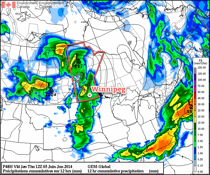
The story will be a little different over southwest Manitoba today, where an incoming surface trough will combine with warm weather and moderate instability to produce mid-to-late afternoon thunderstorms. Around 1250J/kg of CAPE will combine with 25kt of bulk shear and a 25-30kt LLJ to support upscale growth from a few isolated thunderstorms to an eastward moving line by the evening. This line will weaken fairly quickly as it moves into the Red River Valley thanks to the loss of daytime heating and the storms moving away from their main support.
The overall threat of severe weather in southwest Manitoba is marginal. The main risks will be large hail, but that seems like a fairly off chance at best. A rogue wind gust can’t be ruled out either, but again, I don’t have particularly high expectations for severe weather. Were I the SPC, it would be a “See Text” sort of day.
This line will bring a chance of showers or thunderstorms to Winnipeg and the Red River Vally through the overnight hours. No severe weather is expected. Temperatures will drop down to around 15°C or so.
Thursday & Friday
Tomorrow will bring cloudy periods with a slight chance of showers through the day. The precipitation risk will increase towards evening as a second impulse digs the upper trough into Manitoba, leaving us with a chance of showers on Thursday night.
Cooler air will also start filtering in. Thursday’s high of 25°C will be replaced by cooler weather for the remainder of the week and weekend. The temperature will drop to around 10°C on Thursday night.
Things should push off to the east on Friday morning leaving behind some sunny skies, but skies look to become mixed midday. There may be a chance of seeing some rain on Friday afternoon, but guidance is very mixed right now as to whether or not a band of rain will push northeastwards out of North Dakota. At this point it seems more likely that things will stay dry than not. We’ll see highs across the Red River Valley top out around the 21°C mark. The overnight low on Friday night will drop into the high single digits.
The Weekend
The weekend across the Red River Valley is looking fairly nice, albeit a little cool. Saturday will see afternoon cloudiness bring a slight chance of late-day showers. Sunday looks fairly sunny, although cloud will likely increase in the evening ahead of another system forecast to push through the region on Monday. Highs will sit near the 20°C mark with overnight lows in the mid-to-high single digits.