There will be a noticeable chill in the air this week as we begin to see hints of the season to come.
Monday
Mainly cloudy. Chance of Flurries.
2°C / -4°C
Today will be one of the coolest days we’ve seen in quite some time. High temperatures will be in the low single digits with a north-westerly wind. We may also see some scattered flurries during the day. These flurries are not expected to amount to anything, but that probably won’t make their presence any more welcome! On the whole it won’t be a very pleasant start to the week.
Tuesday and Wednesday
Mix of Sun and Cloud. Slight Chance of Flurries.
3°C / -4°C
Mainly cloudy. Chance of Flurries.
4°C / -6°C
Tuesday and Wednesday will be very similar days. High temperatures will be in the low to mid single digits with the wind once again being from the north-west. There may also be some scattered showers or flurries, but accumulations will be minimal. Hopefully above-zero temperatures and a lack of additional snow will allow for the weekend’s snowfall over south-western Manitoba to melt.
Snow on the Weekend
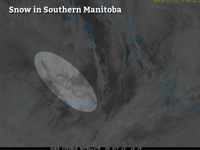
A bit of snow fell this past weekend in parts of southern Manitoba. In particular, south-western sections of the province received 2-5cm of snow, with Oak Lake reportedly getting 7.5cm. There was also snow south of the border in parts of North Dakota. Accumulations down there were very similar to those seen in Manitoba, with amounts of 2-5cm noted (1-2 inches). Thankfully, there will be no additional accumulating snow in the short-range.
Long Range
The weather through the late week period looks to remain cool. Models currently suggest that temperatures will remain in the single digits. There may be more chances for snow as we move toward the weekend.