A cooler weekend lies ahead for Southern Manitoba as cooler air pushes southwards through the Prairies behind a strengthening low pressure system in Northern Ontario. Some of our coolest temperatures of the fall lie ahead although it does seem like warmer air will begin to nudge back in by the end of the weekend.
Today
14°C / 2°C
Mainly cloudy. Lake-effect showers or drizzle has a chance of moving into Winnipeg.
Today will be the most “active” weather-wise thanks to a surge of cold air at 850mb that will be diving southwards through the day today. As this air pushes over the lakes it seems quite likely that lake-effect showers or drizzle will develop and push inland in the lee of the lakes. It’s very difficult to attribute a chance of precipitation to these features as they will almost certainly form, but they produce narrow ribbons (often ≤ 50km wide) that extend along great lengths.
What are the ingredients for Lake-Effect Precipitation?
There are a few ingredients that work together to produce lake-effect precipitation. The basic ingredients are:
- At least a 13°C temperature difference between the water surface and 850mb
- At least 100km of fetch (the wind must travel at least 100km over the water surface).
- Less than 60° of directional shear between the surface and 700mb; less than 40kt of speed shear between the surface and 700mb.
Which areas see precipitation will be extremely sensitive to the wind direction. Here in Winnipeg it seems that the wind will be a little too northerly for the lake effect precipitation from Lake Manitoba to move into the city, but should the winds have a slightly more westerly component we may see some light shower or drizzle activity move in. That being said, some areas in the lee of Lake Manitoba and Lake Winnipeg will likely see some showers or drizzle today. The temperature will struggle to a mere 13 or 14°C and we’ll see temperatures dip to around 2°C tonight. While there should be widespread clearing, some stratus cloud may still be advecting off the lakes. Areas that remain in cloud through the night may end up a couple degrees warmer.
Frost will certainly be a possibility through the Red River Valley tonight as skies clear and winds let up.
Saturday & Sunday
16°C / 5°C
Sunny.
21°C / 13°C
Sunny. Windy out of the south.
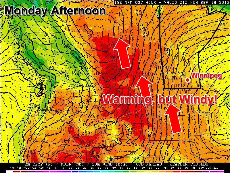
We’ll see a pleasant but cool day on Saturday with mainly sunny skies, light winds and a high near 21°C. Saturday night will bring clear skies and a low of around 4–5°C. Sunday will also be a mainly sunny day although winds will begin to pick up out of the south through the day as a low pressure system pushes towards the province. With cool air in the valley and warmer air struggling to push eastwards, it could actually become quite breezy. At this point it looks like winds will be around 30km/h with gusts to around 50, but if the cold air is a little more stubborn it could end up windier than that and closer to 40–50km/h.
Next week looks to start off with a disturbance pushing through on Monday or Monday night bringing a chance of some rain to the Red River Valley, but at this point it’s far to early to make any real judgements on what it will do. The rest of the week looks fairly quiet with seasonal temperatures.