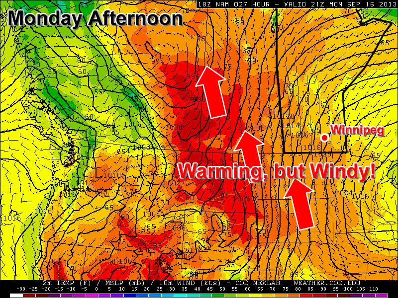
Temperatures will rebound early this week, but a big weather-maker may interrupt that warm-up by midweek.

Monday
Sunny
21°C / 9°C
Today will be bright and sunny with temperatures improving over Sunday’s cool values. Highs will be in the low twenties over Southern Manitoba, which is quite a recovery from this morning’s lows, which were around freezing. The only downside to today’s weather will be a stiff southerly wind that will be 30 to 40km/h gusting to 50 to 60km/h by late afternoon.
Tuesday
Mainly Sunny
27°C / 13°C
Tuesday will be one of the warmest, if not the warmest, days this week with high temperatures in the mid to upper twenties. The humidity may even increase a bit by late in the day over some portions of Southern Manitoba. It certainly won’t be an oppressive mid-summer type of humidity, but may be noticeable nonetheless. Tuesday will be slightly less windy compared to Monday, but the wind will still be fairly strong and from the south.
Wednesday
Mix of Sun and Cloud. Rain late. Risk of a thunderstorm.
25°C / 17°C
What has been a fairly boring weather pattern so far this September may begin to take an interesting turn on Wednesday. A strong low pressure system is forecast to develop in the lee of the Rockies on Tuesday and move eastward into North Dakota by Wednesday. This system will prompt seasonably high moisture values to stream northward into the Dakotas and Southern Manitoba. This moisture will help to destabilize the atmosphere over a large part of the North-Central US, perhaps extending up into Southern Manitoba. This system will also pump warm air up into the region, with models currently suggesting temperatures will once again reach the mid to upper twenties in Southern Manitoba on Wednesday.
As this strong low pressure system interacts with that unstable environment, numerous thunderstorms may develop on Wednesday through Wednesday night. These storms may affect parts of Southern Manitoba at some point on Wednesday or early Thursday. Given the nature of this system it looks like the main severe threat will be heavy rain. However, it is too early to rule out the possibility of other forms of severe weather. We’ll have more updates on this system as the week progresses.
Long Range
The long range forecast will largely be determined by what happens with Wednesday’s system. At this point it appears likely that we’ll receive rain from this system, but the timing of that rain is too early to predict. Unfortunately, once this system moves out of our area it will deliver a parting shot of cold air, which will probably set up a chilly weekend. Again, how cold it will get is still not certain, but getting above seasonal values next weekend may be a struggle.
