Elsewhere in Weather News: August 4th, 2012

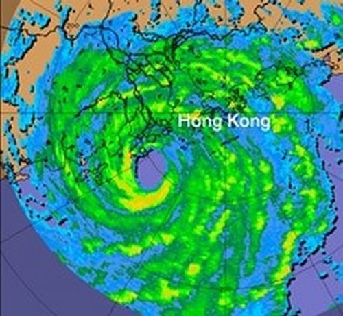
Another Typhoon Churns in the Pacific

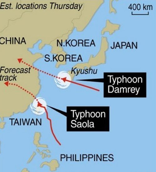
Yet another typhoon, Saola, has made landfall in the Western Pacific this past week, this time hitting Taiwan hard. The “disturbed area” talked about in last week’s EIWN is the culprit for producing typhoon Saola, which made landfall Wednesday, August 1st (Thursday August 2nd Taiwan time), bore winds of around 155km/h. The capital city of Taipei was completely shut down because of this typhoon: financial markets were closed, all businesses were closed, and residents urged to stay inside.

Saola

Typhoon Saola just as the strongest part of the storm made landfall on Taiwan (taken August 1, 2:32pm). (Source: NEXSAT Satellite)

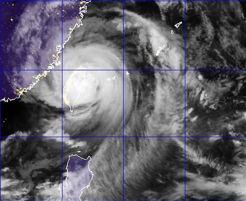
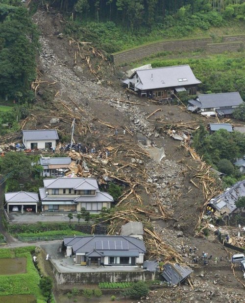
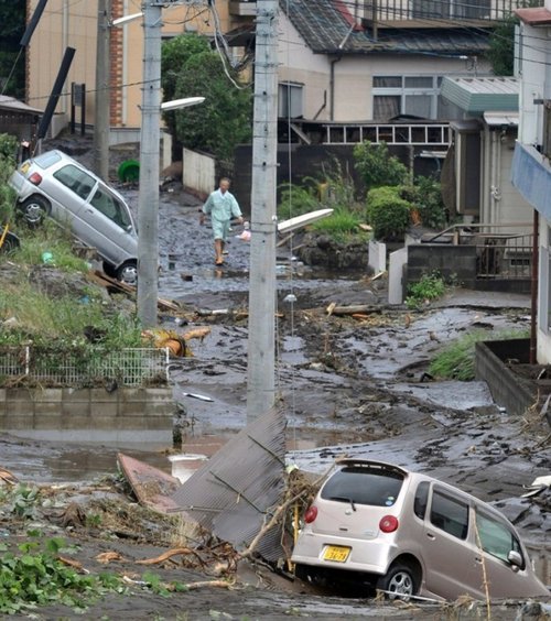
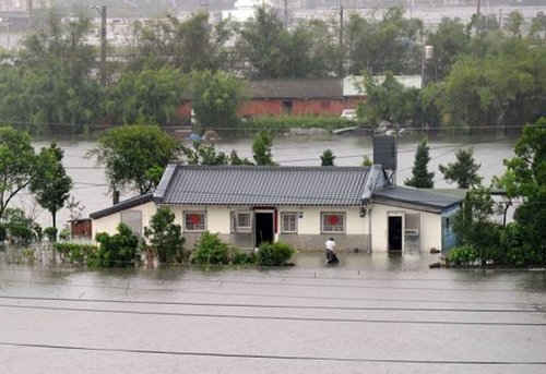
Saola swamped streets and downed large trees as it passed over Taiwan, not to mention the enormous amounts of rain it dumped. Since Tuesday, some areas of Taiwan have received more than 1,000mm of rainfall – that’s about double our yearly amounts here in Winnipeg! The death toll from the extreme flooding Saola caused has reached 27, mostly Taiwan and Philippine residents. The flood waters are still receding and in turn more casualties may be discovered. Taiwan has deployed 48,000 soldiers to the area to help with the cleanup of Taipei and surrounding regions, and rescue teams are also currently hard at work. The typhoon has disrupted flights going in and out of Taiwan and caused chaos in the railway industry.

Flooding

Snapshot of the flooding Saola caused in Taiwan. (Source: AFP)

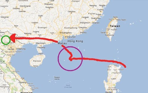
Unfortunately, typhoons don’t seem to be letting up in this already battered region of the Pacific where yet another typhoon has spawned east of China and will make landfall somewhere north of Shanghai. Saola will continue west and is predicted to make a second landfall west of Taiwan on China’s south-east coast on Friday (Winnipeg time).

Typhoons

The tracks of typhoon Saola/Damray as of Thursday evening. (Source: HKO)

In other hurricane-related news (Atlantic basin), a tropical storm, Ernesto, has spawned in the Atlantic eyeing to the Carribean where it will dump massive amounts of rain on the Lesser Antillies. Early Thursday morning a 101km/h gust was recorded at St Lucia where a tropical storm warning has been issued for the Lesser Antillies and residents have bunkered down. Ernesto is expected to make a north northwesterly track and most models show it ending up in the southern Gulf of Mexico by early next week. However, that is still a ways away and hurricanes can sometimes make unpredictable turns, in consequence, a constant eye needs to be kept on the most current satellite and model data.

Elsewhere in Weather News: July 28th, 2012

Severe Typhoon Vicente Plows through Southern Asia

This past week, typhoon Vicente spun up in the Pacific Ocean and made landfall near Hong Kong on July 23rd. The severe typhoon, of category 2 hurricane strength, amassed winds of between 155km/h just before it made landfall about 100 kilometres to the south-west of Hong Kong’s city core. Although the typhoon first touched land outside of Hong Kong, its hurricane-force winds did extend out into the city. In consequence, the Hong Kong Observatory (HKO) issued a level 10 advisory – the highest possible on the scale – advising residents to stay inside and closing non-essential services as well as schools. The level 10 advisory had only occurred 13 times since 1946, with this most recent advisory being the first in the 21st century (the last level 10 advisory was issued in 1999). Vicente had somewhat of an unusual track, being stationary 300 kilometres to the south of Hong Kong for 15 hours then strengthening significantly before moving inland the following day. The strengthening that occurred with Vicente, within this short amount of time (48h), had never been observed this close to land with prior significant typhoons that struck the region.

Vicente

RADAR image of Vicente as he made landfall on the afternoon of July 23rd. (Source: HKO)

Although Vicente forced the HKO to issue a level 10 advisory, damage was fairly minimal in the city – only minor damage to buildings was reported, but no structural damage. Flights in and out of Hong Kong were either cancelled or delayed which did cause some grief to travellers in the region.

Vicente did not stop its tracks in Hong Kong. It continued westward towards Southern China and Northern Vietnam where it dumped large amounts of rain during its passage. This in turn caused landslides and flooding in the mountainous region of Northern Vietnam, killing seven people with three still missing. The Vietnamese government has sent out rescue teams to look for the residents still missing. Damage is quite significant in the region, with most houses and crops destroyed due to the flash flooding and landslides.

Vicente Track

Red line depicting Vicente’s track, green circle are the areas of Vietnam affected by the flooding and purple circle is the area where Vicente intensified quickly. (Map credit: Google Maps)

Another tropical depression appears to be forming to the east of the Philippines with some thunderstorm activity, which is something to keep an eye on in the coming week!

Tropical disturbance

The tropical disturbance east of the Philippines. (Source: HKO)

Elsewhere in Weather News: July 21st, 2012

On Saturday July 14th, an unusually strong tornado struck the northern half of Poland leaving a large path of destruction in its wake, in the region of Pomerania. The twister, at times measuring one kilometer in width, tore up trees, disintegrated houses within seconds, and downed power lines for several kilometers. The village of Wycinki and surrounding forest, Bory Tucholskie National Park, were hit the hardest: upwards of 500 hectares of forest were completely flattened by the tornado; over 100 homes were destroyed; and trains had to reroute because of fallen debris on the tracks.

Dramatic video of the tornado scraping by a house and the aftermath. (Source: Youtube/profoundtransformati)

The tornado was estimated to be of EF-2 strength with winds churning at around 200km/h. One fatality in the village of Wycinki was reported when a man tried to take cover in his cottage and was struck by the walls collapsing on him. There were also an additional 10 injuries reported due to the tornado.

Poland tornado

The tornado from a different angle in Sztum. (Source: Associated Press)

Severe weather in Poland appears to be occurring more frequently these past years. This year alone, Poland has seen its fair share of severe weather spanning from large hail events to flash flooding. Tornadoes are not a common occurrence in Poland but they have happened before. The following lists a few significant outbreaks recorded in the past:

  • The Lublin, Poland tornado of 1931 which killed six people and is thought to have been an EF-5 tornado (however that ranking has not been proven).
  • The May 1958 2-day tornado outbreak in Poland which caused three deaths and over 100 injuries.

  • The August 2008 outbreak where multiple tornadoes including 5 EF-3 and 1 EF-4 were spawned killing three people in south-central Poland.

2008 Poland tornado

Picture of the devastation caused by the August 2008 tornado outbreak in Poland. (Source: Wikimedia)

Elsewhere in Weather News: July 14th, 2012

Japan Faced With Severe Flooding

Significant flash flooding struck Japan this week due to severe thunderstorms that remained nearly stationary for several hours over the southern island of Kyushu. The stationary boundary collided with warm, moist air from the Pacific igniting the thunderstorms and continuing for nearly 24 hours now, from Thursday afternoon to Friday night causing tremendous amounts of rain to fall over the same areas.

Surface map of Japan

Surface map of Japan with stationary boundary in red and flash flooding region talked about in green box. Effective 1pm Friday, CDT. (Source: Japan Meteorological Agency)

According to the Japan Meteorological Agency, a record of 500+mm (20 inches) fell in Aso and Kumamoto City in less than a 24 hour period overnight Thursday, causing severe mudslides in the area. In all, 15 people have died as a result of the flash floods and mudslides, with 11 still reported missing. Authorities have sent out search teams, where it is safe to do so, to find the missing or buried. As of Friday night, they have found eight survivors buried in the mudslides. The severe mudslides forced people to shovel their way out of houses and to wade through thigh-deep mud to make their way around. Thankfully 68,000 people had been evacuated from the area prior to the storm, avoiding additional casualties. Among the damage, about 22,000 households lost power, train services were shut down, many roads were inaccessible, and rice crops were severely damaged.

Mudslide

First responders searching for survivors where a mudslide destroyed homes. Taken in Minamiaso, Japan. (Source: Reuters)

Kumamoto City

Road covered in mud and cars left over by the flash floods in Kumamoto City. (Source: Jiji Press)

Unfortunately the stationary boundary is not going anywhere any time soon and is forecast to continue to spawn thunderstorms for the next three to five days as the warm, moist air continues to collide with it and the mountains. Another 100+mm is forecast for Saturday in the region once again, with even a slight chance of tornadoes added to the mix. Friday night, heavy rains warnings (including ground-loosening and inundation) and flood warnings were still in effect with an advisory (watch) for severe thunderstorms in the region.