Summer-like warmth is on the way back to Winnipeg and the Red River Valley for the second half of the week as a deep southerly feed draws heat northwards out of the United States.
Today will be another pleasant day with seasonal conditions across the Red River Valley as the ridge of high pressure that brought pleasant days to the region continues its gradual trek across the province. Winds will continue light with daytime highs around 24°C and comfortable humidity. Tonight will see a seasonable 10°C for the overnight low.
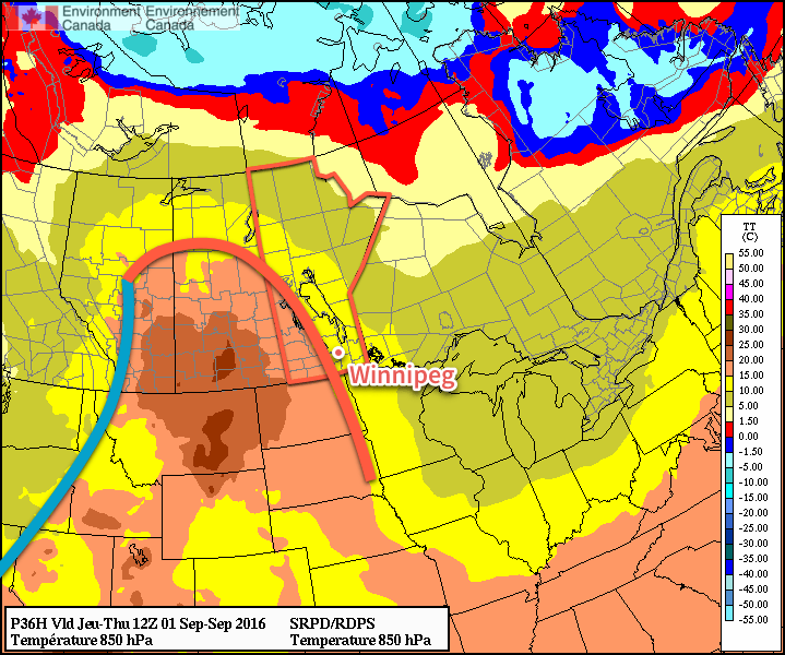
Thursday will mark the return of hotter weather as a deep southerly flow develops ahead of a strengthening low pressure system in Alberta. Morning will bring a few clouds as a warm front pushes eastwards across the valley, bringing with it a chance for some showers or perhaps even a thundershower. After the warm front pushes through in the morning, winds will pick up out of the southeast through the remainder of the day to around 30 km/h by late afternoon. Those breezy southerly winds will draw warmer air northwards, pushing Thursday’s daytime high up to near the 28°C mark under partly cloudy skies in the afternoon.
Thursday night will be significantly milder than the past few nights as the warmer air in the region combines with breezy winds that persist through the night to keep the overnight low from dipping much below the 17 or 18°C mark. Skies will be mixed overnight, but no precipitation is expected at this point.
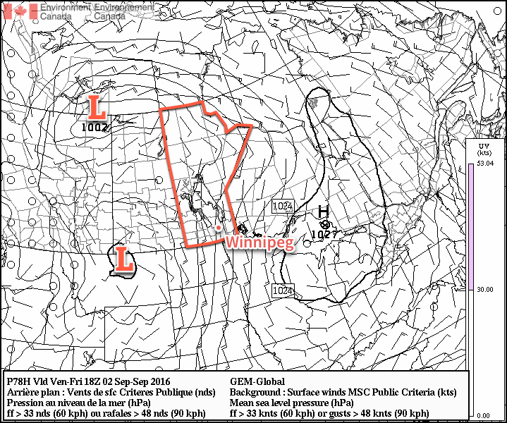
Friday will be a mild and windy day. Southerly winds of 40 gusting to 60 km/h will be in place over the valley for much of the day under partly cloudy to mixed skies as temperatures climb once again to around the 28°C mark. Friday night will be another mild one with an overnight low near 19 or 20°C with breezy southerlies continuing.
Weekend Outlook
This weekend will bring another mild, although likely unsettled, day on Saturday with a surge of humidity ahead of a cold front bringing the chance for some thunderstorm activity. Sunday looks cooler and drier with highs in the low 20’s and mixed skies.