Rain Ends and Summer Returns

Rain will taper off today in Winnipeg and after one cool night, summer heat will begin pushing back into the region.

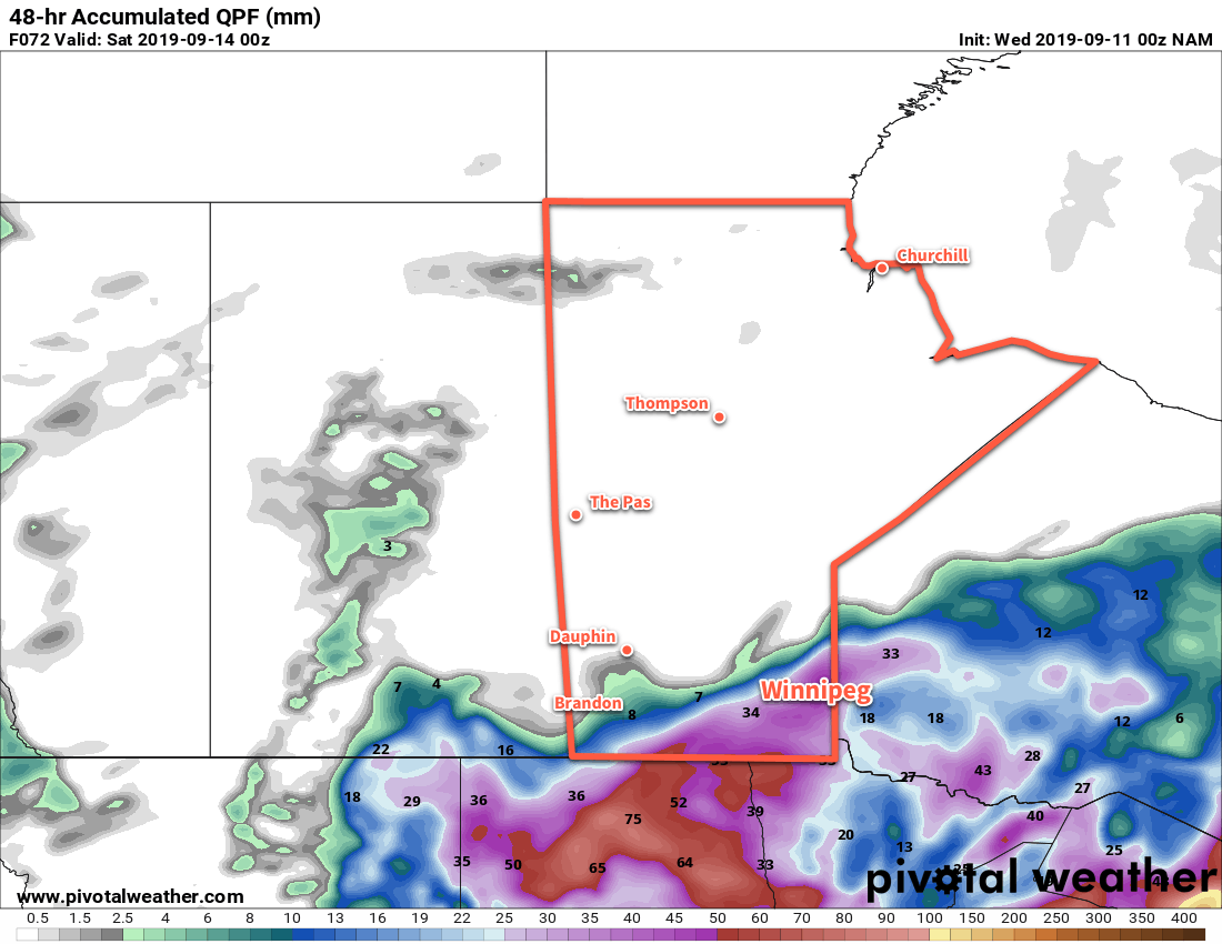
Winnipeg managed to miss out on the heaviest rainfall expected with this system. Rather than stalling near the city, the rain—and associated deformation zone—ended up continuing to rotate northwest of the city. As the low responsible for the unsettled conditions exits the province, that band of rain will push eastwards and move back across the Red River Valley this morning. Winnipeg will see a few more showers as it moves through that taper off midday. Moderate northwesterly winds near 30 gusting 50 km/h will develop this morning and last until the evening. The cloud cover should begin to break up through the afternoon with clearing arriving late in the afternoon or early evening.

A ridge of high pressure moving through tonight will bring cool conditions with temperatures heading to a low near +4°C.

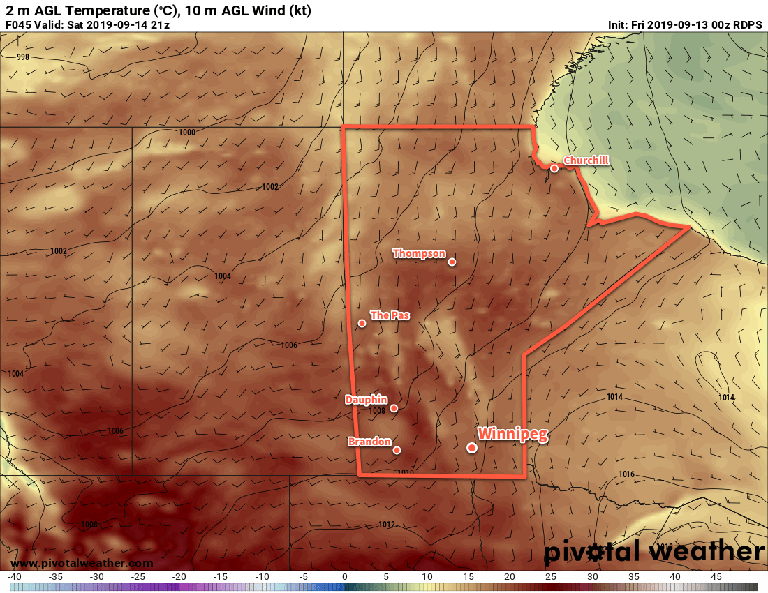
Fortunes change on Saturday as a warm front pushes eastwards through the province. Some morning cloud will give way to mixed skies for the afternoon with a southerly wind of 20 to 30 km/h developing. Some forecast models suggest a chance of showers midday as the warm front passes, but it doesn’t look particularly likely. Temperatures will climb to seasonably mild high near 21°C. Skies will stay partly cloudy on Saturday night with light southerly winds and a low near 11°C.

Milder temperatures near 20°C will return to southern Manitoba on Saturday.

Warm air will continue to stream northwards on Sunday, bringing summer heat back into the region. Winnipeg will see partly cloudy skies as temperatures head to a high near 25°C. Humidity will begin to work back into the region late in the day, helping keep overnight lows warmer near 15°C.

Long Range Outlook

Next week will kick off with even more heat and humidity as Winnipeg’s daytime highs climb into the upper 20s. Multiple days of southerly winds will bring humidity back into the region, producing humidex values in the low 30s and overnight lows in the upper teens.

Today’s seasonal daytime high in Winnipeg is 21°C while the seasonal overnight low is 7°C.

More Wet Weather On The Way, But A Second Summer Approaches

Winnipeg will see more rain in the second half of the week, but all signs point towards a return to summer temperatures by the end of the weekend!

Tucked between two lows, Winnipeg will see a brief reprieve from wet weather today. Although there may be the odd break of sunshine, skies should stay mostly cloudy. Winds out of the northeast at 20 to 30 km/h will keep the daytime high to a seasonably cool 16°C. The winds will persist tonight as temperatures head to a low near 9°C.

A large low pressure system moving towards Lake of the Woods on Thursday will spread more rain into southern Manitoba. Rain should spread northwards into Winnipeg through the morning, then persist through the afternoon into Thursday night. Winds will strengthen to 30 gusting 50 km/h out of the northeast in the morning. The wind and wet weather will keep things cool; Winnipeg should see a high near 12°C.

The wind will shift to the north-northwest on Thursday night with a low near 9°C.

While much of southern Manitoba will likely see at least 20 to 30 mm of rain through the end of the week, some forecast models suggest that the region could see a widespread 25 to 50 mm.

Showers will taper off through the day on Friday with breezy northwest winds near 30 gusting 50 km/h. Winnipeg will likely see at least 20 to 30 mm by the time the rain tapers off, but there’s potential for amounts in the 30 to 40 mm range.1

Temperatures will be marginally warmer with a high near 14°C. Skies should finally clear out on Friday evening as a ridge of high pressure moves into the region. The winds will taper off quickly on Friday evening then Winnipeg will head to a low temperature near 5°C.

Long Range Outlook

After a cool and wet week, conditions will change significantly this weekend as a large upper level ridge builds over central and eastern North America. Temperatures are forecast to climb into the mid-20s by the end of the weekend, then into the mid- to upper-20s to start next week. A deep southerly flow will advect Gulf moisture northwards, and the region could see humid conditions return to start next week with overnight lows climbing back into the upper teens.

The upper ridge is forecast to shift eastwards mid-week, allowing a large upper trough to push into the region, likely bringing unsettled conditions mid-week and a return to more seasonal conditions by the end of the week.

Today’s seasonal daytime high in Winnipeg is 19°C while the seasonal overnight low is 7°C.

  1. Final amounts will depend on exactly where embedded convective bands of rain develop in this system.

Cloudy, Cool and Unsettled Week Ahead for Winnipeg

A series of slow-moving low pressure systems will move through southern Manitoba this week, bringing cloudy, cool and unsettled conditions to the region.

The first disturbance this week will move into the Dakotas today, spreading cloud cover and rain northwards. Winnipeg may see a bit of sun this morning, but skies will cloud over relatively quickly today. Rain will begin spreading north through the Red River Valley in the afternoon, reaching Winnipeg by the evening. Temperatures won’t be too bad with a high near 17°C, but that will likely be earlier in the day before the clouds thicken up. Winds will be noticeable today, though, picking up out of the east into the 30 gusting 50 km/h range.

The rain will persist through the night as winds gradually turn northeast and weaken. Rainfall amounts may be variable, generally in the 10 to 20 mm range. If a few embedded lines of convection develop, then localized amounts could increase into the 20 to 30 mm range. The only potential trouble spot in the forecast is the chance of a slight break in the rain developing over the Red River Valley between hang-back rain over southwest Manitoba and the low-supported rain spreading northeast. If this happens, a swath of the region will see little rain, but we’ll just have to watch as things evolve through the afternoon. Temperatures will dip to a low near 12°C.

Some forecast models suggest rainfall totals of 20 to 30 mm from midday today to midday Tuesady, but widespread totals will likely be lower than that.

The rain will ease early Tuesday morning, but chances for a few patches of light rain or drizzle will persist. Skies will stay cloudy with northerly winds of 15 to 20 km/h persisting through the day; with a high of just 14°C it will certainly feel fall-like out there. The chance for precipitation will taper off for the night, leaving Winnipeg with cloudy skies and a low near 9°C.

Wednesday will bring more cloud to the region with winds picking up out of the east to around 20 km/h. Temperatures will climb to a high near 16°C and despite the cloud it should stay dry through the day. The chance of rain will increase on Wednesday night as the next disturbance begins lifting towards the region from Wyoming. Temperatures will dip to a low near 11°C on Wednesday night.

Long Range Outlook

Thursday will bring more rain to Southern Manitoba as more energetic system pushes towards the region. As a result, there may be a few embedded thunderstorms move through. The region may see more rain with this system as well, possibly in the 20 to 40 mm range. There’s a good chance that some light showers will persist into Friday, then sunshine and near-seasonal temperatures return for the weekend.

Today’s seasonal daytime high in Winnipeg is 20°C while the seasonal overnight low is 7°C.

Seasonal Temperatures and Quiet Weekend Weather

Winnipeg will enjoy benign weather this weekend before the weather turns unsettled next week.

A ridge of high pressure moving into the province will bring Winnipeg sunny skies and breezy conditions today. Temperatures will climb to a high near 21°C today with northwesterly winds picking up into the 30 gusting 50 km/h range. Winds will abate quickly this evening as the ridge moves in and sends temperatures to a low near 8°C.

On Saturday, a low pressure system crossing through the Northern Plains of the United States will graze the region. The rain will stay south of the border, but plenty of cloud will spread into the region. Winnipeg will find itself near the cloud edge, likely leading to mixed skies through the day. Areas south of Winnipeg will see cloudier conditions while areas north see a bit more sun. Temperatures will be cooler with a high near 17°C, but lighter winds will make for a relatively nice day. The cloud cover will clear out on Saturday night with temperatures heading to a low near 5°C.

Mainly sunny skies will return on Sunday with temperatures climbing to a high near 19°C. A weak ridge of high pressure will extend across southern Manitoba, keeping winds light. More cloud will begin pushing back into the region on Sunday night ahead of the next disturbance. Temperatures will head to a low near 8°C.

Long Range Outlook

A major change in the weather is forecast next week as several major low pressure systems are forecast to move through the region.

The first is a Montana Low that is forecast to spread rain with the risk of thunderstorms into southern Manitoba on Monday night. This system will be very sensitive to the location of a high pressure system over the northern Prairies; it will be pumping dry air southwards as well as support a strong deformation zone along the northern flank of the low. If the high slumps further south, the rain could end up remaining south of the border. Current forecasts have the rain tapering off on Tuesday with the potential for a widespread 10 to 30 mm.

The second system is a Wyoming low forecast to push into Manitoba on Thursday night. This low will support a large area of thunderstorm activity across the Northern Plains and spread a broad area of rain with the risk of thunderstorms into parts of Saskatchewan and much of Manitoba. It’s far out, so the forecast on this system is definitely subject to change, but could produce a widespread 20 to 40 mm over much of southern Manitoba.

We’ll be keeping an eye on these systems as they develop heading though next week.

Today’s seasonal daytime high in Winnipeg is 20°C while the seasonal overnight low is 8°C.