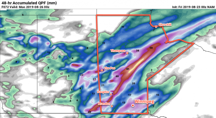
A passing low pressure system will bring wet, cool, and windy conditions to the Red River Valley to start the week.
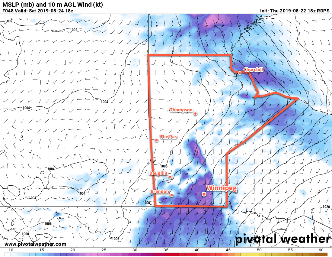
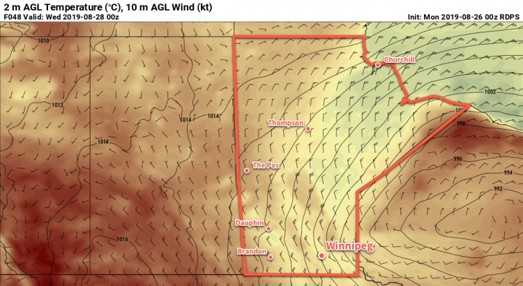
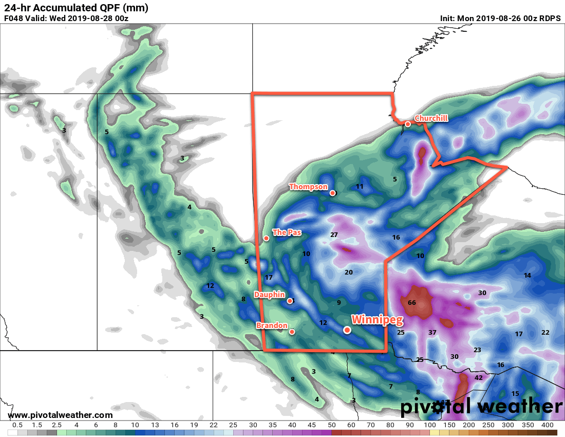
Today will be another unsettled day across southern Manitoba, but Winnipeg might just miss out on most of the activity. Skies will stay mostly cloudy through the day and temperatures will be seasonably cool with a high near 20°C. A low pressure centre moving from the Interlake into northwestern Ontario will bring light winds in the morning that strengthen out of the northwest into the 30 gusting 50 km/h range for the afternoon. The region will be mostly dry to start the day, but through the afternoon widespread showers and thunderstorms will develop. The precipitation will track from northwest to southeast and has the potential to impact most of the Red River Valley. That said, Winnipeg may stay dry and sit between bands of showers to the southwest and the northeast.
Temperatures will dip to a low near 14°C tonight with mostly cloudy skies and a chance of showers. Winds will persist out of the northwest near 20 km/h.
Tuesday will be a bit of a shock to the system as the first blast of fall-like conditions moves into the region. A trough of low pressure will keep it cloudy and likely bring periods of rain to the city. The northwesterly wind will strengthen as high as 40 gusting 60 km/h and usher in a significantly cooler air mass. As a result, the temperature will slide from near 14°C in the morning to 11 or 12°C in the afternoon. The wind will continue around 30 gusting 50 km/h on Tuesday night as temperatures drop stay steady around 11 or 12°C.
Wednesday will finally bring clearing skies and sunshine back to the region. Winds will continue out of the northwest near 30 gusting 50 km/h right through the day, but temperatures will rebound back to a high near 19°C. The wind will finally ease on Wednesday evening with temperatures heading to a low near 13°C under mixed skies.
Long Range Outlook
The remainder of the week should bring more settled conditions with plenty of sunshine and no significant precipitation expected. Temperatures should gradually return to near-seasonal values.
Today’s seasonal daytime high in Winnipeg is 23°C while the seasonal overnight low is 10°C.