The Winnipeg area will finally see a stretch of pleasant temperatures and plenty of sunshine.
Warmer weather will finally spread across southern Manitoba this week.
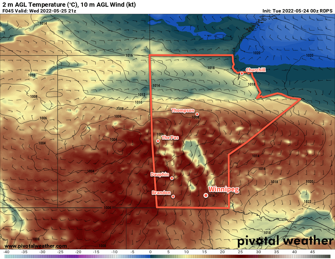
Settled conditions and warm weather will persist through the work week in Winnipeg as an upper ridge slowly builds into the Prairies. Daytime highs will climb into the low 20s each of the next few days with overnight lows climbing from around 10 °C into the mid-teens.
Skies will stay mainly sunny over the next few days as well. One exception will be a bit of cloud will skimming through the region on Wednesday morning as a system passes to the southeast.
It will be generally breezy over the next few days with southerly winds increasing to around 30 km/h today, Wednesday, and Thursday.
A few weak disturbances will move through the province over the coming days, but they should mainly impact the Parkland and Interlake regions.
Long Range Outlook
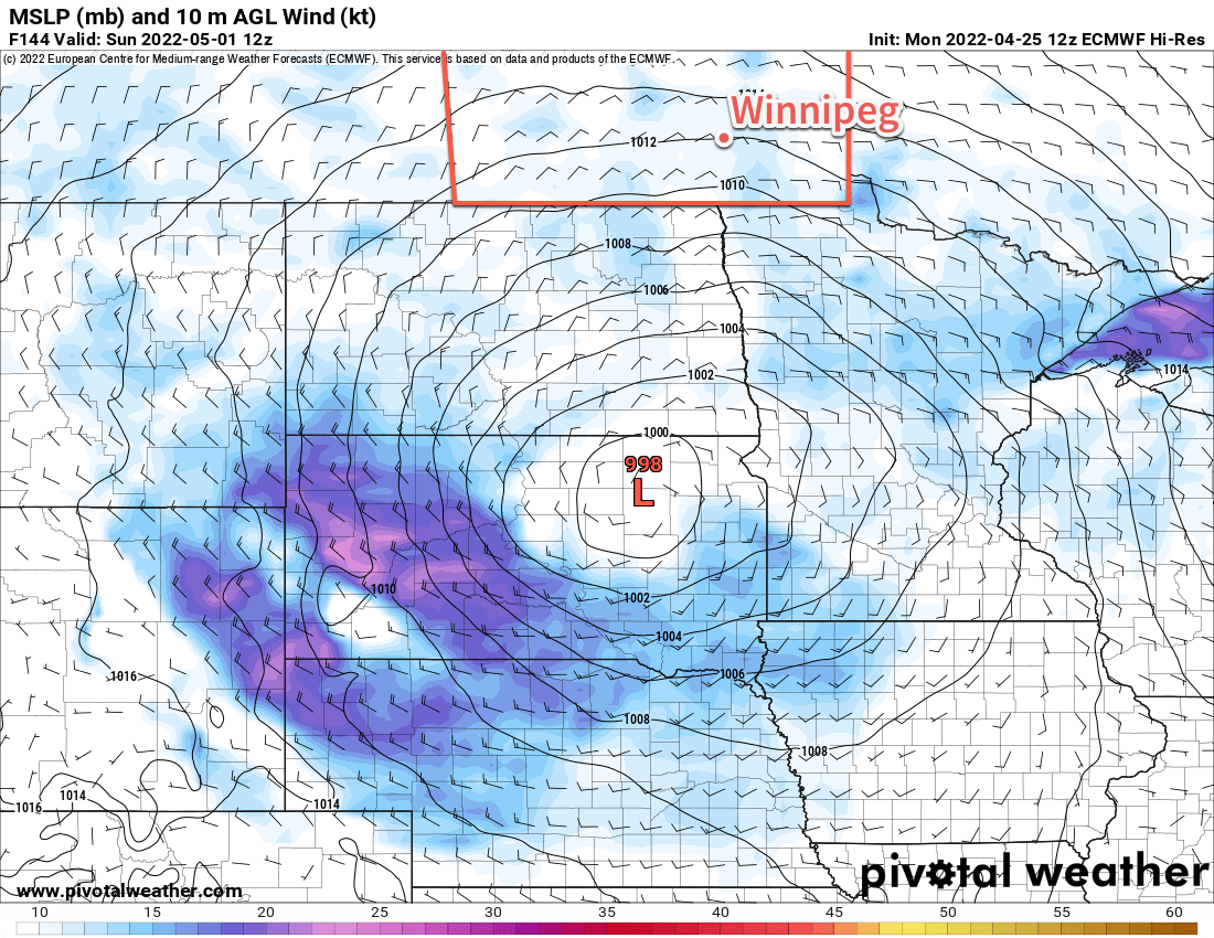
Unsettled conditions will begin to push into the region on Friday night. A slow-moving low pressure system will begin to track across the southern Prairies and northern United States over the weekend. This system will bring a couple chances for showers or thunderstorms through the weekend, and then cooler, showery conditions next week.
Today’s seasonal daytime high in Winnipeg is 21 °C while the seasonal overnight low is 7 °C.
Rain will taper off in the Winnipeg area this morning, leaving behind cold conditions as the region begins to dry out.
Very cool temperatures will flood the eastern Prairies in the wake of the departing rain.
Rain will taper off this morning in the Winnipeg area and leave behind mostly cloudy skies. Moderate northerly winds near 40 gusting 60 km/h will stick around through the day, flooding the region with much cooler air. Daytime highs will struggle to reach even our seasonal overnight low in Winnipeg; the city will top out at around 6 °C.
Conditions will improve in the evening as the wind begins to taper off and some clear breaks develop. It will be a cold night with lows dipping to around the freezing mark. Frost will be possible, especially in outlying areas, overnight.
After that, conditions will be on the up and up. Mixed skies on Saturday will give way to sunshine on Sunday, and daytime highs will climb by around 5 °C per day. Saturday’s high will be near 10 °C and Sunday should reach the mid-teens. Overnight lows will also ease towards the mid-single digits. With the sunshine on Saturday, a few scattered showers will be possible in the afternoon.
To start of next week, Monday will bring partly cloudy skies with a high in the 15–20 °C range. Overnight lows will climb into the 5–10 °C range for the start of next week.
Long Range Outlook
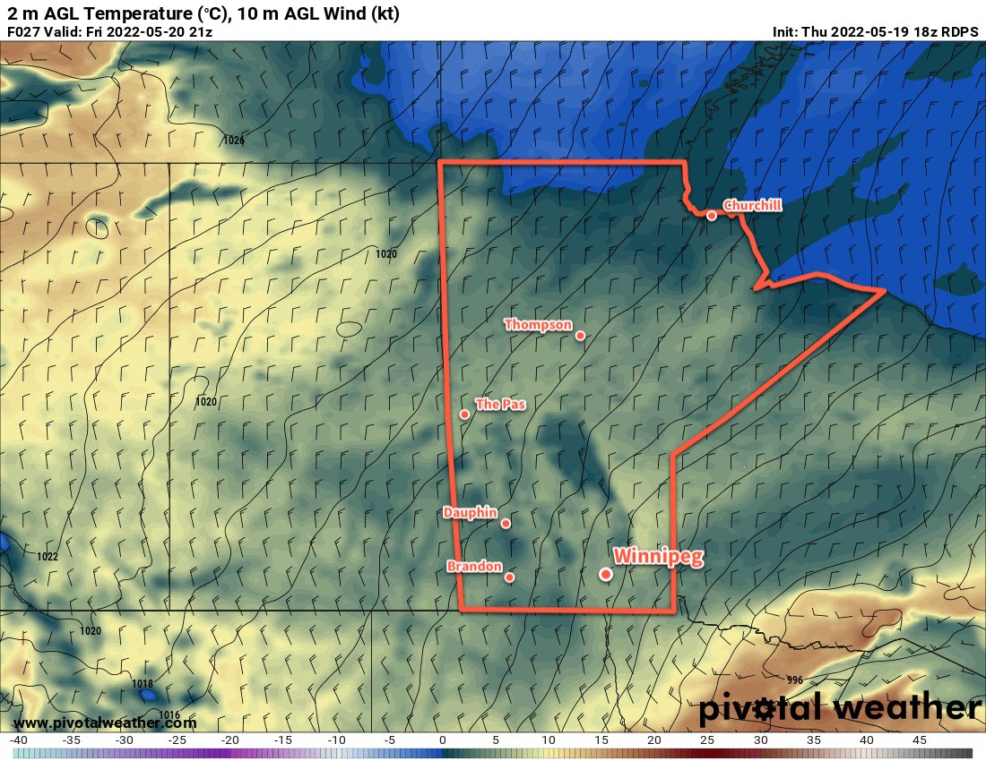
Next week begins to look decidedly more summery for southern Manitoba. Daytime highs will finally return to more seasonal values, sitting in the 20–25 °C range for most of next week. A few chances for some scattered thunderstorms are possible next week, but no widespread significant rain is in the forecast. Overall, it looks like a shift back towards more seasonal conditions with an opportunity to dry out.
Today’s seasonal daytime high in Winnipeg is 21 °C while the seasonal overnight low is 6 °C.
The Red River Valley will finally escape from the grip of the last few weeks’ weather. Dry, sunny, and warmer conditions will develop over the region this week.
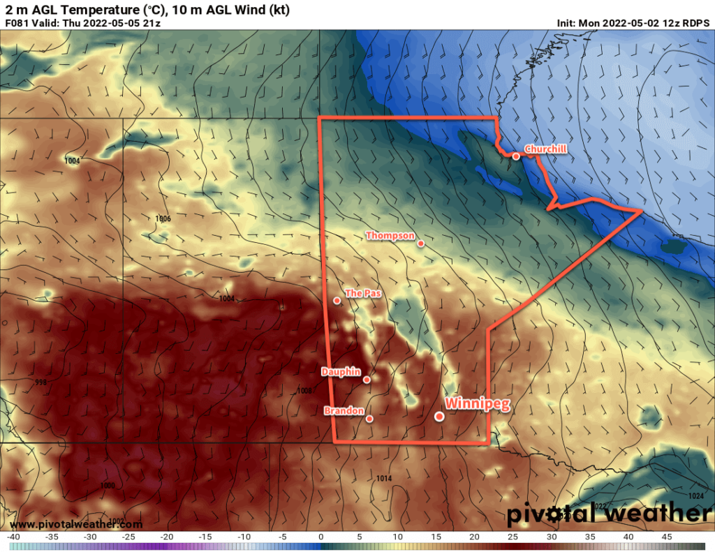
Much warmer weather will push into the southern Prairies this week as an upper ridge builds across the region.
Southern Manitoba will see beautiful conditions over the next several days as spring finally arrives across the region. An upper ridge will build over the Prairies this week, bringing plenty of sunshine and dry weather to the area. Temperatures will finally head back towards seasonal values over the next several days as well. Highs will reach the low teens today in Winnipeg, then climb into the upper teens tomorrow, and close to the 20 °C mark for Thursday and Friday. Overnight lows will also climb through the week from close to freezing tonight to near 10 °C by Friday night.
Not only will it be dry, sunny, and warm, but winds will also be fairly light through the week. They’ll pick up out of the south on Thursday into the 20–30 km/h range, ease overnight, then return near 30 km/h on Friday.
All in all, no complaints for the rest of the work week. Open your windows and enjoy the long-awaited arrival of spring!
Long Range Outlook
Unfortunately, it doesn’t look like things will stay dry beyond that. Heading into the weekend, a deep upper trough will dig over western North America as an upper low builds into the Pacific Northwest. This will send a series of systems northwards through the eastern Prairies. Cloudier conditions will move in for the weekend, but for now, it looks like Saturday and Sunday will stay dry. Most models suggest the pattern change comes Sunday night.
The first of a series of convectively-driven systems is forecasted to move out of North Dakota into Manitoba on Sunday night. This system could bring 25–50 mm of rain to portions of southern Manitoba, but where exactly is unclear at this point. Some models have it as a slower moving system over the southwest corner of the province, others have it slightly more progressive over the Red River Valley.
A second system will follow that up just 24–36 hours later, but there’s currently a lot of uncertainty with where it will track. Certainly something to keep an eye on as the weekend — and the flood crest — approaches the region.
Today’s seasonal daytime high in Winnipeg is 17 °C while the seasonal overnight low is 3 °C.
Southern Manitoba will see a very slow shift back towards more seasonal spring weather over the next week. Another storm system will impact the region this weekend, but its impact isn’t quite clear yet.
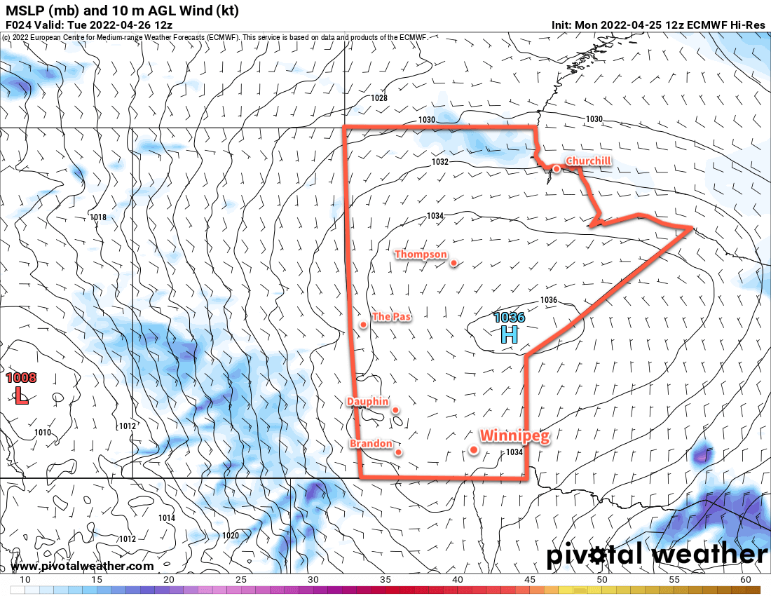
A sprawling Arctic high will influence southern Manitoba right through the week.
The weather over the next few days will be dominated by a stubborn Arctic high lingering over the region. It sits on top of the province today, then gradually shift into NW Ontario over the next 36 hours. Southern Manitoba will continue to see a ridge of high pressure hang back across the region. This ridging will stick around until a developing storm system in the United States finally weakens it at the end of the week.
Its presence will be a bit of a mixed bag. On one hand, it will keep temperatures cool over the region. On the other, it will help deflect some weaker lows over the western Prairies away. This will keep conditions dry through the rest of the work week; a welcome outcome considering the flooding in the wake of the weekend’s storm.
For Winnipeg, this will mean that the city sees a fair amount of sunshine over the next couple days. Today’s high will be a few degrees above freezing, then increasing into the 5–10 °C range on Wednesday.
Thursday will bring some cloud to the region as an upper frontal wave pulls away from a low over the northwestern Prairies. There could be a few showers that skirt the region later in the day, but amounts would likely be very light
Skies will continue to be cloudy on Friday, this time due to another significant storm system taking shape in the United States.
Daytime highs will likely hover close to 10 °C both Thursday and Friday. Overnight lows will increase from several degrees below zero tonight to the mid-single digits by Friday.
Long Range Outlook
Unfortunately, it looks like southern Manitoba could be in for more rain to end the week. This system — a sort of “Utah Low” — won’t have quite as much energy as the weekend’s Colorado Low. It will still be a substantial storm in its own right, though.
There is, unlike the previous two storms, significant uncertainty with this one. Forecast models have been flopping around, placing the precipitation right across southern Manitoba, keeping it almost entirely south of the border, or shifting it into SE Saskatchewan and southwestern Manitoba.
So at this point, it’s still too early to say with much skill where the rain is going to show up. But there is pretty good agreement that this system will be capable of producing 25–50 mm of rain somewhere in the southeastern Prairies.
While there’s disagreement about where the rain will fall with this weekend’s system, all forecast models are producing a moderately strong low pressure system over the Dakotas and Minnesota.
If that rain did fall over the Red River Valley, it would be a significant concern. Not only is the ground very saturated in most areas, it would also coincide with the second crest of the Red River travelling northwards.
Should the rain fall further west, that would also be a concern. It would likely impact many areas that have seen substantial snowfall amounts over the past two weekends. This would help accelerate the melt and could present flooding risks in some of those areas as well.
So probably not a welcome storm in any situation. We’ll keep a close eye on it as it develops and have a full forecast later in the week.
If you have a property that experienced flooding issues this past weekend, it may be prudent to plan possible flood mitigation efforts in case this storm ends up impacting your area again.
Today’s seasonal daytime high in Winnipeg is 14 °C while the seasonal overnight low is 1 °C.