An upper ridge will bring hot summer weather back to southern Manitoba this weekend.
Another very warm air mass building into the region will send temperatures in Winnipeg back into the low 30s this weekend. Alongside the heat, an upper ridge building across the Prairies will keep skies mainly clear over the next few days.
A weak ridge of high pressure draped across southern Manitoba will also keep winds light the next couple days. Winnipeg should see a bit of wind by Sunday afternoon, but only southerlies to around 20 km/h.
Manitoba will see very warm temperatures on Sunday with highs in the low 30s through most of the province.
Overnight lows will warm to around the 20 °C mark for the weekend, but humidity levels should stay fairly comfortable through the weekend.
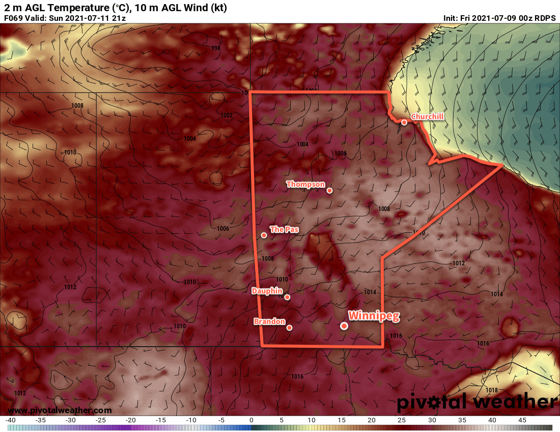
Long Range Outlook
Forecasts show next week starting with unsettled conditions as a couple disturbances move through the region. Unfortunately no widespread rain can be guaranteed for the Red River Valley; these systems will more likely produce scattered showers and thunderstorms rather than broader areas of rain.
Forecasts show temperatures breaking back to seasonal values mid-week, then climbing back to the low 30s for next weekend.
Today’s seasonal daytime high in Winnipeg is 26 °C while the seasonal overnight low is 13 °C.
After a cool and smokey interlude to the week yesterday, fresher air and warmer temperatures will return to the region for the second half of the week.
An upper ridge building across the Prairies will shape the weather this week. As it pushes eastwards, a southerly flow will begin to push warmer air from the south back into the region.
Today, Winnipeg will see light winds and perhaps a bit of lingering smoke from the forest fires east of Lake Winnipeg. Temperatures will return to a near-seasonal high of 25 °C under mainly sunny skies. A light southerly wind will persist tonight at 15–25 km/h with a low 13 °C.
On Thursday, Winnipeg will see a bit more cloud as a weak disturbance pushes towards the province from Saskatcehwan. Southwestern Manitoba will likely see showers through the day, but they will struggle to move into the Red River Valley. A dry southerly wind around 30 km/h will develop in the morning and, combined with a lack of upper support, will weaken the showers as they move east. There’s a chance for a few drops here and there, but any accumulating shower activity should stay further to the west. Tmeperatures will reach a near-seasonal high around 26 °C. The city will see partly cloudy skies on Thursday night with diminishing winds and a low near 15 °C.
Summer heat will spread back across the Prairies by the end of the week with highs in the low to mid-30s in northern Manitoba and upper 20s in the south.
Friday will bring slightly warmer temperatures to Winnipeg with a high near 28 °C and a light southeast wind. The disturbance that will bring the unsettled condtiions on Thursday is forecast to stall out over Saskatchewan. As a result, southwestern Manitoba will likely see some scattered showers, but skies should clear in Winnipeg through the day. Tmeperatures will head to a low near 17 °C on Friday night with clear skies.
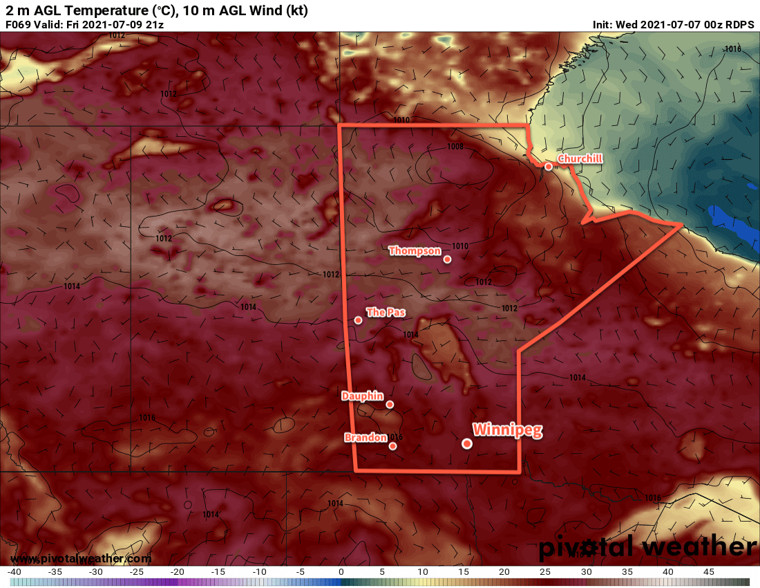
Long Range Outlook
It will be a hot weekend in Winnipeg with highs climbing back into the low 30s. The city will see mainly sunny skies throughout and overnight lows around 20 °C. The forecast is absent of any notable precipitation for the Red River Valley. The hot weather will continue into next week, but conditions may become a bit more unsettled. There may be better chances for some showers and/or thunderstorms heading into the week.
Today’s seasonal daytime high in Winnipeg is 26 °C while the seasonal overnight low is 13 °C.
Winnipeg will see relief from the heat this week as an Arctic high brings slightly below seasonal temperatures to the region.
A series of cold fronts sweeping through the province over the last 24 hours are ushering in cooler temperatures from the north, bringing an end to the intense heat that’s been in place over the region. This cooler air mass will be brought by a sprawling Arctic high building into the Prairies.
Winnipeg will see a seasonably warm day today with a high near 26 °C under mainly sunny skies. Winds will pick up out of the north into the 30–40 km/h range for the afternoon. The clouds will thicken up heading into the evening as an upper-level disturbance pushes into the region. Another cold front will push through at the surface tonight, keeping winds up at around 20 km/h. This upper-level disturbance will bring a chance of rain to the city, but the cold front will likely shunt everything southwards a bit. It’s likely that the rain moving through will just glance Winnipeg, or move completely south of the city. Temperatures will head to a low near 11 °C.
The southern Prairies will see seasonably warm conditions today, but a cold front pushing southwards will bring cooler temperatures for Tuesday.
Winnipeg will find itself behind a second cold front on Tuesday with much cooler weather. Temperatures will climb to a seasonably cool 21 °C with partly cloudy skies as the overnight system clears out. The wind will keep put out of the north-northeast at 20–30 km/h. These winds may bring plumes of smoke into the region from fires burning east of Lake Winnipeg. How thick the smoke ends up being depends on a lot of nuance. If you have sensitivities to smoke, be sure to keep on the lookout for any special air quality statements issued by ECCC. Winds will ease Tuesday night with temperatures heading to a low near 10 °C.
Winnipeg will see plenty of sunshine on Wednesday with a near-seasonal high near 25 °C. Winds will be light through the day, and any smoke is left in the area should clear out early. Otherwise, it should be a beautiful day for the city. Temperatures will head to a low near 14 °C on Wednesday night with an increasing southerly wind.
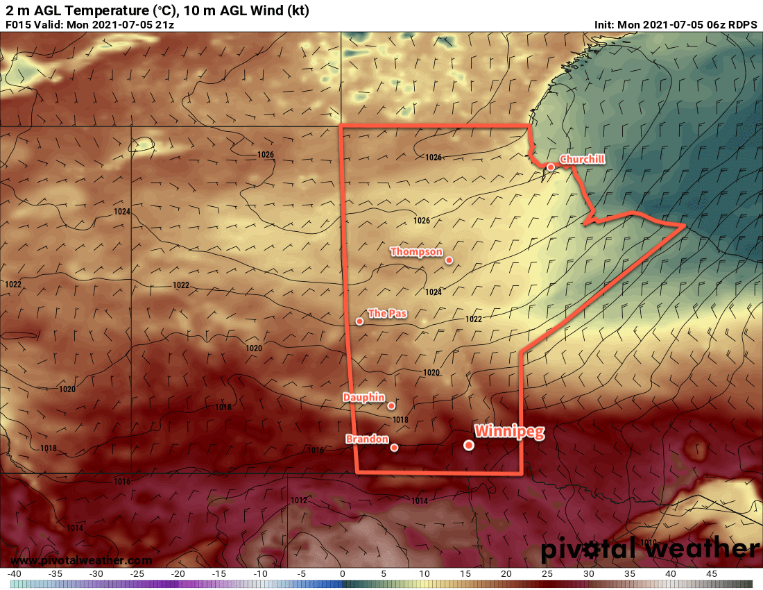
Long Range Outlook
Unsettled conditions will develop over the region on Thursday as a warmer air mass begins to return. Winnipeg will see cloudier conditions on Thursday with a chance of showers, followed by a bit more sun and warmer temperatures on Friday. The heat is back for the weekend with highs in the low 30s and overnight lows in the upper teens.
Today’s seasonal daytime high in Winnipeg is 26 °C while the seasonal overnight low is 13 °C.
Summer heat arrives this week for Winnipeg with a prolonged stretch of hot, dry weather.
The weather driver for Winnipeg this week will be a potent upper-level high that is currently situated over British Columbia. This feature is responsible for a dangerous, record-setting heat wave over the region right now. In fact, yesterday the town of Lytton, B.C. set a new record for hottest temperature recorded in all of Canada at 46.6 °C, beating out the previous record of 45.0 °C set in both Yellow Grass and Midale, SK on July 5, 1937. And records aren’t just falling in British Columbia, they’re being smashed by 5–10 °C.
This feature will slowly drift eastwards this week, gradually weakening as it pushes across the Prairies. But it will continue to bring several days of record-shattering heat to British Columbia and Alberta.
Daytime highs will reach around 30 °C in Winnipeg mid-week. Note the temperatures in excess of 40 °C forecast for northern Alberta.
Winnipeg will see daytime highs climb to around 30 °C over the coming days with lows increasing into the upper teens. The city will see plenty of sunshine over the next few days with just a few clouds around. Winds will pick up out of the north to around 20 km/h today, then ease tonight and stay light over the next couple days. As mentioned at the top, no notable precipitation is in the forecast. There is a slight chance that a few showers may move through overnight Tuesday or very early Wednesday morning, but it doesn’t look particularly likely at this point.
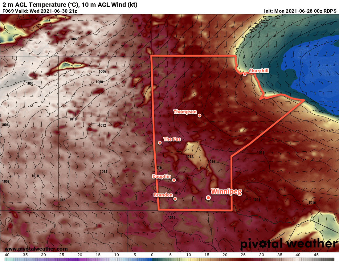
Long Range Outlook
The rest of the week will be more of the same with temperatures increasing further. Highs should reach the mid-30s by the weekend with overnight lows warming to around 20 °C. No precipitation is expected through the second half of the week.
Today’s seasonal daytime high in Winnipeg is 25 °C while the seasonal overnight low is 12 °C.