Temperatures Warming Back up Over the Weekend

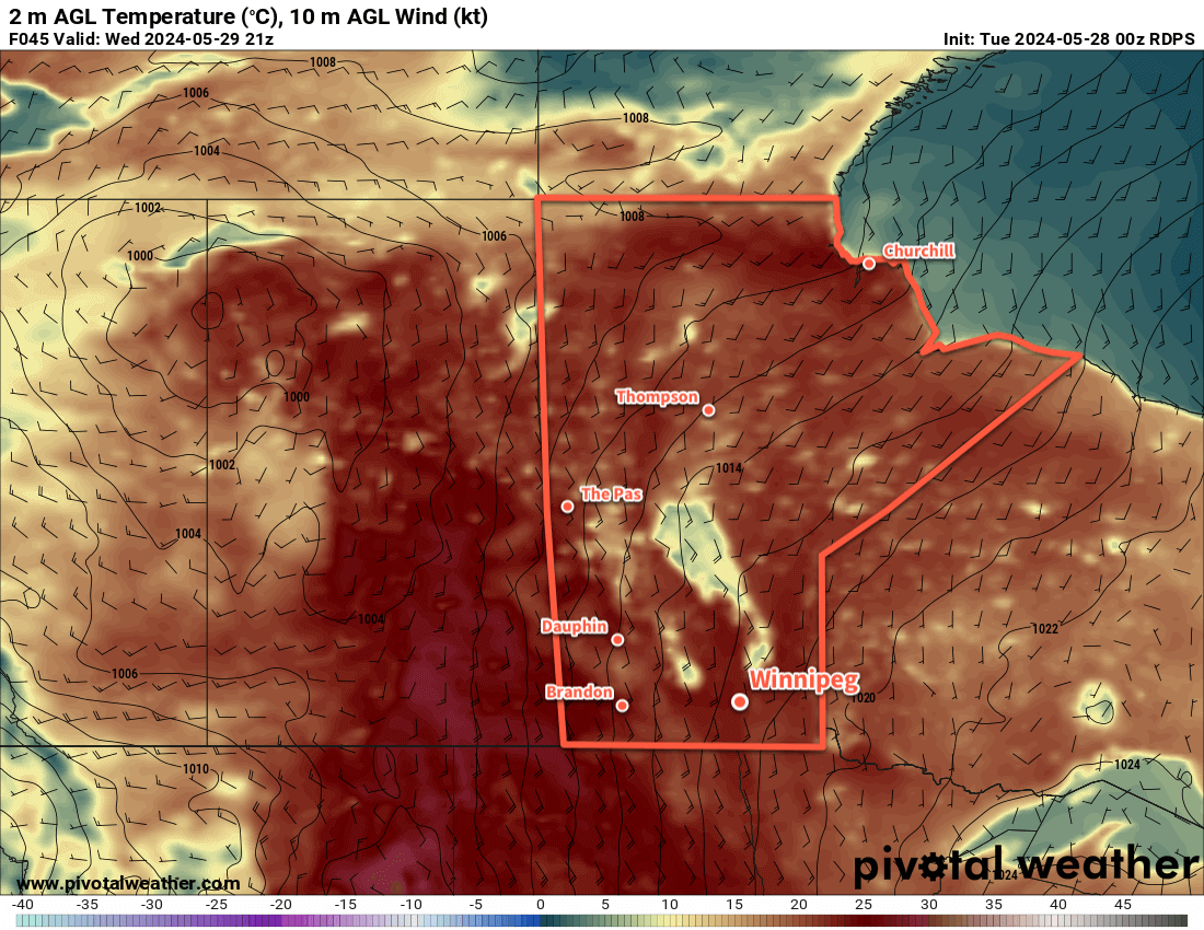
An Arctic high will bring one more day of cool weather to Winnipeg, but warmer temperatures will build back in through the weekend.

RDPS 10m Wind Forecast valid 21Z Friday August 9, 2024
A sprawling Arctic high will be the dominant weather feature over the eastern Prairies this weekend.

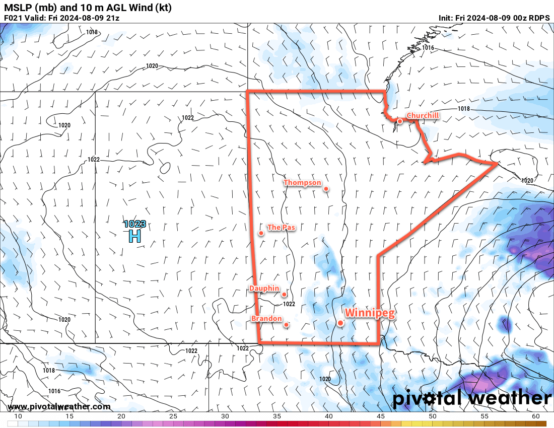
An Arctic high will sit entrenched over the eastern Prairies over the next few days, gradually weakening as the cool air over the region gradually warms. This will result in a simple forecast for Winnipeg: gradually increasing sunniness with warming temperatures.

Skies will improve from mixed skies today to partly cloudy skies on Saturday to mainly sunny skies on Sunday. Northerly winds in the 20–30 km/h range today will ease tonight; heading into the weekend the winds will be light out of the northwest on Saturday and the west on Sunday.

Temperatures will be cool today as the region is under the remains of the cold air core from the low that passed into the region earlier this week. Temperatures will climb to around 20 °C today in Winnipeg, return to seasonal values on Saturday in the low to mid-20s, then climb into the mid- to upper-20s on Sunday.

Overnight lows will slowly climb through the weekend into the mid-teens as more seasonal levels of humidity build back in.

Long Range Outlook

The start of next week will continue to bring warm and settled weather to the region as the area of high pressure over the region continues to weaken and gradually drift to the southeast. The chance of showers or thunderstorms may return mid-week, but settled conditions will likely return quickly with near-seasonal temperatures.

Today’s seasonal daytime high in Winnipeg is 26 °C while the seasonal overnight low is 13 °C.

Sunshine Returns as Temperatures Warm Up

Winnipeg will finally see the sun for a couple days as the cooler temperatures break across the region and some summer warmth builds back in.

RDPS 2m Temperature Forecast valid 21Z Wednesday May 29, 2024
Mild temperatures will spread into southern Manitoba on Wednesday with daytime highs in the low to mid-20s.

A brief note to start: the absence over the past couple weeks wasn’t planned. I caught COVID and it ended up being a rough ride that’s taken a while to recover from. I’m getting back into form now and hope to move back towards posting with more regularity again.

That said, I’m back with good news. After a large cool and wet couple weeks, the weather will finally turn a corner today. A large area of high pressure will descend from the Arctic into Manitoba today, while an upper ridge builds into the Prairies. This will settle the weather and bring sunny skies to the region as northerly winds ease. It will be seasonably cool today with a high in the 15 to 20 °C range and an overnight low near 5 °C.

Warmer weather will arrive tomorrow as the high pushes off to the east and a deep southerly flow develops. A broad area of southerly winds from 30 to 50 km/h will develop across southern Manitoba and southeast Saskatchewan, sending highs into the low to mid-20s. As the upper ridge moves over the region on Wednesday night, temperatures will stay mild with lows dipping to the mid-teens.

As the upper ridge moves east, a deep upper trough will follow in its wake, spreading unsettled conditions through Alberta and Saskatchewan. Widespread thunderstorm activity will develop in those areas on Tuesday and Wednesday as the system progresses.

By Thursday, the upper trough will be pushing into Manitoba. Down at the ground, this system will show as a low pressure system over northern Saskatchewan with an occluding frontal wave dropping southwards into the American Plains. The region will see cloudier conditions on Thursday as this disturbance moves through, and a band of [thunder]showers is likely to develop and move across the Red River Valley on Thursday afternoon. Temperatures should be near-seasonal with a high in the low 20s and an overnight low on Thursday night in the 10 to 15 °C range.

Long Range Outlook

Conditions will settle for the end of the week with highs in the low to mid-20s on Friday, Saturday, and Sunday. The region will likely see a mix of sun and cloud through all three days, but there may be a chance of isolated showers on Friday and Sunday.

Next week looks to start with more of the same! Seasonal temperatures, variable cloudiness, and occasional chances for showers.

Today’s seasonal daytime high in Winnipeg is 22 °C while the seasonal overnight low is 8 °C.

Sunny and Warm This Weekend in Winnipeg

A stagnant pattern over the region will bring sunny skies and warm weather to Winnipeg for the rest of the weekend.

RDPS 2m Temperature Forecast valid 21Z Friday April 5, 2024
Mild temperatures will continue to wash over the southern Prairies this weekend.

A slow-moving upper ridge over the the province and a stalled surface low in Montana will result in little change to the weather in Winnipeg this weekend.

In the days ahead, the region will see sunny skies with daytime highs warming from the low teens into the mid-teens. Overnight lows will hover near or just above freezing.

Winds will strengthen out of the southeast into the 20 to 30 km/h range today, stay steady tonight, then increase to 40 gusting 60 km/h on Saturday. The winds will ease on Saturday night back into the 20 to 30 km/h range and shift easterly for Sunday.

Long Range Outlook

Monday brings the partial solar eclipse to the region, and unfortunately the region may struggle with cloud cover through the day. A low pressure system crossing the American Plains will spread thick cloud cover all the way through North Dakota and it’s likely that it will spill into southern Manitoba. At this point, it’s unlikely that skies will be overcast, but the region will likely have at least a mix of sun and cloud.

Skies will clear out Tuesday, leaving partly cloudy skies for much of the rest of the week. Temperatures will continue to be mild with highs in the 10 to 15 °C range and lows hovering near the freezing mark.

Today’s seasonal daytime high in Winnipeg is 7 °C while the seasonal overnight low is -5 °C.

Mild Week Ahead With Above-Freezing Highs in Winnipeg

With daytime highs above freezing through the rest of the week, Winnipeg will see cloudier conditions develop as the snowpack across the region undergoes significant melt.

RDPS 2m Temperature Forecast valid 21Z Wednesday March 13, 2024
Mild temperatures with daytime highs above freezing will be commonplace across the southern Prairies this week.

Warm Pacific air will sweep across the Prairies this week as upper ridging gradually dominates the upper air pattern over the coming days. As a result, Winnipeg will see daytime highs that climb above freezing throughout the work week.

It won’t all be sunshine though; a cold front dipped southwards overnight and another frontal boundary will slowly drop southwards through the province over the coming days. This will bring cloudier skies to the region with daytime highs in the +1 to +4°C range. Dew point values are expected to climb above freezing both today and tomorrow which will aid in the melting and erosion of the snow pack. Overnight lows will dip into the -5 to 0 °C range over the next several nights.

A weak disturbance will bring light snow to southwest Manitoba on Wednesday; while there may be a chance of flurries in Winnipeg, the system is likely to fall apart west of the Red River Valley.

As the melt continues through the week and the cloud lingers across the region, the chance of seeing fog patches or mist will increase. Northerly winds will pick up in the second half of the week which should help clear out any lingering moisture in the air.

Long Range Outlook

The next system of note will be a low pressure system dropping southeastwards through Manitoba on Friday. This system could bring a mix of rain and snow to the Red River Valley, though current indications are that it should pull enough warm air eastwards that most of the precipitation would be rain.

GDPS Precipitation Type and Rate Forecast valid 00Z Saturday March 16, 2024
A low pressure system moving through Manitoba on Friday will bring a mix of rain and snow to the province.

This system could bring rain amounts ranging from a trace to the 5–10 mm range across the Red River Valley. With a cold front swinging through on Friday night, it would leave behind cooler weather with a chance of flurries into the weekend.

Today’s seasonal daytime high in Winnipeg is -2 °C while the seasonal overnight low is -12 °C.