The first half of this week will bring generally pleasant summer weather to Winnipeg & the Red River Valley. Some showers or thunderstorms may be possible on Monday and/or Tuesday, but mainly south and east of Winnipeg.
Monday
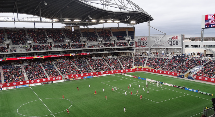
Today will be a beautiful day for the first 2015 FIFA Women’s World Cup game played here in Winnipeg. Skies will be mainly sunny and high temperatures will climb into the upper twenties. Winds will be relatively light from the north-west at 20 km/h or lower. There may be a few passing showers or very weak thunderstorms south and east of Winnipeg, but nothing of particular significance. Overall it will be a very nice day!
Tuesday
Tuesday will see mainly sunny skies prevail once again, with temperatures in the mid twenties over much of southern Manitoba. Winds will be fairly gusty from the north-west at 30km/h gusting up to 50km/h. Similar to Monday, there will be a risk of thunderstorms south and east of Winnipeg. The risk for storms may shift in later forecasts, but presently it appears that eastern Manitoba could see some marginally severe storms, with perhaps some severe hail. We will provide another update if this threat is expected to materialize.
Wednesday
Benign weather looks to return for Wednesday with mainly sunny skies and no precipitation expected. Temperatures will be in the low twenties and winds will be from the north-west at 20-30km/h.
Long Range
Long range models suggest that generally normal to above-normal weather is expected for the next week or two. Frequent passing weather system will bring unsettled conditions from time to time, with a risk of thunderstorms (generally non-severe). We are certainly not in a full-blown summer pattern just yet, but average temperatures continue to warm!