Hot Weekend Ahead

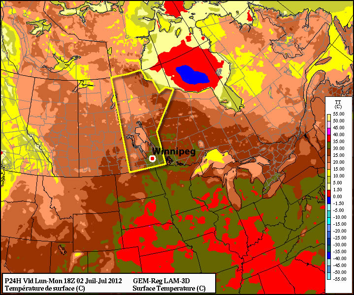
Hot weather will continue through the Red River Valley this weekend, but unsettled weather will return at weekend’s end as an upper trough swings across the Prairies.

850mb Temperatures from the NAM for Friday Afternoon

850mb temperatures from the NAM for Friday afternoon. While temperatures have cooled since Wednesday, very warm air is still in place over Southern Manitoba.

We’ll see quite a nice day today with plenty of sunshine and a high near 31°C. Winds will light out of the west-northwest across most of the Red River Valley. We’ll see a warm night tonight with an overnight low of just 19°C.

For Saturday, we’ll see another sunny day with highs in the low 30’s across the Red River Valley. Some thunderstorms are possible over portions of southwest Manitoba, including Melita, Virden, Brandon, and the Pilot Mound areas. Some communities very close to the western escarpment of the RRV may also have a slight chance at seeing a thundershower.

Clouds will begin to roll in Sunday morning as a upper trough begins pushing into our region. It’s too early to tell who will get what for precipitation, other than it looks like there might be a slight chance of showers for the Southern Red River Valley on Sunday afternoon before the main system pushes through on Sunday night into Monday morning. Precipitation distribution is still questionable with this system, but amounts generally look light with less than 5mm for areas that see rain. We’ll narrow down the expected areas to see rain as we get a little bit closer to this system’s arrival. The cloud cover will limit our high temperatures to the mid-to-upper 20’s and the wind will be out of the southeast at 15 to 30km/h.

new TWTR.Widget({
version: 2,
type: ‘list’,
rpp: 30,
interval: 30000,
title: ‘July 15nd, 2012’,
subject: ‘AWM Storm Chase’,
width: ‘auto’,
height: 500,
theme: {
shell: {
background: ‘#3c3c3c’,
color: ‘#eeeeee’
},
tweets: {
background: ‘#eeeeee’,
color: ‘#2c2c2c’,
links: ‘#489ce1’
}
},
features: {
scrollbar: true,
loop: false,
live: true,
behavior: ‘all’
}
}).render().setList(‘WeatherInThePeg’, ‘awm-team’).start();

Hottest Day of the Year to Give Way to Unsettled Weather

Winnipeg may see the warmest day of the year today as temperatures soar into the mid-30’s under the influence of an upper ridge and southwest wind. The upper ridge that has brought us our sunny weather will then be weakend by multiple upper disturbances tracking across the Prairies, bringing us a few days of more unsettled weather across Southern Manitoba.

850mb Temperatures for this afternoon.

850mb temperatures from the NAM for this afternoon.

A southwest wind, combined with significantly warmer temperatures under the upper ridge (around 22 or 23°C at 850mb) today will help Winnipeg’s temperature soar to a scorching 35°C if we can stick to sunny skies. Today will be the warmest day of the week, with temperatures returning to near 30°C for Thursday and Friday. Overnight lows will be mild with the temperature bottoming out at only around 19°C.

Several disturbances are set to track through the southern portion of the province beginning this afternoon/evening, which will bring us a risk of thunderstorms late this afternoon and this evening as well as tomorrow afternoon/evening. While some storm parameters will be significant given the heat, a distinct lack of wind shear will ensure that any storms that form will likely be relatively slow moving pulse-type storms. They may strengthen to severe levels, but they will likely be scattered and it will be quite hit and miss as to who sees them and who doesn’t. The main threat from the storms would be large hail and heavy rain. Strong winds area also a possibility. Extremely weak wind shear will likely preclude the development of tornadoes, but it’s important to remember that any thunderstorm has the potential to produce a tornado; some are just more likely than others.

Things clear up a bit for Friday (although a few hit and miss storms are possible through the Red River Valley) before another system pushes in for the weekend and we’ll see more significant chances for thunderstorms return.

Staying Hot, Storms Possible

This week will start out right where last week left off – hot!

Monday's temperatures at 1pm

Temperatures at 1pm on Monday. The dark green colour represents temperatures between 30 and 35C.

Today will be another hot and humid day in Southern Manitoba. High temperatures are expected to be in the upper twenties, or possibly thirty degrees, with thunderstorms possible both in the morning and later in the day. There will some cloud and possible rain or thunderstorms during the morning from a decaying thunderstorm complex. The speed at which this complex clears the region will determine how hot it will get. The progress of this complex will also determine if there is a second round of storms on Monday afternoon and evening. If it stays cloudy all day with temperatures remaining low then it is unlikely that there will be a second round of storms later in the day. Based on current model guidance it does appear that the clouds will clear out in the afternoon, but there remains some uncertainty with this.

Tuesday will be hot once again, but somewhat less humid than Monday. Temperatures will be up near 30C, but thunderstorms are not expected.

Wednesday will be yet another tricky forecast. A cold front is expected to swing through Manitoba at some point on Wednesday, but it is not entirely clear when that will happen. If the cold front goes through in the morning the day will be warm, but not humid, with highs in the mid to upper twenties. However, if the front only goes through in the evening it will be hot and humid with the risk of severe thunderstorms. The details of Wednesday should become more clear over the next day or two.

You’ll probably be surprised to hear that more hot weather is expected to start July (hint, I hope you’re NOT surprised). Models point to continued hot weather for at least the next 7-10 days as we roll smoothly in the heart of summer.

A quick note…Myself and Matt will be chasing south of the border today! You can keep tabs on our progress using the twitter feed by clicking through below.

new TWTR.Widget({
version: 2,
type: ‘list’,
rpp: 30,
interval: 30000,
title: ‘July 2nd, 2012’,
subject: ‘AWM Storm Chase’,
width: ‘auto’,
height: 500,
theme: {
shell: {
background: ‘#3c3c3c’,
color: ‘#eeeeee’
},
tweets: {
background: ‘#eeeeee’,
color: ‘#2c2c2c’,
links: ‘#489ce1’
}
},
features: {
scrollbar: true,
loop: false,
live: true,
behavior: ‘all’
}
}).render().setList(‘WeatherInThePeg’, ‘awm-team’).start();

Warm Weather to Continue, Slight Chance of Showers

Our warm weather is expected to continue as a significant upper-level ridge continues to strengthen over Southern Manitoba. The weather will slowly grow slightly more unsettled into next week.

500mb Winds valid Saturday Morning

500mb winds valid Saturday Morning. The building/approaching upper ridge is shown by the ridging in the black height contours; I’ve marked the ridge axis with the thick blue squiggly line.

We’ll see sunny skies today with a daytime high of 28°C today and lighter winds only at about 20-30 km/h. Warming temperaures aloft will bring warmer nights back into the cards, with our overnight low tonight and through the weekend expected to sit only at about 17 or 18°C. Fortunately, our dewpoints should remian in the low teens, which will help make the warmth more comfortable.

A weak low sliding across Central Manitoba on Saturday will spread an area of rain and thundershowers through Parkland Manitoba across the Interlake and into NW Ontario. For those heading out to Dauphin for this weekend’s Country Fest, be sure to bring your tarps for your tents and your rain slickers; you’ll likely get a little wet on Saturday morning. Fortunately, conditions should be considerably better than, well, many of the recent years. Here in the Red River Valley, there’s only a slight chance of showers on Friday night/Saturday. For Winnipeg, Saturday will be a mix of sun and clouds with a high near 28°C.

Conditions improve again on Sunday, with more sunny skies across Southern Manitoba and highs near 30°C.

The upper ridge that has brought this beautiful weather to us will begin to break down early next week, bringing slightly more unsettled weather back to the Prairies. It currently looks like we’ll see some rain on Monday evening, and then building heat and humidity mid-week with the threat of thunderstorms. We’ll have more on that first thing next week!