After a mild weekend that brought cloud, freezing drizzle, and a fresh coating of snow, colder weather will settle over southern Manitoba this week.
As the low pressure system that impacted the region trundles off to the east, a ridge of high pressure will build southeast out of the Arctic into Manitoba. This will bring gradually clearing skies to the region today. The lingering cloud will produce a bit of light snow through the day with temperatures hovering near -10 °C through the day. Skies will clear tonight in Winnipeg with temperatures falling to a low in the -25 to -20 °C range.
Wednesday will bring mainly sunny skies to the region as an Arctic ridge sits over southern Manitoba. Temperatures will struggle to recover much during the day with daytime highs only reaching around -20 °C in the afternoon.
The region will be saved from a bitterly cold night on Wednesday night, courtesy of a low pressure system sliding through the southern Prairies. Cloud cover and light snow will build into the region through the night. This will keep temperatures relatively warm with lows in the -25 to -20 °C range.
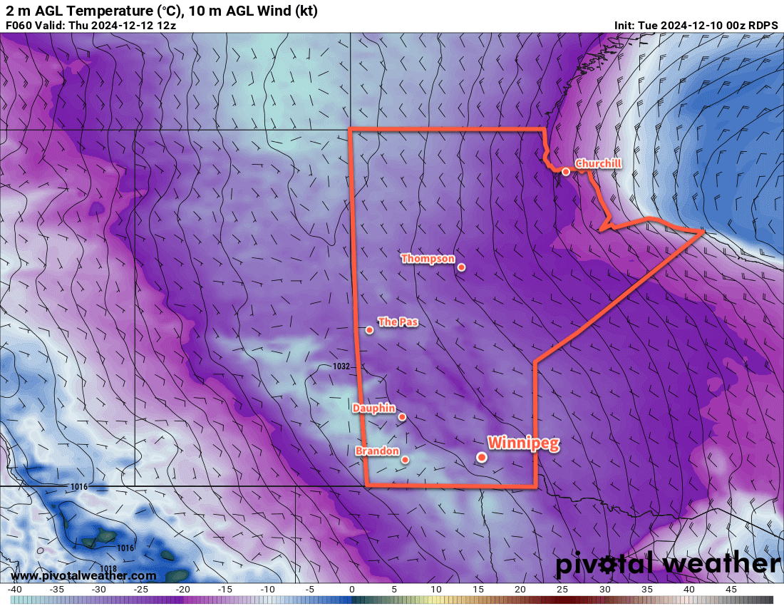
By Thursday morning, snowfall accumulations in Winnipeg will likely be 2 cm or less, but amounts will increase to the east-southeast up to 5 to 10 cm in Brandon and 10 to 15 cm in Melita. The snow will taper off on Thursday with clearing skies. Temperatures will climb to a high near -15 °C on Thursday. With clear skies and light winds, temperatures will head back down into the mid-minus 20s on Thursday night.
Long Range Outlook
Heading into the end of the week, Friday will bring more cold weather with a high in the -20 to -15 °C range, but then a significant pattern change develops as the Polar Vortex retreats towards the pole and an upper ridge builds into western Canada.
This will bring increasing cloud to the region as temperatures warm through the weekend with strengthening southerly winds. Temperatures will be well-above seasonal heading into next week with several above-freezing daytime highs possible!
Today’s seasonal daytime high in Winnipeg is -11 °C while the seasonal overnight low is -21 °C.