Temperatures will be seasonably cool in the Red River Valley through the remainder of the week with the chance of showers returning to the region.
Today will be fairly pleasant, all things considered, with a fair amount of sunshine until cloud cover moves in through the mid- to late afternoon ahead of a low pressure system lifting northeastwards out of the Northern Plains. Temperatures will climb to around 20°C this afternoon.
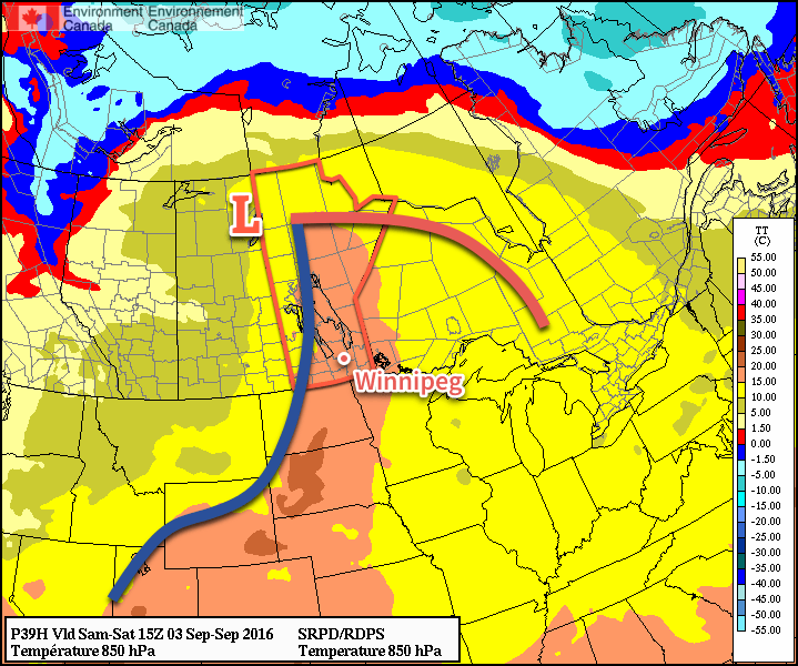
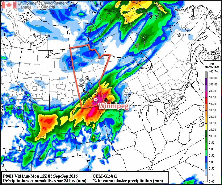
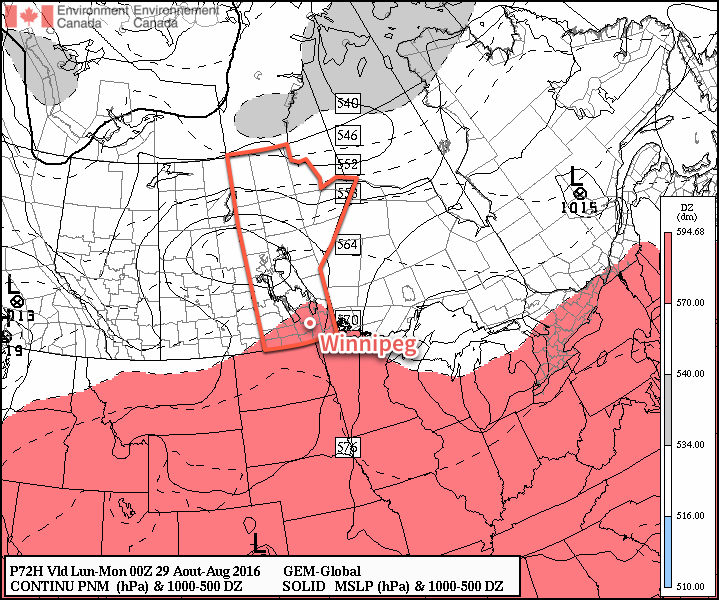
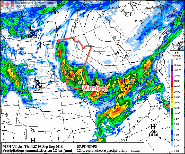
Tonight will bring showers and/or thunderstorms to Southern Manitoba, however the exact distribution of the precipitation remains a little uncertain. Two features will support rainfall: the main upper low which will track through WestMan & the Interlake and a secondary shortwave that will lift through North Dakota. What begins as a large line of rain will likely focus towards these two features overnight. This means that here in the Red River Valley, amounts will likely be less, or even non-existent, compared to areas to the west/north or south/east. The primary chance for rain will occur between around 9PM to 4AM. In heavier showers, 15-25mm of rain could be seen, while many places will likely see 5-10mm. Again, here in the Valley, we may escape with little precipitation, depending on how things develop. Expect a low near 12°C.
Thursday will bring mixed skies with a high once again near 20°C. The day will be otherwise fairly unremarkable. Expect more cloud and a low near 11°C. All in all a pleasant first day of school!
Friday will see another disturbance move across Southern Manitoba, bringing another chance for some scattered showers under mainly cloudy skies. Sunshine should start poking out through the afternoon as skies become more mixed behind the disturbance. Expect a high near 18°C. Skies will clear overnight as temperatures dip to around 9°C. Some lake-effect showers are possible overnight in the lee of both Lake Manitoba and Lake Winnipeg as cool northwest winds roll over the warm lake surface.
Long Range
The weekend is looking fairly dry with variable cloudiness and daytime highs in the upper teens or low twenties. Sunday will likely be windy out of the south. Overnight lows will continue near 10°C.
Winnipeg’s seasonal daytime high is currently 20°C while the seasonal overnight low is 8°C.