Beautiful Friday Gives Way to Unsettled Weekend

Summer heat will push into southern Manitoba for the weekend, starting with a beautiful Friday in Winnipeg. More humid conditions will develop on Saturday which will also bring the chance of stormy weather.

RDPS 2m Dew Point Temperature Forecast valid 21Z Saturday July 9, 2022
Humid conditions will develop across southern Manitoba on Saturday.

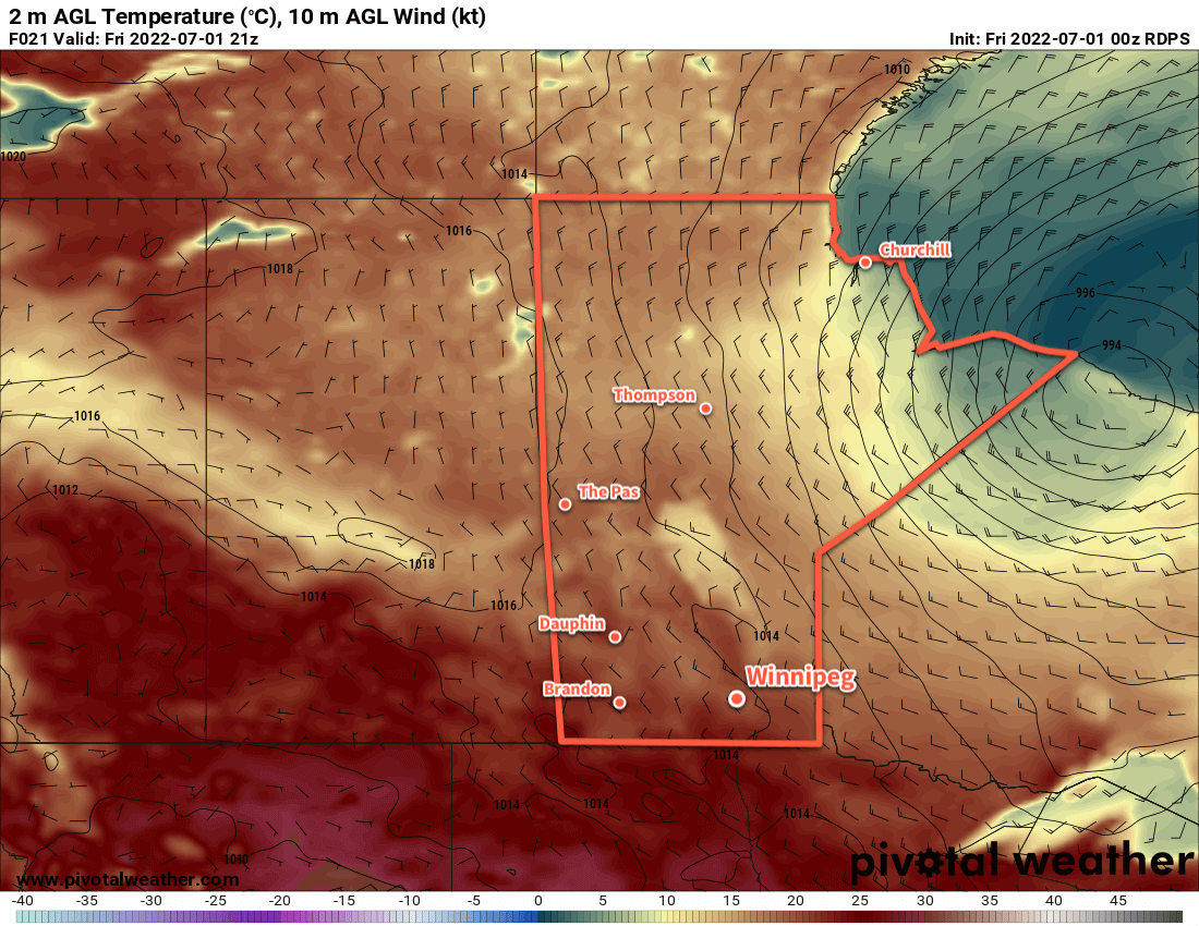
A light southeasterly flow will develop across the Red River Valley today as a warmer air mass moves into the region. Highs will climb into the upper 20s across the region under mainly sunny skies, making for a beautiful afternoon. The humidity will stay at comfortable levels through the day.

Temperatures will stay mild tonight with a low in the upper teens as more warm air pushes into the area. There will be a significant push of humidity northwards overnight, which could result in a few thunderstorms later in the night or early Saturday morning.

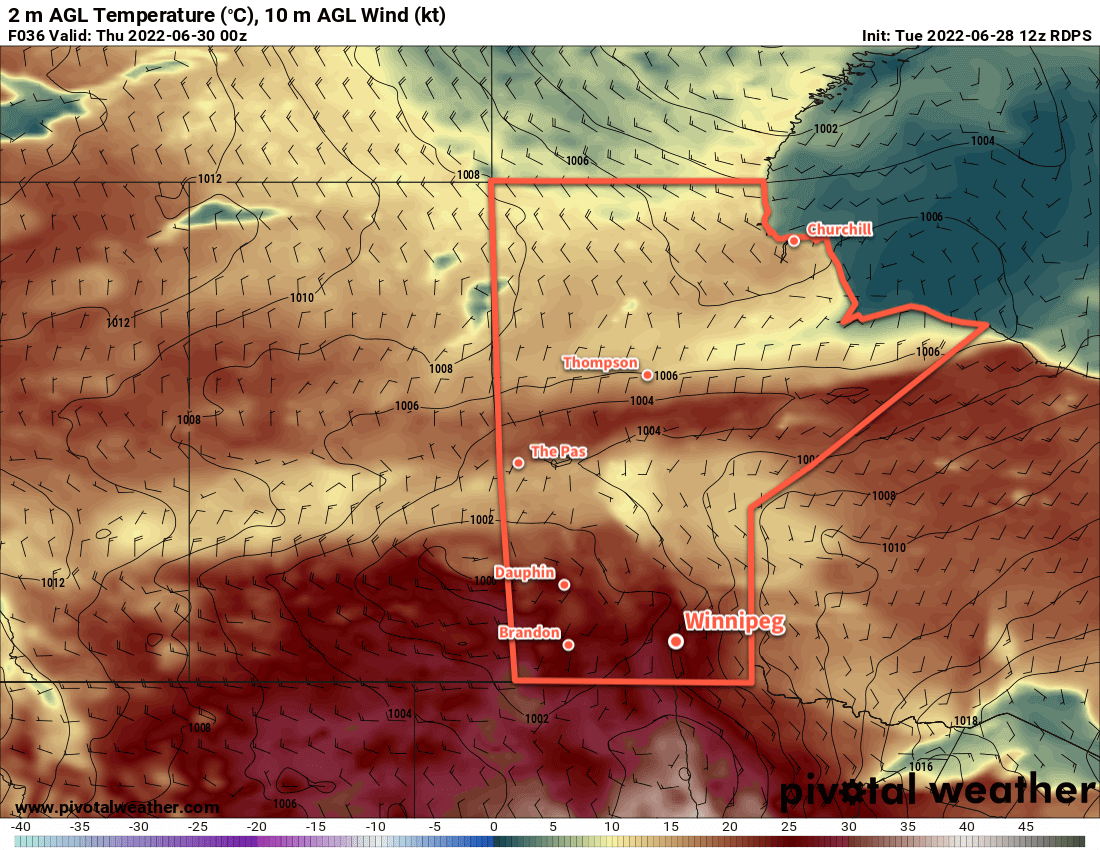
As temperatures warm up on Saturday, the moisture that streamed northwards will mix back down to the surface, resulting in a dramatic increase in humidity through the morning. Dew point values will climb near or above 20 °C by midday, making it feel very muggy outside. Mixed skies will keep temperatures a bit cooler than they would otherwise be with highs in the upper 20s.

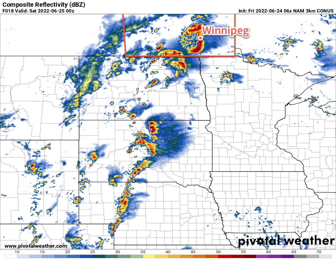
Another risk of thunderstorms will develop as a trough of low pressure moves across the region later in teh day. Given the heat and moisture over the region, there will be a risk of severe thunderstorms with this system. All thunderstorm hazards will be possible, including an isolated tornado if storms are able to develop early enough to be surface-based. Definitely keep an eye out for any alerts issued by ECCC on Saturday.

Temperatures will stay very warm on Saturday night with lows near the 20 °C mark. The risk of thunderstorms could continue well into the night across much of the region.

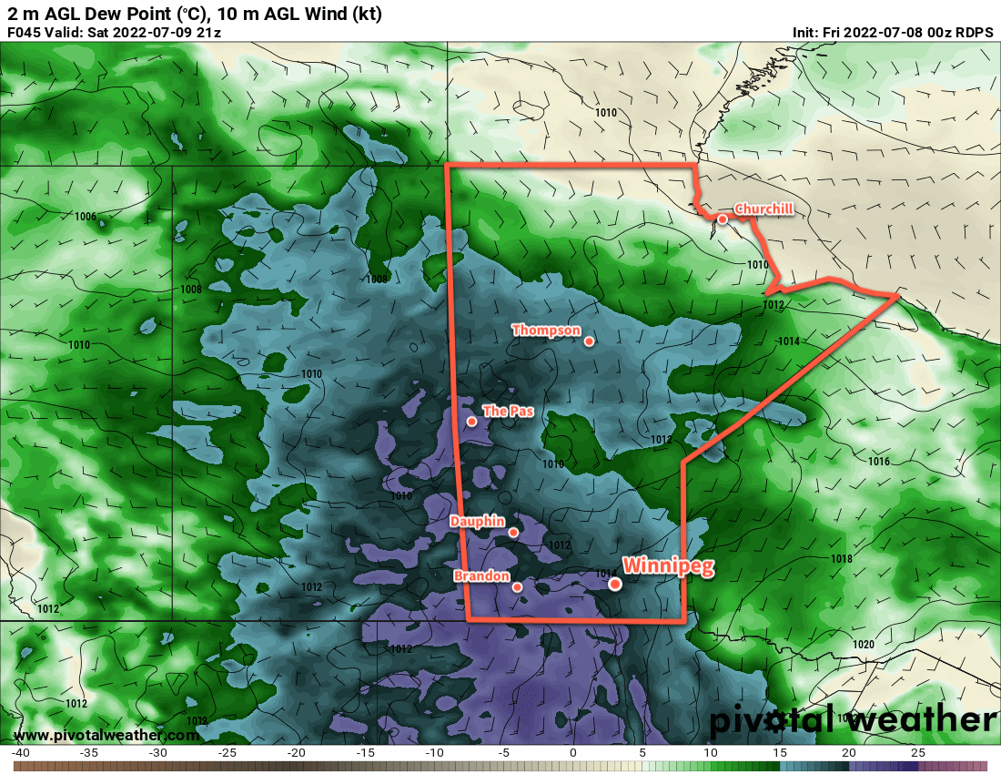
Sunday will bring mixed skies to the region with temperatures once again climbing into the upper 20s. The humidity should ease a bit heading into the afternoon with slightly drier conditions behind Saturday’s surface trough. The potential for thunderstorms will return in the evening as a cold front slumps towards the area from the north. This activity shouldn’t be as bad as Saturday night’s, but there’s enough support for strong to marginally severe thunderstorms. This risk will continue into the night as an upper-level disturbance tracks over the province.

Long Range Outlook

Next week will bring near- to above-seasonal temperatures with generally pleasant conditions. A small chance for isolated showers or thunderstorms will continue into the early part of the week, but a building upper ridge will likely bring much sunnier, warmer weather to the region for the latter half of the week.

Today’s seasonal daytime high in Winnipeg is 25 °C while the seasonal overnight low is 13 °C.

Pleasant Weekend With a Return to Seasonal Temperatures

There will be plenty of sunshine in Winnipeg over the coming days as temperatures gradually ease back to seasonal values.

RDPS 2m Temperature Forecast valid 21Z July 1, 2022
Canada Day will bring seasonably cool temperatures and a northwesterly wind to Winnipeg this year.

A low pressure system over Hudson Bay will keep a persistent west-northwest flow over the province for the next couple days. This pattern has brought a slow-moving high pressure system to the Prairies; it will keep the clouds (mostly) away and temperatures seasonably cool.

Temperatures in the city today will climb to a high in the low 20s this afternoon. A northwest wind will pick up into the 20–30 km/h range later this morning. In the afternoon a few clouds will pop up, but it should stay dry through the afternoon. The clouds will dissipate this evening as the wind dies off. Temperatures will head to a low near 10 °C.

A few clouds will move through the region on Saturday as temperatures climb to a high in the low 20s again. Winds will be light as the area of high pressure moves across the province. A weak low crossing Saskatchewan will begin pushing a warm front towards the region by evening. This will bring some cloud cover into the region overnight as temperatures drop to the low teens.

Sunday will be an unsettled day across the region as enough warmth and moisture returns to produce broad instability. A combination of the passing low and stalled frontal boundary will provide support for showers and/or thunderstorms, likely possible at several points throughout the day. Temperatures should reach the mid-20s in the afternoon the afternoon. At this point, severe weather is unlikely, but a few strong thunderstorms may develop.

Conditions should settle on Sunday night with temperatures heading into the low teens.

Long Range Outlook

Forecasts show temperatures staying at seasonal to above-seasonal values through the week with gradually increasing humidity. By the end of the week, daytime highs could reach close to 30 °C. Conditions will be pleasant for the first couple days, but an unsettled pattern could develop mid-week, bringing occasional periods of stormier weather.

All in all, a pretty typical and pleasant summer weather forecast!

Today’s seasonal daytime high in Winnipeg is 25 °C while the seasonal overnight low is 13 °C.

Near-Seasonal Summer Weather Ahead

Winnipeg will see near-seasonal warmth through the rest of the week as pleasant summer weather settles over the region.

RDPS 2m Temperature Forecast valid 00Z Thursday June 30, 2022
Near-seasonal temperatures will push into southern Manitoba on Wednesday as an approaching low lifts a warm front into the region.

The city will see sunny skies today with cooler temperatures in the wake of a cold front that slumped through last night. A high pressure system moving into the region bring a northerly breeze the region today. Temperatures in Winnipeg will climb close to 20 °C under mainly sunny skies. Temperatures will dip into the upper single digits tonight with light winds.

Seasonal temperatures will return to Winnipeg on Wednesday as a warm front lifts towards the region. This will bring some cloud and a chance of showers to the region in the morning as any remnants of overnight convection slide eastwards. After that, the sun will break through the clouds a bit as temperatures warm into the mid-20s.

A cold front will push through on Wednesday evening, bringing a chance of showers or thunderstorms to much of the Red River Valley. Temperatures will head to a low in the 10–15 °C range.

On Thursday, some lingering cloud will gradually clear as temperatures warm into the low 20s. Both Thursday and Friday will bring highs in the 20–25 °C range with lows near 10 °C.

Long Range Outlook

Forecasts show the heat building back in this weekend with highs pushing into the mid- to upper 20s by Sunday. Long-range models show an increased probability of wetter weather, which also suggests that the region may see more unsettled conditions into next week.

Today’s seasonal daytime high in Winnipeg is 25 °C while the seasonal overnight low is 12 °C.

Stormy Friday Leads to Cooler Weekend

Severe weather is possible across southern Manitoba today as thunderstorms fire up in the afternoon.

3km NAM Simulated RADAR Reflectivity valid 00Z Saturday June 25, 2022
Most weather models show strong to severe thunderstorm activity developing over southern Manitoba on Friday afternoon into the evening.

A dynamic weather setup will develop over southern Manitoba today. To begin the day, a warm front lies draped west-to-east across southern Manitoba. Temperatures will warm into the upper 20s this afternoon as a humid air mass pushes northwards out of the Dakotas. A few showers or thunderstorms are possible beginning later this morning, followed by the chance for more potent thunderstorms later this afternoon. All modes of severe weather will be possible, but the main threats will be damaging hail and torrential downpours/flooding. Some thunderstorms may be capable of producing damaging wind gusts. An isolated tornado may be possible too.

Watch for any severe thunderstorm or tornado watches and/or warnings issued by Environment and Climate Change Canada as the day progresses.

The unsettled weather will continue into the evening, then gradually taper off into the overnight period. Temperatures will head down to a low in the mid-teens overnight.

More cloud and unsettled weather will be around for Saturday as an upper low moves through the region. The morning will likely be cloudy with just a slight chance of some showers. Temperatures will climb only to around 20 °C with a strengthening west-northwest wind. As the upper low passes in the afternoon, the region will see a good chance of some more showers swinging in from the northwest. The wind will ease overnight and the showers will taper off as the system tracks off into Ontario. Temperatures will head down to the low teens by Sunday morning.

Finally, mainly sunny skies return for Sunday as a ridge of high pressure moves towards the region. Temperatures will climb into the low to mid 20s with a light northwesterly wind that tapers off later in the afternoon. Temperatures will dip to the mid-teens on Sunday night.

Long Range Outlook

It will be a bit unsettled next week as a relatively active pattern develops over the region. Stormy weather is possible again on Monday, followed by cooler temperatures and calmer weather on Tuesday. Again, Wednesday may bring more showers or thunderstorms that could possibly linger into Thursday. By the end of the week, a pattern of more settled, sunnier conditions should develop.

Today’s seasonal daytime high in Winnipeg is 24 °C while the seasonal overnight low is 12 °C.