Unsettled Weather On The Way

A broad trough of cold air aloft is set to park itself over Manitoba the next couple days, preventing any warmer air from spilling eastwards and keeping us cool, cloudy and slightly snowy.

24 Hour QPF Accumulation

24 Hour QPF Accumulation valid 12Z Thursday morning. This shows the total precipitation accumulation from 12Z Wednesday morning to 12Z Thursday morning.

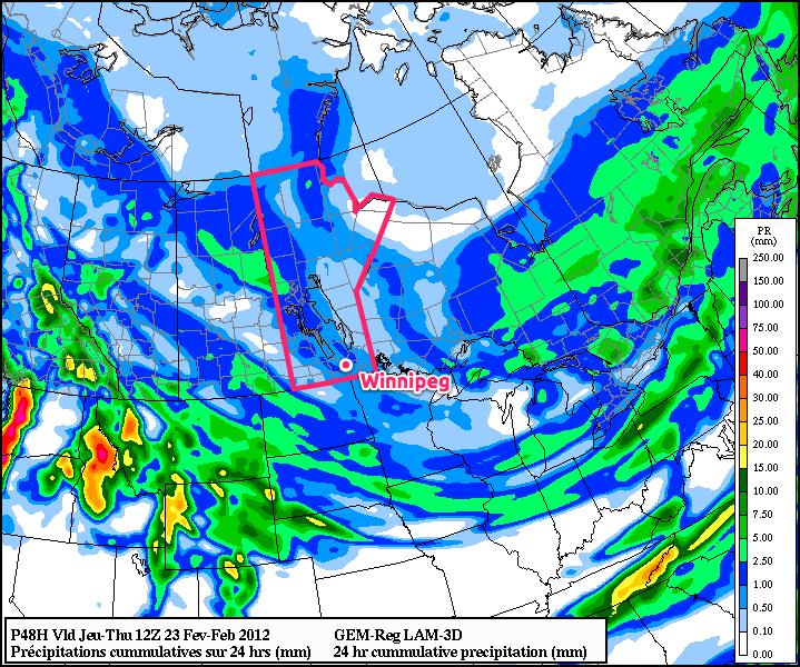
A weak, broad upper trough will build over the province as a northerly at all levels provides cold air reinforcement. The general instability produced by the trough, combined with a slowly advancing cold front over the Interlake and a weak shortwave sliding across SW Manitoba from Saskatchewan, will produce plenty of cloud and occasional flurries. None of these features should generate significant snowfall, reflected by the generally meagre amounts produced by the model (<1mm of liquid equivalent over Southern Manitoba). Temperatures will remain relatively mild, moderated by the cloudy skies we’ll see for the rest of the week. Daytime highs should sit right around -5°C and overnight lows should be right around -10°C.

The cold front, after staying relatively stagnant for a few days, will push southwards this weekend as an upper trough swings southwards out of the Arctic. This should provide us with some sunny skies, but drop our temperatures down in the the -10°C to -15°C range for daytime highs with overnight lows closer to -20°C. By the end of the weekend, Southern Manitoba has another chance at snow, as a moderately strong low pressure system sweeps across the Northern Plains.

The general long-range forecast shows that after this slightly-above-average temperatures week is over, we’ll switch back into a slightly below-normal temperature pattern with daytime highs on the cold side of -10°C, with the possible return of overnight lows south of -25°C. Will March come in like a lion? We’ll have to wait and see…

Summer is Pushing Into Southern Manitoba

The beautiful conditions we’ve had over the past while will take a slight break today, with notably summer-like weather pushing over the Red River Valley. With the Red River and Assiniboine River rapidly rising, how much rain will we see?

A low pressure system currently in Eastern Montana continues to push warm air northwards through the Dakotas towards Southern Manitoba. This warm air brought thunderstorms to Eastern Montana and the Dakotas overnight, and as they have pushed northwards, they have lifted up over the warm front and transitioned to elevated convection that, while weakened, is producing an area of rain that is pushing into our area.

As this precipitation continues to move northwards, away from the warm front, it will weaken as it looses it’s precipitation generating support. The rain that currently resides over the international border will slowly push north, and could give a few light showers to Winnipeg late this morning before it peters out. The main weather that will impact us is currently developing over southeastern Saskatchewan and Southwest Manitoba.


This area of rain visible on the southern edge of the RADAR image will continue to blossom as the low strengthens and overall lift in the area intensifies. This will then begin to track east-northeast later today and spread an area of rain across Southern Manitoba, including the RRV. The models are having some difficulties determining how much precipitation this will produce, which is to be expected, however their tracks for the precipitation are beginning to agree.
GEMLAM

GEM-GLB

GFS

NAM

These models are all from their respectice 06Z runs, except the GEM-GLB which is the 00Z run, showing the precipitation accumulation from 00Z – 06Z tonight. The NAM is a big lighter on the precipitation, but other than that, they all agree (more or less) on location and intensity of the rain. So what will happen?

The precipitation accumulation will vary significantly depending on the amount of embedded convection that manages to develop. Current indications are that after a few showers late this morning, rain will begin to push across the Red River Valley late this afternoon or early this evening. The rain should end over the Southern RRV overnight as the low pulls further north and shifts the precipitation north as well. In Winnipeg, the rain should end sometime early tomororw morning; likely before 8 AM. Total rainfall amounts are difficult to pin down, as it will be directly proportional to the amount of convection that develops, but I would put my money on a general area of 5-10 mm (1/5 – 2/5”). If any significant convection should develop, some areas could potentially see up to 15mm of rain (~ 1/2”).

Once this precipitation clears out, the rest of the weekend will remain a little unsettled. The warm front maintains its position across ND, which will result in the chance of rain over the RRV as convection rides up over the warm front into Southern MB. Next week looks quite nice, however, with mostly sunny skies and temperatures in the low-to-mid teens. How all this precipitation will affect the river levels remains to be seen, however any accumulating precipitation has people concerned with the extremely high river levels that already are impacting the RRV. For more flood information, Rob over at Rob’s Blog has put together a nice collection of flood links.

It’d Be A Shame to Let the Puddles Dry Up

Don’t put your umbrella away yet; our wet start to September isn’t going to be going away any time soon…

I wish I had better news to share, especially for our farmers outside The Perimiter©, but more wet weather is in store as the cool and unsettled weather continues.  At least the mosquitoes won’t be much of a problem, right?

The first thing to note is the incoming surface ridge that will be moving across Southern Manitoba tonight and tomorrow.  Cool air combined with clear skies will drop our overnight lows down to 3-4°C in the city, with temperatures a degree or two colder outside the city.

Cool daytime highs trying to reach 20°C should persist through the weekend.  To begin next week, it appears as if another low pressure system will track through North Dakota, with a warm front draped across the state close to the international border.  I have decided to go with the NAEFS (North American Ensemble Forecast System) solution, as individual models have been varying their solutions a bit for this system:

This shows the probability of 10mm of precipitation or more through 00Z Sept 6 to 00Z Sept 8.  Current indications are that areas close to the border should expect rain through this period, with NAEFS indicating a 70-80% chance of >10mm of rain.  The probability decreases as you head north, but even for Winnipeg the probability of more than 10mm is still > 50%.  This solution will likely change, however I’m fairly confident in saying that people in the RRV can expect a gloomy, rainy Monday into Tuesday.

Things settle down for a couple days with highs near 20°C until the next system rolls through the Dakotas at the end of the week.

This system is currently forecast to be a bit further south, but the NAEFS still plasters the RRV with a 50-70% chance of > 5mm of precipitation from 00Z Sept 9 to 00Z Sept 11.

All in all, likely a rainy start to our week and rainy end to our week after a rainy middle of this week.  And to make things “worse,” there doesn’t look like there will be too much of a chance of thunder making an appearance, except for (most likely) the US side of the border with the first system.

I’ll go get my rubber boots and put them by the door.

A Rainy Weekend; Sunny Next Week?

Photo from Mike O’Flaherty to CJOB

Winnipeggers were woken by a severe thunderstorm on Friday morning around 5:40AM.  The storm ripped through Winnipeg leaving torrential rains in it’s wake.  Rob wrote an excellent summary of some of the damages that occurred in Winnipeg, including flooded underpasses, power outages, and explosive manhole covers.

Later that day, convection fired up through the RRV and brought another round of heavy rain.  Winnipeg had only heavy rainshowers that caused some localized flooding.  There was another tornado report out of Steinbach, however.  Looking through the damages, I’m highly doubtful that it’s a tornado.  While they’ve had more than their fair share of strong wind events this year, it’s a little ironic that we get more false tornado reports out of one of the only storm-ready communities than a lot of other places it seems.

Now moving on to this weekend’s weather for Winnipeg.

A large upper low positioned north of Winnipeg is bringing huge amounts of rain to the province.  A heavy rain warning exists for Grand Rapids right now, with Environment Canada expecting between 50-75mm of rain.  Through today, rain will wrap around the upper low and spread into the northern RRV by early afternoon.  The models are vary slightly in the exact positioning, but by this evening, areas in the RRV north of Morris can expect rain.  The upper low sinks to the SE overnight, drawing the wrap-around precipitation further south, and most communities within the RRV should expect a fairly rainy Sunday with unseasonably cool temperatures with daytime highs only in the mid-teens.

After this system clears out on Sunday night, the northern half of the RRV will see somewhere from 10-20mm of rain, while the southern half will see more along the lines of 5-10mm, perhaps as high as 15mm.  Following this system should be a relatively unremarkable week.  Cooler temperatures will be the name of the game, with daytime highs around 20 degrees.  The current forecast is for sunshine, however don’t expect completely clear skies as while we may be in a cooler airmass, we still have a strong August sun, which will likely produce lovely cumulus-filled afternoon skies.

One last thing to watch out for in the deceptive Environment Canada “a sunny week!” forecast is the fact that Winnipeg will be under a northwest flow for the duration of the week.  The weather has a sneaky habit of throwing little shortwaves down in a northwest flow that the model doesn’t pick up very well, and should any of these happen (as is even being hinted at for Monday evening), we could easily see another batch of showers and/or thunderstorms.

So instead of thinking this coming week will be a beautiful sunny week, wear thicker shirts, bring a jacket, and don’t be surprised if it ends up more unsettled than the forecasts are hinting at right now.