Stormy Start to the Long Weekend

The August long weekend will be off to a stormy start today as the threat of severe thunderstorms bears down on the Interlake, Red River Valley and Whiteshell this afternoon.

Tornado near Lake Diefenbaker

One of a couple of tornadoes that the incoming system spawned in Saskatchewan yesterday. Photo by @TheMrsCogs.

A very powerful low pressure, responsible for at least two tornadoes in Saskatchewan yesterday, will move into Southern Manitoba today and push a cold front across the province through the day. Very strong dynamics will accompany this system, a stark contrast from the last few systems which have had comparatively strong thermodynamics instead. Despite the lack of strong thermodynamic parameters that are often looked at when diagnosing severe thunderstorm potential, such as CAPE, EHI or LIs, the strong dynamics will present a significant severe weather threat over south-central and southeast Manitoba.

Dynamics are physical, kinematic properties of the atmosphere, such as jets, shear and lift. Thermodynamics are thermal/energetic properties of the atmosphere such as temperatures, humidity and instability.

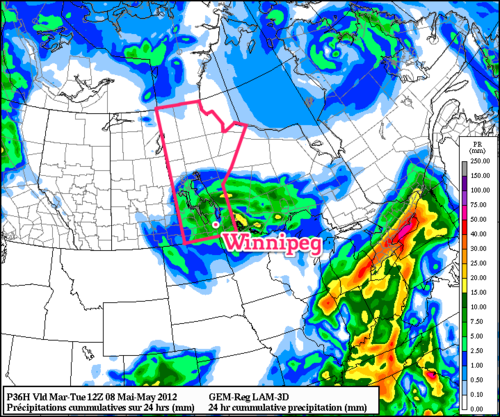
A band of showers will push into the western Red River Valley early in the afternoon ahead of the upper low. As the afternoon progresses, the upper low will begin to deepen and enhance the destabilization over the Red River Valley. By mid-to-late afternoon, despite the cool temperatures and cloudy skies, there should be rapid development of storms along the cold front. Tornadoes are unlikely, although not impossible, here in Southern Manitoba; that threat should be relegated to the Dakotas where even greater dynamics and substantially better thermodynamics are present. If any tornadoes do form tomorrow, it’s likely that they will be of the short-lived variety and relatively weak. The greatest threat from today’s storm will be extremely heavy rain giving rapid accumulations of 1-2” (25-50mm) given precipitable water values of 40-50mm and large, damaging hail given the cool temperatures aloft.

Thunderstorm Outlook

Day 1 thunderstorm outlook valid 18Z today through 12Z tomorrow morning.

The storms will exit the province overnight, and we’ll have a brief reprieve from precipitation. On Saturday, some showers will wrap down into the RRV on the back side of this system. Amounts will vary across the region, but in general less than 5mm is expected. Temperatures will struggle to climb to even 20°C; daytime highs of only 18 or 19°C are expected. Winds will be breezy from the NW.

This system will clear out Saturday night before nicer weather builds back in. The second half of the long weekend will see increasingly sunny skies and daytime highs near 25°C.

Warm, Unsettled Weather Continues

Warm weather will continue to dominate Southern Manitoba as we climb into the high 20’s almost every day this week. We’ll continue to see active weather as multiple systems move through the province over the second half of this week.

500mb Wind Field Valid Friday Night

Forecast 500mb wind field with heights depicting powerful upper low entering Southern Manitoba on Friday evening.

July ended up being a very hot month for Winnipeg, with 14 days of the month with daytime highs over 30°C. The month ended with an average temperature (highs and lows both considered) just over 22°C, which is about 2.5°C above the normal average temperature of 19°C. July marked the 13th consecutive month that Winnipeg has seen above-normal temperatures.

July marked the 13th consecutive month that Winnipeg has seen above-normal temperatures.

We’ll see a chance of afternoon thunderstorms across most areas of Southern Manitoba as a weak disturbance rounds the cold trough left behind yesterday’s system that brought a thunderstorm threat to Southern Manitoba. Chances for thunderstorms will be significantly higher through SW MB northwards through the Parkland region while the Red River Valley will see just a chance of thundershowers in the evening as the upper feature passes by. Daytime highs will be near 28°C through the Red River Valley with an overnight low tonight near a comfortable 15°C.

We’ll see a reprieve on Thursday, with no precipitation expected and a high near 28°C again. A powerful upper low will begin pushing across the Western Prairies bringing rain and cooler temperatures tommorow and will be the main weather-maker on Friday for us. Showers and thunderstorms will push into Western Manitoba on Thursday night and slide eastwards across the province through the day on Friday. It’s likey that we’ll see little precipitation on Friday as most of it pushes through the Interlake, however there’s a good chance of showers overnight on the backside of this system. We’ll see a daytime high of 24°C on Friday and a considerably cooler high near 20°C on Saturday.

Conditions will rapidly rebound through the end of the weekend as sunny skies return and temperatures shoot back up to 30°C.

Showers Today to Give Way to a Beautiful Week

A well-developed upper low will blanket the Winnipeg & the Red River Valley with showers today as it slides southwards into the Northern Plains. Its exit will leave room for an upper ridge to build in from the Pacific Coast, flooding the southern Prairies with some beautiful warm and sunny days.

GEMREG 24hr. QPF valid Tuesday morning

24 hour accumulated rainfall from the GEMREG model valid for Tuesday morning.

Winnipeg will see showers off and on today with a cool daytime high of around 13°C. Winds will be in the 20-30km/h range, starting out of the SW and switching to the NW this afternoon. Conditions will be similar through much of the Red River Valley, with temperatures generally between 12-15°C and similar winds. Showers will clear from north to south overnight, with only a slight chance of some lingering showers or drizzle through the Morder/Winkler, Altona & Gretna areas first thing tomorrow morning. In total, most areas in the Red River Valley, including Winnipeg, will see 4-8mm of rain by the time the showers clear out.

We’ll see sunny skies tomorrow through the entire Red River Valley, with highs from 12-15°C again and northerly winds from 20-30km/h. For the rest of the week, we’ll see a big warm up as mild Pacific air pushes into our area. Currently, it looks like Wednesday will have high temperatures near 20°C and Thursday will push even higher towards the mid-20’s. Things will cool off for the end of the week as a cold front pushes through and brings with it showers and a slight chance of thunderstorms across the Red River Valley.

Showers and Thunderstorms, U2, Then More Rain

While the temperatures may not be completely summer-like, today will be a day that indicates a clear shift towards summer weather.  An incoming disturbance will produce widespread convection today with showers and thundershowers covering much of Southern Manitoba.  Pleasant weather should make an appearance for tomorrow’s U2 concert, but Winnipeg will quickly return to rainy weather on Monday as a system that will bring significant challenges to those with housing near the lake moves into the province.

A substantial stacked low pressure system currently positioned just east of Regina is set to move across Southern Manitoba today.  A few factors will combine to produce what could be a fairly interesting afternoon today.  

First, a southerly wind, combined with yesterday’s rain has pushed dewpoints to nearly 10°C throughout the Red River Valley with a relatively deep layer of evidenced by the stratus cloud that has managed to form overnight despite winds of 15-20km/h.  This moisture will provide the fuel needed for thundershowers. 

Secondly, rather cool mid-level temperatures will be in place.  As the low pushes in, temperatures in the mid-levels should drop to -7 to -8°C, which when combined with daytime heating will produce ample instability to get convection initiating.  It is also indicative of fairly low freezing level, which will help in the generation of small hail.

And last but by far not least, the fact that this upper disturbance is stacked on top of a surface low means that there will be significant rotation through the mid and upper levels which will help storms develop rotation.

When these things combine, it’s considered a pretty classic case for cold core funnels.  These funnel clouds do not develop in the classic sense; instead of developing in the rapidly rotating updraft of supercell thunderstorms, they develop through the descent of cold air through a storm that has developed rotation due to significant mid-to-high level spin.  Think of it as a funnel cloud that develops because of how air is coming out of the cloud rather than how air is being ingested into the cloud.

These funnel clouds do have the potential to touch down and become tornadoes.  If they do, they are often extremely short lived (< 1-2 minutes) and are much weaker than the tornadoes that form from supercell thunderstorms.  Any of the storms that could produce a cold core funnel cloud are also extremely likely to be capable of producing hail.

I think that most areas across Southern Manitoba could see hail today, although the threat is biggest in the Red River Valley and east.  Winnipeg and areas south should most likely see pea-sized hail should it develop.  Further east in the Whiteshell and Sprague regions, the potential exists for marginally severe hail (about dime to quarter-sized).

The biggest hindrance to the development of all this is the lack of focus for convection.  With no strong front or trough, convection may simply blow up all over the place instead of in any organized fashion, which will leave all the storms fighting each other for resources.  If this happens, it’s likely that it would quickly blossom into a big area of showers with only the odd lightning strike.

My bet for the Red River Valley is this: low stratus this morning will burn off quickly with the morning sun.  By mid-morning, most areas should be seeing a mix of sun and cloud.  Daytime heating, combined with a weak cap, will initiate the convection earlier than typical, resulting in showers spreading into the Red River Valley around 12-1PM or shortly thereafter.  Any showers that develop in the RRV are just as likely to become thundershowers, and I think there will be numerous funnel clouds today.

As for Sunday and the big U2 concert, it should be quite a pleasant day.  We’ll see a sunny morning give way to a mix of sun and clouds in the afternoon with a daytime highs around 15-17°C.  It will cool off quick in the evening, so make sure to bring a sweater if you’re headed to the concert.


12hr. QPF valid 06Z May 31 from the 06Z May 28 GFS

After that, it looks like a significant low pressure system will track through Southern Manitoba, bringing nothing but headaches and grief for residents on the lakes.  Current indications are for a widespread area receiving 20-40mm of rain with winds potentially as high as 50 gusting to 70 km/h.  This system will do no good for the flood-striken areas near the lakes, and I would suggest that residents in the area should begin to make preparations already as with the strong winds out of the north-east, significant water damming will likely occur on the western to southern beaches.