The mild fall conditions seen across southern Manitoba will continue into mid-November. There will be weather, though: after a blustery Tuesday, Winnipeg will see several chances for rain over the next week.
Temperatures will stay well above seasonal values in Winnipeg this week as mild air continues to flood into the southern Prairies. While winter weather isn’t that far away — the farther reaches of northern Manitoba and southern Nunavut have seen temperatures near -20 °C or colder already this year — that cold air won’t be making its way south any time soon.
Rather, winds will stay more southerly and westerly over the coming week, bringing daytime highs 5 to 10 °C above seasonal values and keeping overnight lows equally mild.
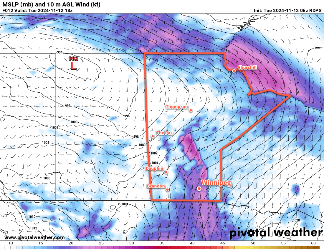
Starting off with today, it will be a seasonably mild day but marked most notably by strong southerly winds. with the region squeezed between a high pressure system to the southeast and a low pressure system in northern Saskatchewan, southerly winds will strengthen into the 40 to 50 km/h range today with gusts as high as 70 km/h through the Red River Valley. Temperatures will climb to a high near 7 °C this afternoon as skies cloud over.
Cloudy skies will continue through the night as southerly winds gradually taper off into the 20 to 30 km/h range. The cloud and wind will keep things mild with lows dipping just below 5 °C.
On Wednesday, temperatures will rebound back into the upper single digits as a trough of low pressure moves through the region. That trough will bring a chance of some light midday rain showers that clear out of the region for the afternoon. Some sunny breaks are possible as skies likely clear out heading towards the evening. Those southerly winds will also ease in the morning, then switch to light northwesterlies behind the trough.
Temperatures will head to a low near freezing on Wednesday night with light winds and clear skies. Some fog patches could develop overnight and last into Thursday morning.
On Thursday, more cloud will develop over southern Manitoba as another low pushes into Saskatchewan. Temperatures will again climb into the upper single digits as winds shift back out of the south and strengthen into the 20 to 30 km/h range. The low in Saskatchewan will lift northeast through the day, lifting its warm front with it and bringing the Red River Valley into its warm sector. This should bring clearing skies on Thursday night with a low in 0 to 5 °C range and southerly winds of 15 to 20 km/h.
Long Range Outlook
On Friday, Winnipeg should see a beautiful mid-November day in the warm sector of the low tracking through the province. Daytime highs could be as high as +10 °C with sunny skies and a southerly breeze.
The warm weather will persist into the weekend, but another low moving into the area will bring cloudier skies with a good chance of rain on Saturday. Conditions will settle on Sunday with mild weather lasting right into Tuesday.
Tuesday/Wednesday next week will likely bring more rain to the region with temperatures likely beginning to cool off behind it. That said, there’s quite a bit of discrepancy in the guidance at this point; some keep it relatively mild, while others bring a sharp cold snap into the region.
Either way, there’s at least another week of pleasant, mild November weather ahead. Hope you can enjoy it!
Today’s seasonal daytime high in Winnipeg is -1 °C while the seasonal overnight low is -8 °C.