Just like that, fall weather has arrived in the Red River Valley with temperatures over 10 °C cooler than seen on the weekend.
Today marks the start of fall weather in southern Manitoba, courtesy a much cooler air mass brought in by yesterday’s cold front and very gusty winds. This change reflects a major shift in the large-scale weather pattern; the upper ridge over the Prairies has collapsed, and a quasi-stationary upper low is becoming established over the western coast of Hudson Bay. This change will result in a more west to northwest flow aloft over Manitoba, ushering in seasonal conditions for this time of year.
The result will be a week filled with daytime highs in the mid-teens and overnight lows dropping into the 0 to 5 °C range with a risk that we may see the first frosts of the season.
For a bit more detail, today will bring cloudier conditions with lighter winds than yesterday. A high pressure system passing to the south will spread southwest winds of 20 to 30 km/h into the region as temperatures climb into the mid-teens. A weak disturbance slumping southeastwards across the Prairies will keep conditions cloudy tonight; this will ensure that the overnight low stays mild (for this week) at around 10 °C.
Another cold front will sweep through on Wednesday, bringing gusty northwesterlies and cooler temperatures back to the region. With the cooler temperatures moving in and the prolonged northwesterly flow, some lake-effect showers may develop. Winds will likely keep these north of Winnipeg, but worth noting the possibility for areas in the northern Red River Valley.
A ridge of high pressure will push into the province behind the front, bringing clearing skies and sending overnight lows to near-freezing for the rest of the work week. A widespread freeze could be possible over southern Manitoba overnight Thursday into Friday morning.
Long Range Outlook
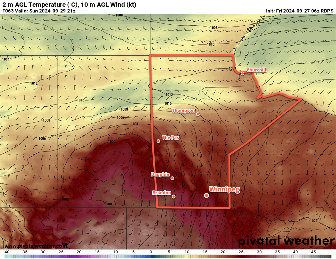
A moderating trend will develop over the weekend across southern Manitoba with daytime highs heading back towards the upper teens. Overnight lows will also follow the warming trend, likely heading back into the 5–10 °C range through the weekend.
The region will see variable cloudiness, but little to no precipitation is expected.
Today’s seasonal daytime high in Winnipeg is 15 °C while the seasonal overnight low is +3 °C.