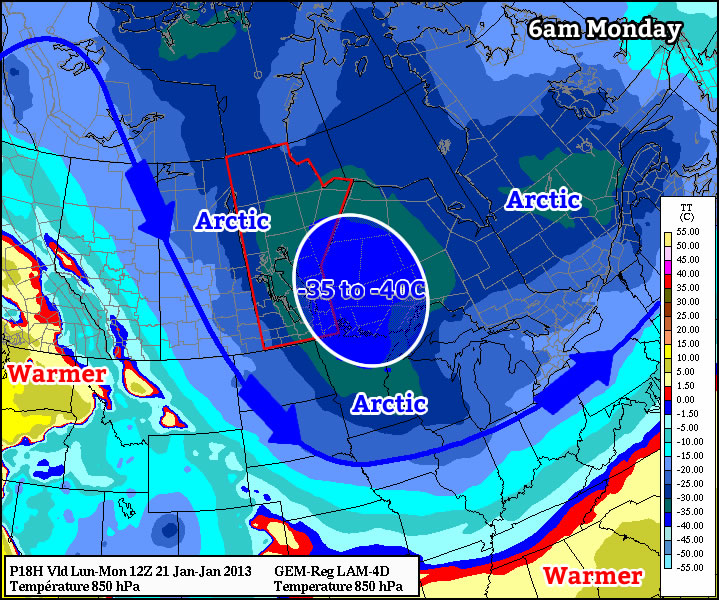
This week will feature the coldest weather so far this winter, which is probably about all you need to know.

As we come off Monday morning’s very cold low temperatures, daytime highs won’t be able to get very warm, with values in the mid minus twenties expected. When you factor in the wind chill it will feel more like the low minus forties on Monday morning and the mid minus thirties on Monday afternoon. As we move into Monday night temperatures are expected to plummet once again. Models have had significant difficulties figuring out what will happen by Tuesday morning. Models have shown lows as cold as -47C on Tuesday morning (obviously an erroneous value), or as warm as -28C. It seems probable that we’ll end up somewhere between those two extremes, with lows in the mid minus thirties most likely. It shouldn’t be very windy at all on Tuesday morning, so at least we won’t have a big wind chill to contend with as well. It looks like we’ll “warm” up a bit on Tuesday, with daytime highs in the low minus twenties expected.
We shouldn’t see extreme overnight lows again on Wednesday morning since a weak passing weather system will prevent temperatures from bottoming out. However, another arctic front is forecast to pass through Southern Manitoba during the day on Wednesday, setting up more very cold weather for late week.
Unfortunately, there are no indications to suggest that we’ll see a warm-up any time soon. That means we may be stuck with cold to very cold weather for the rest of January.
