This week hasn’t exactly started out on a pleasant note as you’re no doubt aware. Unfortunately, conditions won’t improve much after today.
Snow ending. Blowing snow.
-12°C / -21°C
Monday
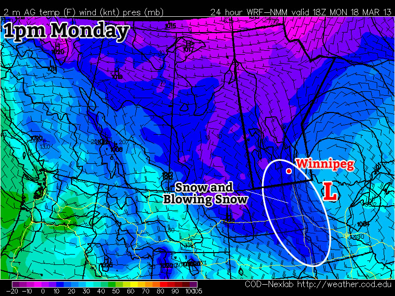
Snow and heavy blowing snow is currently ongoing in parts of the Red River Valley. This snow and blowing snow will gradually taper off today, but not before snow totals of 10 to 20cm have piled up across Southern Manitoba. High temperatures today won’t be very pleasant, nor will low temperatures tonight. Overall a horrible start to the week.
Tuesday and Wednesday
Mainly cloudy
-12°C / -22°C
Mix of sun and cloud
-11°C / -21°C
Conditions on Tuesday will see little improvement from Monday. Highs will once again be very cold by March standards. Luckily no more precipitation is expected on Tuesday (except maybe a flurry here or there), which is at least something to be thankful for. Wednesday will again be a seasonably cold day, with no weather of note.
Long Range
The long range is…you guessed it, ugly. At this point the GFS model (a longer range model) doesn’t show us even getting to the freezing mark in the next ten days. While this may be an overly pessimistic forecast, it is certainly possible given the extensive snowpack over the Eastern Prairies. We can only hope it is wrong, and perhaps we’ll see at least some melting, however minimal, by the weekend.