After several weeks of weather that resembled fall more than summer, we may begin to see hot weather return.

Monday
Mix of Sun and Cloud. Slight Chance of Showers.
23°C / 6°C
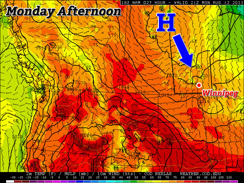
However, before we see hot weather again in Southern Manitoba, we’ll have to deal with yet another burst of polar air. Another surface ridge will drop down from the north on Monday, which will result in reasonable, but still cool conditions. High temperatures on Monday will be in the low twenties, though there may be some readings in the mid twenties along the International border. There might be a few showers around during the afternoon and evening as cool air aloft generates a bit of instability. The wind will generally be light and from the north, though it will be a bit breezier in open areas.
Tuesday
Mainly Sunny
22°C / 7°C
Tuesday looks to be just a slightly cooler version of Monday. Highs will be in the low twenties once again with with a light northerly wind. Shower activity looks less likely on Tuesday, but there may still be some bubbly cloud cover as the ground heats up during the day.
Wednesday
Mainly Sunny
23°C / 10°C
At this point there is a bit of uncertainty as to how warm Wednesday will get. Some weather models suggest we’ll see temperatures in the mid to upper twenties, while others suggest temperatures in the low twenties are most likely. I’m leaning towards the later of those two scenarios, as I don’t think the warm air will move in quite that quickly. As a result, I’m once again calling for temperatures generally in the low twenties with variable cloudiness through the day. The area with the best chance of seeing some warmer conditions on Wednesday will be portions of Western Manitoba where that warmer air may filter in a bit during the afternoon and early evening.
Long Range
The longer range forecast is where things begin to look more promising. Models suggest that we’ll stand a good chance of seeing high temperatures in the upper twenties on Thursday. If we’re lucky, we may take a run at the 30C mark as early as Friday, but that type of heat looks more probable on the weekend right now. There have also been some hints in the models that this heat may also be accompanied by elevated humidity levels. Given that the model I’m looking at for this (GFS) is notorious for being too humid, I’m not going to get overly caught up on this for now. Once we get closer to the weekend, and more accurate information is available, this part of the forecast can be more appropriately addressed.
