A summer heat wave is on the way as a strong upper ridge builds over the Prairies. Winnipeg will likely see 30°C at least once by mid-week.
Monday
Today will feature increasingly cloudiness through the day as convective clouds develop with daytime heating. We may see a few showers or thunderstorms develop as these convective clouds grow, but any storms will be non-severe. Other than the chance of a shower, it will be a pleasant day with highs in the mid twenties and light northerly winds.
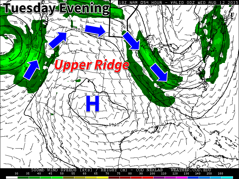
Tuesday
Tuesday will be one of the warmest days we’ve seen in a awhile as high temperatures climb up to the 30C mark in much of southern Manitoba. Skies will be mainly sunny and winds will be breezy from the south. It appears that the humidity will increase somewhat with the push of warmer air, but not too oppressive levels.
Wednesday
Wednesday should be the warmest day of the week with high temperatures climbing into the low thirties. Some weather models even suggest we may reach the mid thirties, but that remains to be seen. Humidity levels should edge up further on Wednesday, to uncomfortable levels. Humidex values will likely be near 40 in most areas by late afternoon. This higher humidity will also help to create a risk of thunderstorms on Wednesday. At this point it appears severe storms will be possible, but we’ll provide another update as the risk gets closer.
Long Range
The long range forecast suggests we’ll continue to see frequent periods of hot weather through mid August. However, it doesn’t look like the hot weather will be in place continuously, with frequent surges of cooler air breaking up warmer periods. The long range forecast also shows a fairly active storm track through our region, so there will likely be a fairly frequent risk of thunderstorms and precipitation over the next while.