Showers will taper off today across Southern Manitoba and be replaced with sunshine for Thursday. The reprieve from the wet weather will be short-lived, however, as another low pressure system tracking across the Prairies on Friday will spread more showers back into the region.
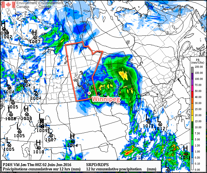
Today will be a cool, damp day once again throughout Winnipeg & the Red River Valley as the main upper-level low drags a final swath of rain and showers through the region as it exits into Ontario. Further amounts should be relatively light with anywhere from a trace to 10mm possible over the Red River Valley1 with the bulk of the organized rain falling before noon. A few scattered showers will remain through the region this afternoon as northerly winds to 30-40km/h move into the region. The wind and shower activity will taper off this evening. Temperatures will reach a high of just 12°C—a full 10°C below normal for this time of year—and with clearing skies tonight lows will dip to around the 7°C mark.
Thursday will be a pleasant day with just a few afternoon clouds, light winds and a high near 20°C. Temperatures will dip to 12°C on Thursday night as cloud cover moves in from the west as the next low pressure system moves into the region.
Friday will bring shower activity back to the Red River Valley as an occluding frontal wave associated with a low pressure system forecast to track through the Interlake moves into the region. Early morning showers appear likely at this point2, but they will push off to the east through the morning, leaving behind some mixed skies. Temperatures will climb to around the 20°C mark, which will likely be all we need to re-develop convection along a trough3 that will be located somewhere between Brandon and Winnipeg.
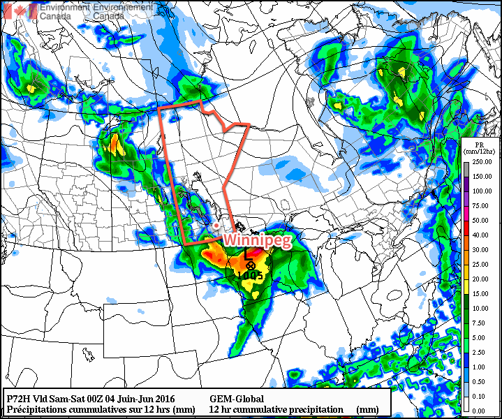
The thunderstorm potential actually looks like strong to marginally severe thunderstorms may be possible. Going over the MIST ingredients:
- Moisture: Dewpoint values are expected to climb towards the 15°C mark, which should provide suitable amounts of moisture for thunderstorm development.
- Instability: With temperature and dewpoint values of 20°C/15°C, MLCAPE values are expected to climb to around 1000 J/kg, on the lower end of things.
- Shear: Weak 0-6km bulk shear will be in place at just 15-25kt.
- Trigger: A trough should provide enough focus to trigger convective development.
All these combine to make moderate-to-strong thunderstorms possible. Limited instability coupled with weak shear make severe thunderstorms unlikely; the primary threat at this point from storms would be heavy rain, but it looks like the thunderstorms should be moving at 20-30km/h which should limit the amount of water these storms will be able to dump over any one location. Skies will begin to break up out on Friday night as temperatures head to a low near 12°C.
Long Range
The weekend finally looks nice!
Both Saturday and Sunday appear to be bringing partly cloudy to sunny skies with highs in the low 20's. Overnight lows will be near 12°C. Winds will remain out of the north to northwest at 15-25km/h. Really not much to say; it appears that the Red River Valley will finally get a chance to dry out!
Winnipeg’s seasonal daytime high is currently 22°C while the seasonal overnight low is 9°C.
- Lightest amounts will be over the western Red River Valley, while higher amounts will be over the eastern and southeastern Red River Valley. ↩
- Although they may be dependent on the magnitude and nature of the convection that manages to develop along this feature in Saskatchewan on Thursday afternoon and how it sustains over southwestern Manitoba on Thursday night. Precipitation dependant on the development and transition of thunderstorms into larger rain features is notoriously difficult to forecast. ↩
- A trough is a weather feature that marks the line along which winds are converging. For an example, a line where winds are blowing to the east on the western side and to the west on the eastern side. Troughs are focus points for thunderstorms because where the winds at the surface come together, the only way to go is up! ↩
Thanks for putting a complicated forecast into laymen language for us neophytes! I am learning a lot from reading your posts!
Glad to hear it! 🙂