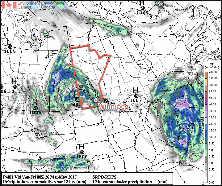
Winnipeg will dodge the worst of a major storm system that will slam Alberta and portions of Saskatchewan with strong winds and rain; comparatively, things will be quite pleasant!
A major storm is developing over Alberta today that will bring 30-50 mm of rain to the province alongside winds gusting over 100 km/h. This system will spread eastwards and bring significant weather to Saskatchewan later today, but will begin to weaken as it approaches Manitoba overnight. While Winnipeg will be spared from the brunt of this storm, some breezy and unsettled weather is still on the horizon.
First up, today will be a warm and windy day as moderate southerlies develop ahead of the Alberta storm. We should see fairly sunny skies, but winds will pick up out of the south-southeast to 30-40 km/h with gusts to 60 km/h through the morning and early afternoon. Temperatures will be near-seasonal with a high of 21°C.
The winds will continue out of the south-southeast tonight at around 30 gusting 50 km/h as cloud cover pushes in late overnight. Temperatures will drop to a low near 11°C.
Thursday will bring cloudy skies to the region as a trowal1 moves through the region. Whether or not Winnipeg will see rain is still somewhat uncertain; support for it definitely tapers off as the feature moves into the Red River Valley, but it will likely be able to sustain a band of rain or showers that will move through mid-day. A second batch of showers is possible in the early evening as the low pressure system moves into the Interlake.

While the winds will be breezy first thing, they should diminish through the morning as the low approaches. Temperatures will reach a high near 18°C. Temperatures should dip to around 12°C on Thursday night with the cloud cover breaking up.
Friday will bring mixed skies to Winnipeg & the Red River valley with a high near 19°C. It should stay dry, with any showers to our east and north. Winds will be out of the west at 15-25 km/h. It looks like skies should be fairly clear on Friday night as temperatures dip to a low near 9°C.
Long Range
The mixed bag continues this weekend with Saturday likely bringing a fair amount of sunshine and highs near the 20°C mark, but things take a turn on Sunday with highs dropping into the mid-teens as showers slump southwards out of northern Manitoba. With breezy northwesterly winds, it will likely be a relatively unpleasant day. The unsettled weather may persist into Monday, but then the remainder of next week looks pleasant with dry conditions and highs in the low 20’s.
Winnipeg’s seasonal daytime high is currently 21°C while the seasonal overnight low is 7°C.
- Trowal stands for “trough of warm air aloft” and is the warm air rising around a low pressure system from the occluding frontal wave. ↩
