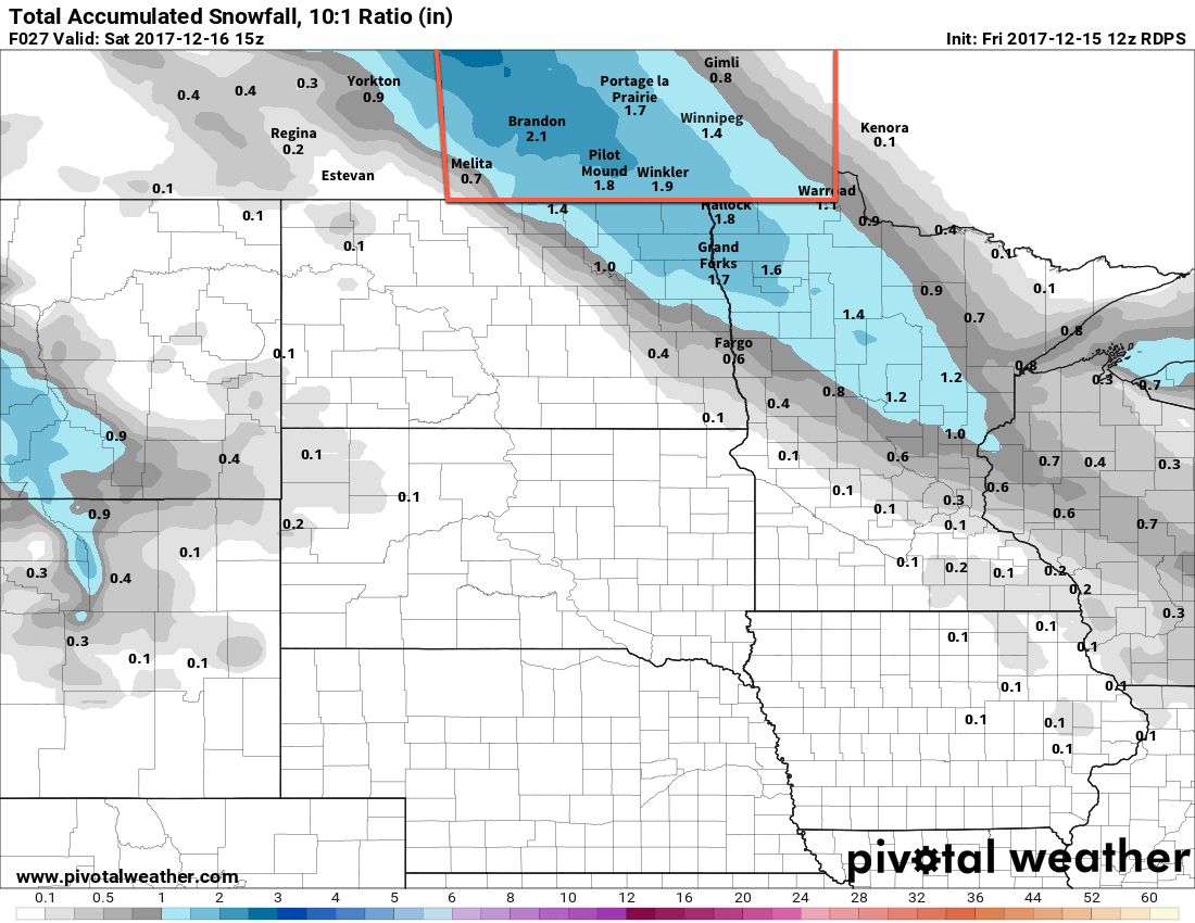
A pair of low pressure systems working their way into the Prairies will spread snow eastwards into the Red River Valley today.
Under cloudy skies, Winnipeg will see temperatures climb to a high near -11°C today as snow develops through the morning hours. Once developed, the snow will persist through Friday night before tapering off on Saturday morning. Although it will snow for quite a while, it won’t be a particularly large snowfall event, with just 2 to 5 cm of snow expected in the Red River Valley. Further west, in parts of southwestern Manitoba and into the Parkland areas of western Manitoba, amounts will be higher with 4 to 8 cm expected by the time it tapers off. Temperatures will remain steady near -11°C tonight in Winnipeg with winds out of the east-southeast at 15 to 20 km/h.
Snow will taper off on Saturday morning, then some sunny breaks will work into the Red River Valley through the afternoon. Temperatures will climb to a high near -7°C with light winds. Mixed to cloudy skies are expected on Saturday night as temperatures dip to a low near -10°C.
Milder air will continue moving into the region on Sunday as Winnipeg climbs to a partly cloudy high near -4°C and winds out of the southwest at 15 to 20 km/h. Clouds are forecast to build back into the region on Sunday night, bringing a chance of flurries to the region as temperatures drop to a low near -7°C.
Long Range Outlook
Another big pattern shift will occur in the coming week, this time bringing the deep freeze.
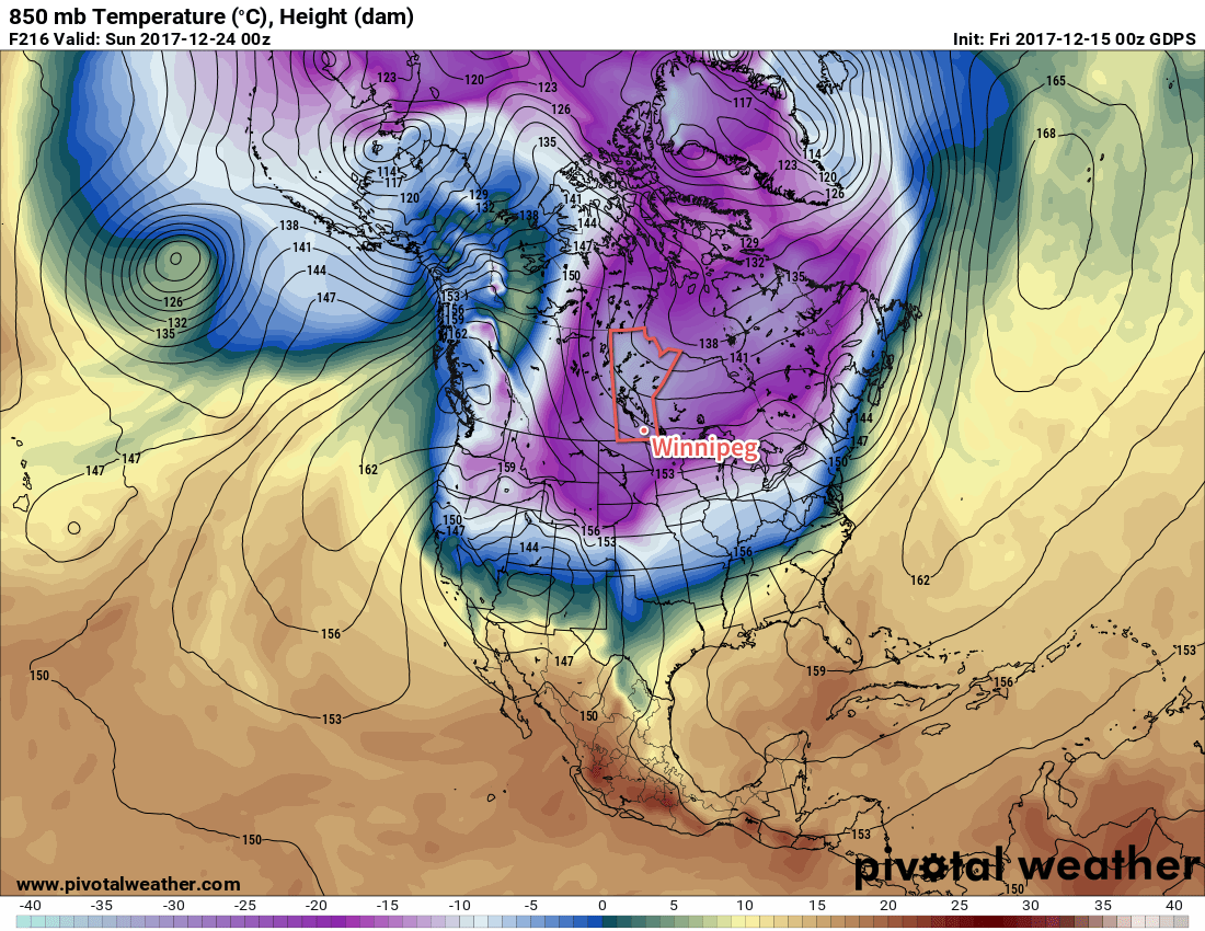
A significant low pressure system will work its way across the Prairies on Monday and once it passes, a potent Arctic ridge is forecast to build into the Prairies from the northwest. This will usher a much colder air mass into the region that will plunge daytime highs down into the low minus teens by the later half of the week.
So get out there and enjoy the mild winter weather; it doesn’t look like it will be sticking around for too much longer!
Winnipeg’s seasonal daytime high is currently -10°C while the seasonal overnight low is -20°C.