Temperatures remain well above seasonal in Winnipeg for one more day before plummeting as a powerful cold front blasts southwards out of the Arctic.
Winnipeg will see mostly cloudy skies today as a weak impulse slides along the U.S. border. It will support an area of light snow that will spread around 2 cm of light snow across the southern Red River Valley. There’s a chance that Winnipeg will see a bit of light snow, but the snow will likely pass to the south. Temperatures will climb to a high near 0°C with winds out of the southwest at 15 to 25 km/h. The snow will move out of the region in the evening along with the cloud. Temperatures will dip to a low near -7°C with winds shifting to the west at 20 to 30 km/h.
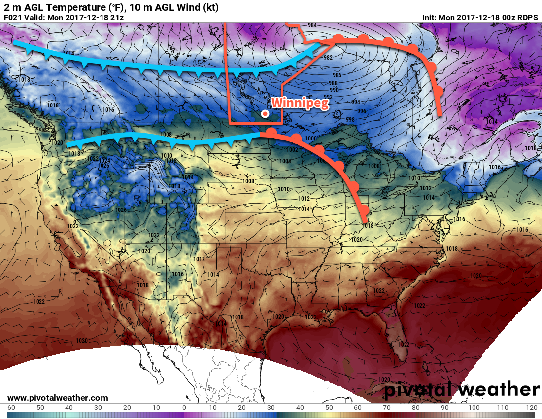
Tuesday will bring the arrival of the Arctic front as it surges southwards behind a low pressure system exiting the Arctic Prairies. Winds will shift to the northwest in the morning at around 30 km/h as temperatures fall through the day, reaching around -12°C by the evening. The cold front will bring mixed skies to the region and Winnipeg may see a stray flurry or two, but no accumulating snow is expected. Skies will remain partly cloudy on Tuesday night with winds easing as an Arctic high builds in from the northwest. Temperatures will dip to a cold low of -21°C.
Temperatures will remain quite cool on Wednesday as a low pressure system passes to the south, spreading cloud into the region alongside northeasterly winds that will tap the Arctic high to the north. Skies will remain mostly cloudy much of the day as temperatures climb to a below-seasonal high near -14°C. Winds will be light at around 10 to 15 km/h. Winnipeg may see a bit of light snow in the evening, but once again most of the snow is expected to pass to the south. The southern Red River Valley may end up seeing a couple cm, while the northern Plains of the United States see significantly more snow. Temperatures will be very cool on Wednesday night, dipping down to around -24°C.
Long Range Outlook
A low pressure system will slump through the region in the latter half of the week, bringing with it some chances for light snow, however the bigger impact will be a reinforced surge of cold air as it passes by.
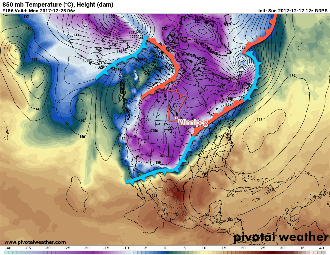
This shot of cold air will bring some coldest air in the continent into the southern Prairies, amplifying in intensity all the way until Christmas Day. Daytime highs will likely fall into the -20’s with overnight lows dipping near to or below -30°C. Christmas Day in particular looks quite unpleasant with temperatures potentially starting off below -30°C and climbing to a high in the -21 to -23°C range. Throughout the core of the coldest temperatures, which looks to from December 23rd through December 26th, Winnipeg may see its first extreme cold warning(s) of the year, with the potential for wind chill values to drop into the -40 to -45 range.
Yikes! Enjoy the warmth today and get those long johns out and ready to go!
Winnipeg’s seasonal daytime high is currently -11°C while the seasonal overnight low is -21°C.