Winnipeg will see a 36 hour reprieve before another low pressure system works into the region, bringing back the chance for showers and thunderstorms.
Sunny skies and seasonably mild temperatures will be in place for Winnipeg today as a weak ridge of high pressure moves through in the wake of the cold front that brought a few showers and thunderstorms to the Red River Valley last night. Winnipeg will see a high near 25°C with a light northwesterly wind at 15 to 25 km/h. Additionally, dew point values will plummet once it warms up a bit this morning, eliminating any feeling of it being humid outside. Skies will remain mainly clear tonight as temperatures drop to a low near 15°C with light winds.
Thursday will kick off with sunny skies and temperatures quickly warming into the mid-20s. Skies will become mixed in the afternoon as a warmer, increasingly humid air mass works into the region. Winnipeg should see a high near 28 or 29°C. Winds will be out of the south at 15 to 25 km/h.
A few showers are possible Thursday evening, but the larger focus will be a low pressure system moving through the Dakotas. As it moves eastwards overnight, it will likely develop a broad region of thunderstorms across the Dakotas and Southern Manitoba. These thunderstorms will spread eastwards across the province overnight, bringing with a chance of severe weather. Temperatures will remain warm on Thursday night as it gets increasingly humid; Winnipeg should see a low near 18°C.
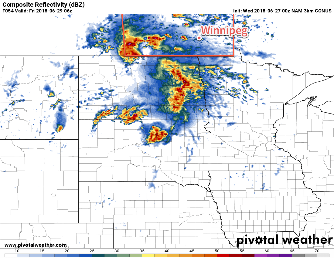
Friday will bring generally unsettled weather to Winnipeg and the Red River Valley. Temperatures will remain warm with a high near 25°C under mostly cloudy skies. There will likely be a few sunny breaks here and there, but they’ll just allow things to heat up enough to produce a chance of scattered showers or thunderstorms across the region. Winds will be out of the north at 10 to 20 km/h. Skies will clear out by evening, then Winnipeg will head to a low near 16°C.
Long Range Outlook
Looking ahead to the weekend, early indications are that Winnipeg will see variable cloudiness with a chance for more showers. Winnipeg is forecast to see near-seasonal highs in the mid-20s and slightly mild overnight lows in the mid-teens.
Winnipeg’s seasonal daytime high is currently 25°C while the seasonal overnight low is 12°C.